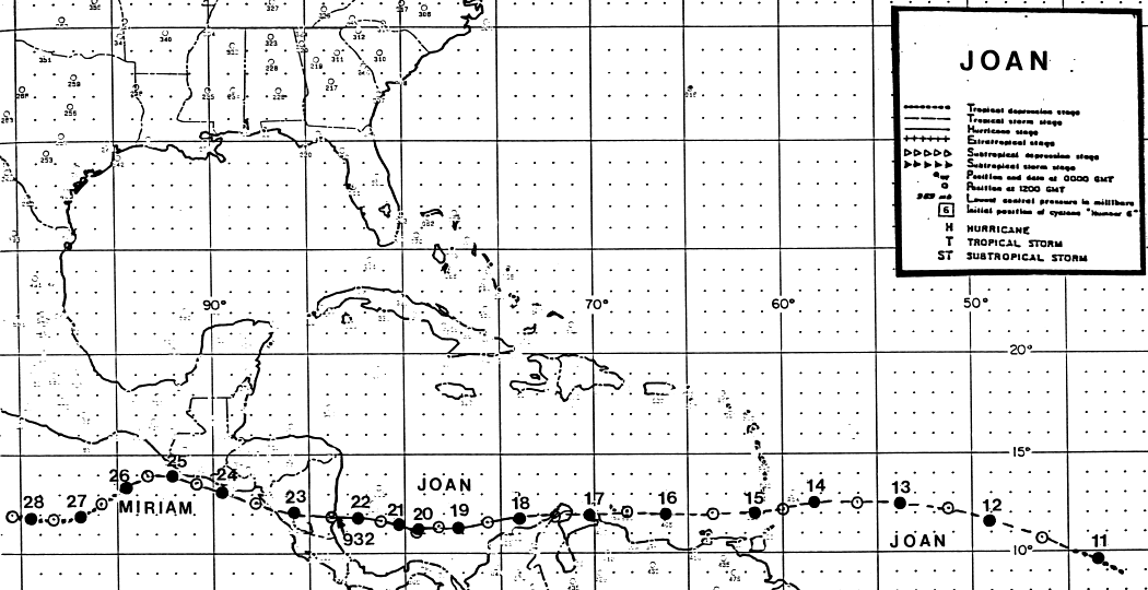
The initial disturbance which led to this cyclone's development
moved off the coast of Africa on October 5th.
The system moved westward without note until the 9th when the
convective system began to detach from the
Intertropical Convergence Zone. By the afternoon of the 10th, the
system became a tropical depression, the
17th of the season. Late that night the system became a tropical
storm named Joan. Moving westward, the
cyclone began to weaken as it approached the Windward Islands.
The cyclone moved across Grenada, and
slowly developed as it grazed the coast of South America, the first to
track so far south since 1971. The cyclone
moved across Curacao, the Paraguana peninsula of Venezuela, and the
Guajira peninsula of Columbia. After
clearing the Columbian peninsula, Joan strengthened into a
hurricane. The cyclone transcribed a loop about
130 miles north of Panama City, Panama on the 20th. Tropical
Depression #18 may have helped contribute to
this motion.
Strengthening resumed after the loop, and Joan became a category 4
hurricane to the east of Bluefields,
Nicaragua. Moving acorss Nicaragua on the 22nd and early on the
23rd, the cyclone remained well-
organized and at tropical storm strength as it emerged into the eastern
Pacific ocean. The system was
named Miriam upon entering the Pacific, and moved just offshore El
Salvador and southern Guatemala
before upper level shear weakened the tropical storm with the system
dissipating as a tropical cyclone about
300 miles south of Acapulco on the 28th. Below is the track of
this cyclone,
provided by the National
Hurricane Center.
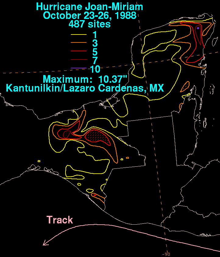
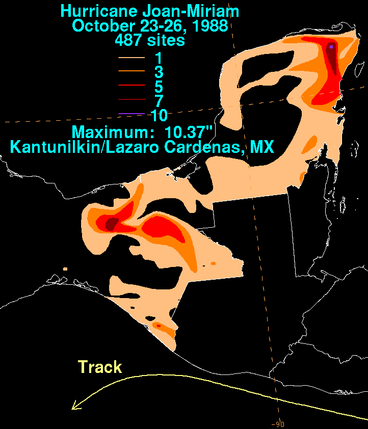
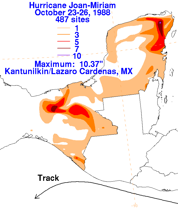
The graphics below show the storm total rainfall for Joan/Miriam.
Note
the maxima over the Yucatan Peninsula
and extreme southeast Mexico, which occurred under inflow bands to the
northeast of the cyclone. Rainfall data
was provided by the Comision Nacional del Agua, the parent agency of
Mexico's National Weather Service.
 |
 |
 |