A Central American Gyre formed in early October. A tropical wave moved into the area, which formed a few different
circulation centers within the gyre. The circulation in the southwest Caribbean on the 2nd would ignite thunderstorm
activity. The low pressure system slowly became better defined, and was deemed a tropical depression by the morning
of the 4th south of San Andres Island. Moving northwest, the system became a tropical storm on the morning of the
5th before striking northeast Nicaragua. The storm moved north- northwest, emerging into the Gulf of Honduras
late on the 5th. While this occurred, a circulation across the Florida Straits shot westward into the Gulf of Mexico,
joining an upper level low in the region and thereby become deep layered. This accelerated south-southeasterly flow near
Nate which caused acceleration. Nate strengthened into a hurricane in the southeast Gulf of Mexico early on the 7th.
Racing quickly across the Gulf, the hurricane began to experience south- southwesterly vertical wind shear as it approached
the northern Gulf Coast. Nate made landfall at the Mouth of the Mississippi River during the evening of the 7th and struck
Biloxi that night. The weakening tropical storm accelerated northeast, moving into central Tennessee late on the 8th.
The cyclone became extratropical while linking up with a front in the Ohio Valley, then tracked into New England by the
10th before crossing Atlantic Canada thereafter.
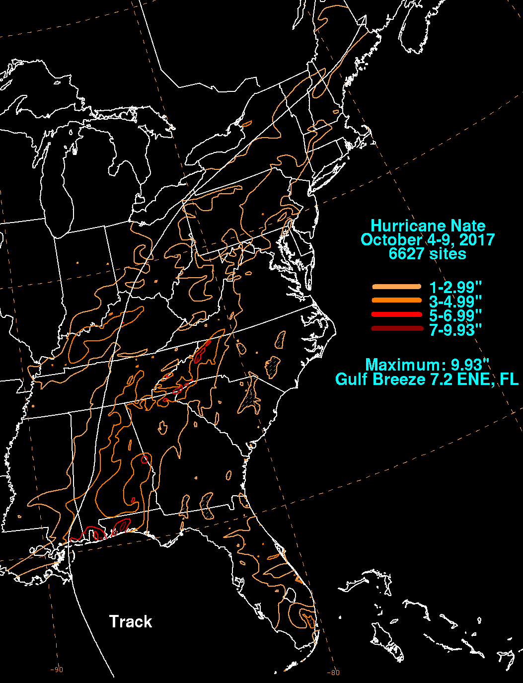
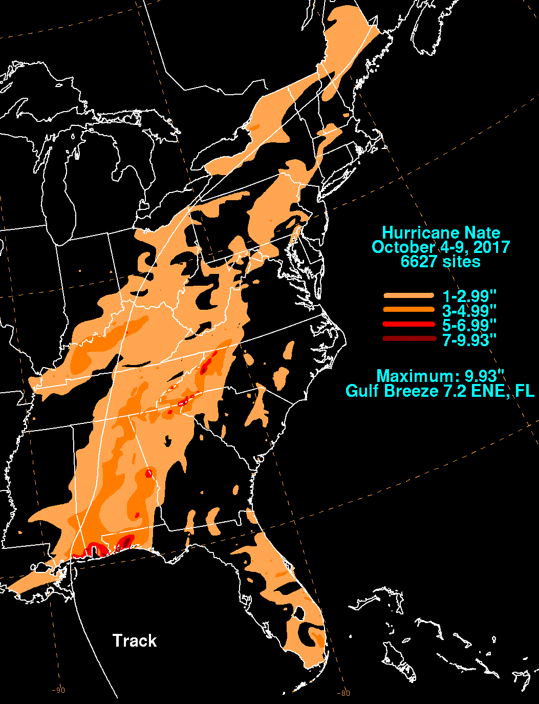
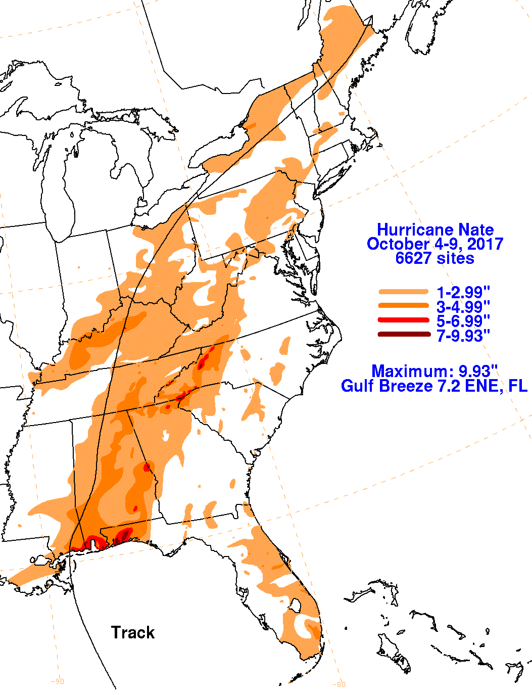
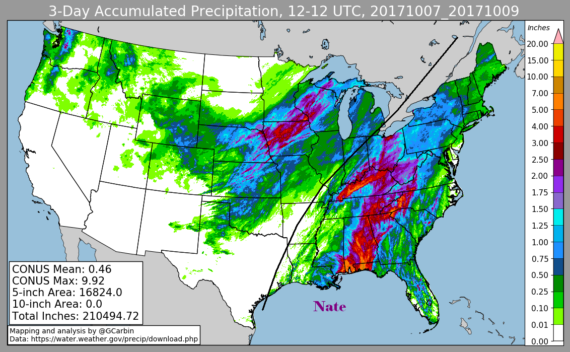
The first three graphics below show the storm total rainfall for Nate, which used rain guage information from the National Weather
Service River Forecast Centers, Forecast Offices, and CoCoRAHS. The fourth graphic uses the official National Weather Service multi-
sensor rainfall estimate, which includes radar-dervied information.
 |
 |
 |
|
 |