As Tropical Storm Matthew moved through Central America into
southeast Mexico, the monsoon trough
from the eastern Pacific moved northeastward into the northwest
Caribbean sea. While Matthew was weakening
across the Isthmus of Tehuantepec, a broad monsoon depression formed
within the monsoon trough just offshore
Belize and Honduras on September 25th, southeast of the base of a deep
trough located over the Midwest. The low
slowly deepened as it moved northeast, and developed a well-defined
circulation center on the 28th, when it was
classified as a tropical depression. The system slowly organized,
becoming a tropical storm as it was crossing Cuba
on the 29th. Later that morning, the cyclone lost its
well-defined circulation center, and the remnant low moved
north-northeast to northeast near the coast of Florida and the
northwest Bahamas before becoming absorbed by a
new non-frontal cyclone to its north off of northeast Florida.
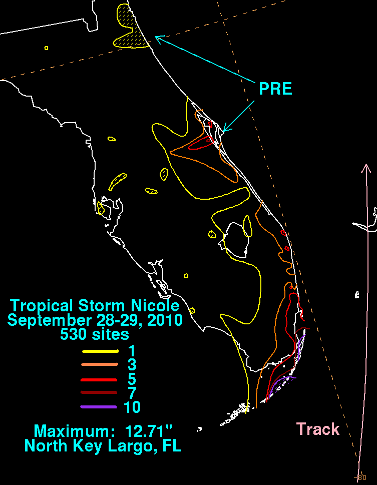
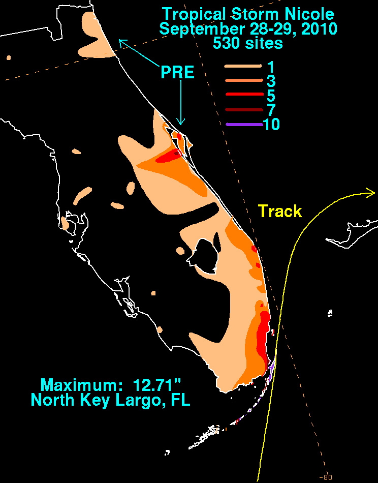
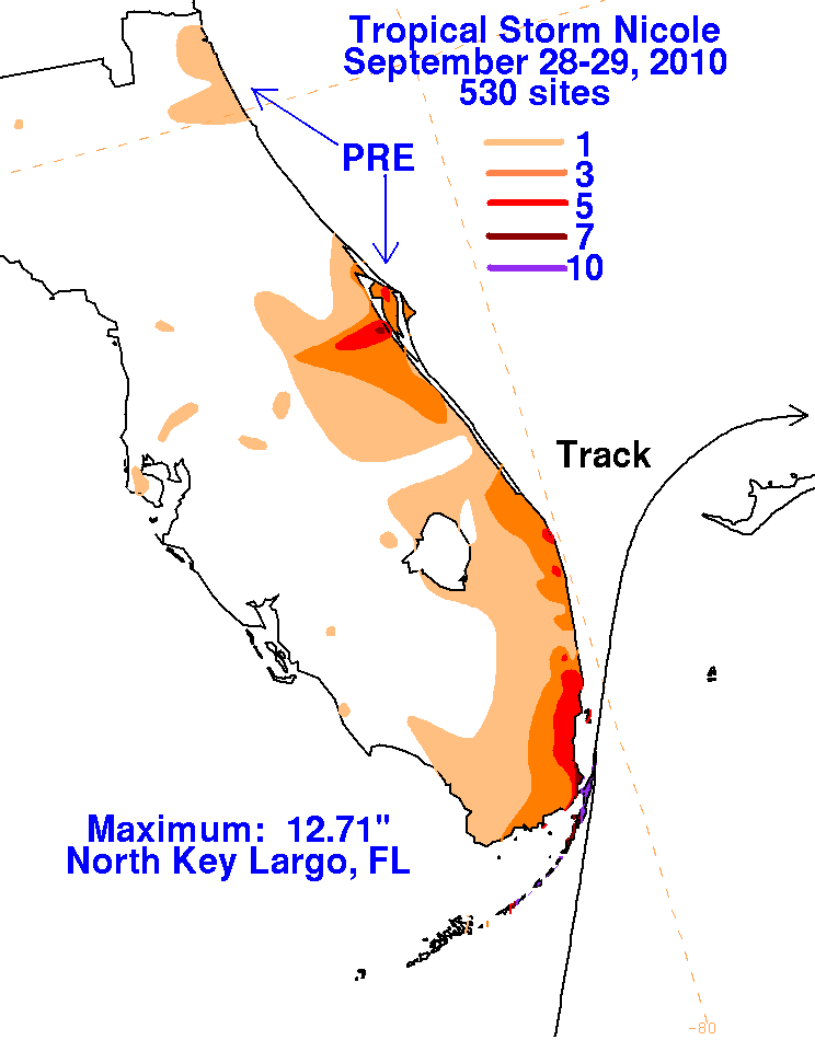
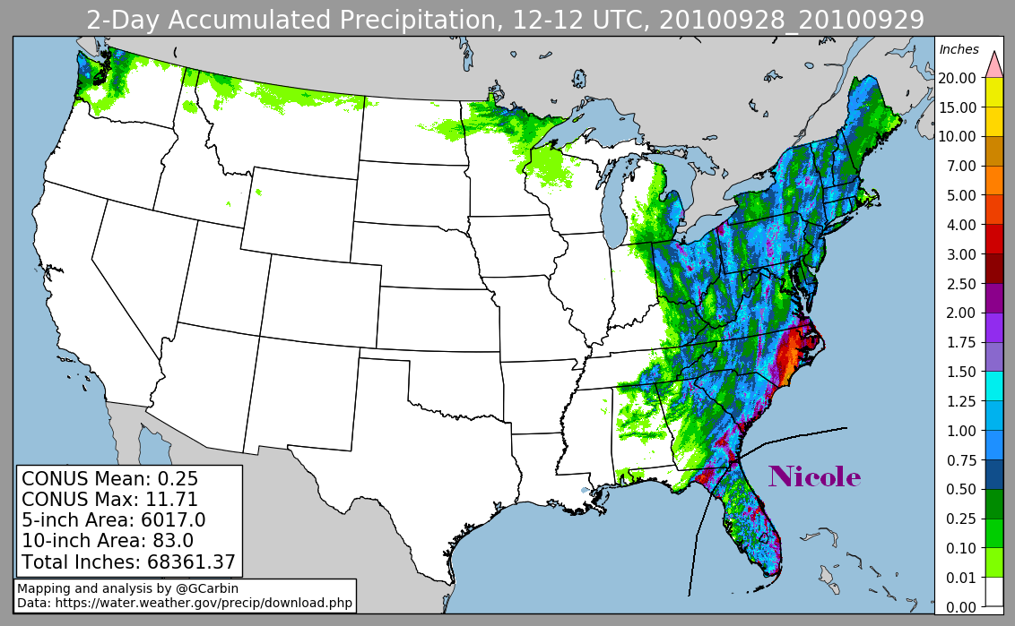
Below are the storm total rainfall maps for Nicole for the
Eastern United States. The first three were produced using
rain guage data from the National Weather Service River Forecast
Centers, the Key West Weather Forecast Office, and
CoCoRAHS. The fourth included radar-derived information. The
heavy rains in east-central Florida developed north of
Nicole when a disturbance aloft tapped its moisture, and could
be considered a predecesor rainfall event (PRE).
 |
 |
 |
 |