A tropical wave departed the west coast of Africa on October 16th. As the wave approached the
Lesser Antilles, it began to interact with an upper level trough located near Puerto Rico. This
interaction lead to the formation of a broad surface low on the 23rd about 150 miles east-northeast
of the northern Leeward Islands. After forming, the low moved slowly west to west-southwest
during the next couple of days. Vertical wind shear over the region decreased on the 27th. By the
28th, the system had organized into a tropical depression 200 miles south of Port Au Prince, Haiti.
The depression turned northwest and quickly strengthened into a tropical storm. Noel struck Haiti
early on the 29th, moving quickly across the country and maintaining tropical storm strength.
Noel turned west to the north of a deep layered low in the Caribbean, and moved into eastern
Cuba on the 30th. While moving through the western Greater Antilles, its inflow band led to
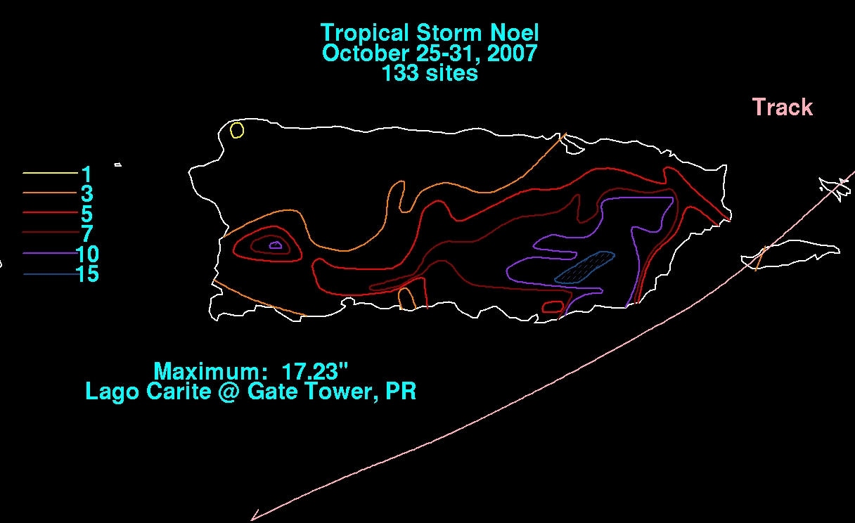
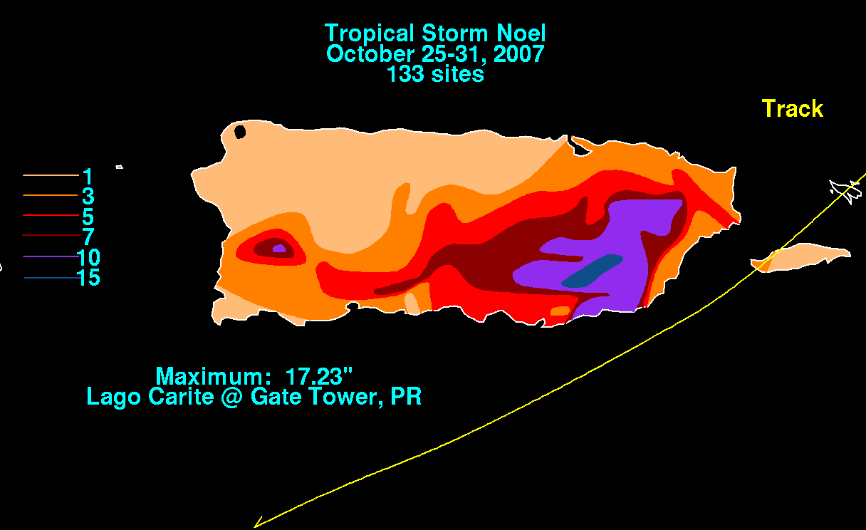
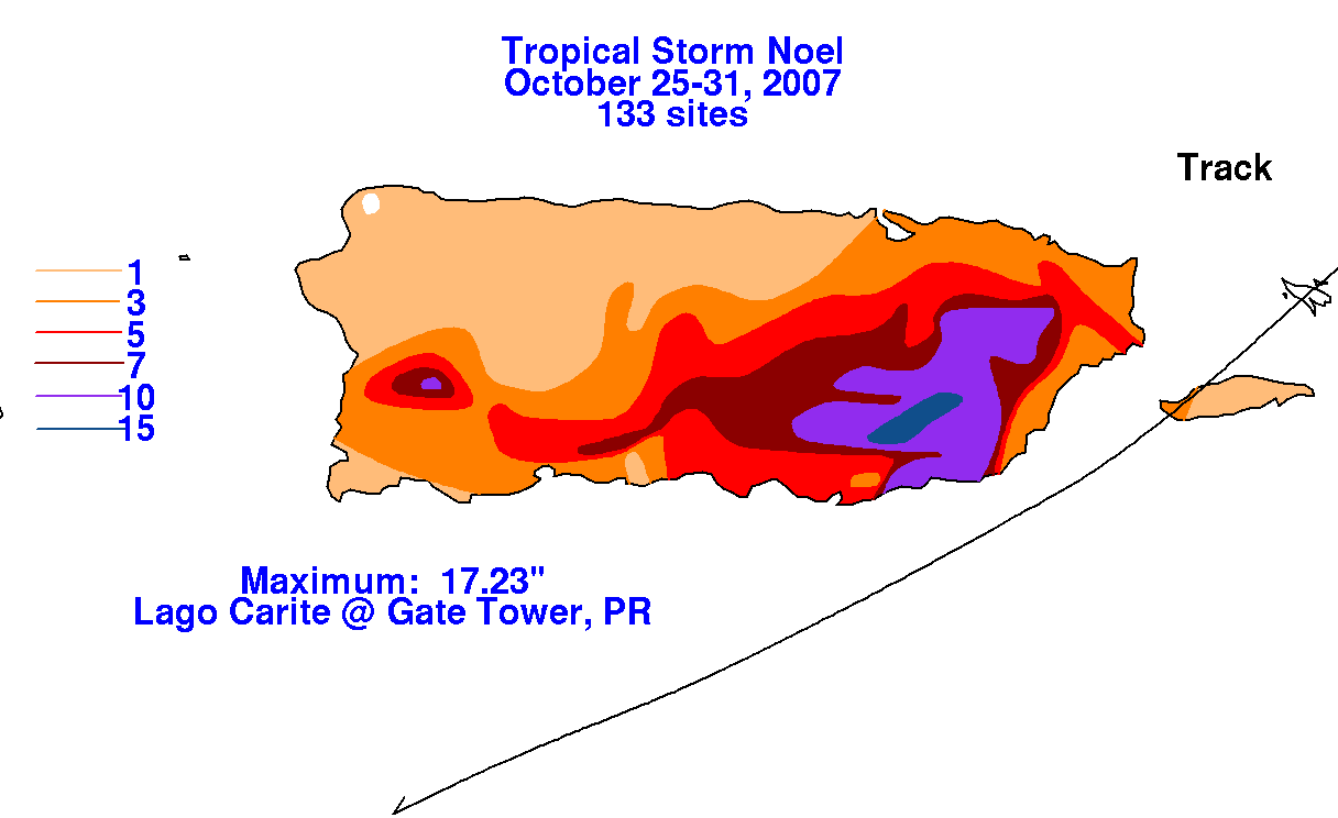
heavy rains primarily across Puerto Rico and Hispaniola. Below are the storm total graphics for
Puerto Rico, prepared with data provided from the Southeast River Forecast Center in Peachtree
City, Georgia.
 |
 |
 |
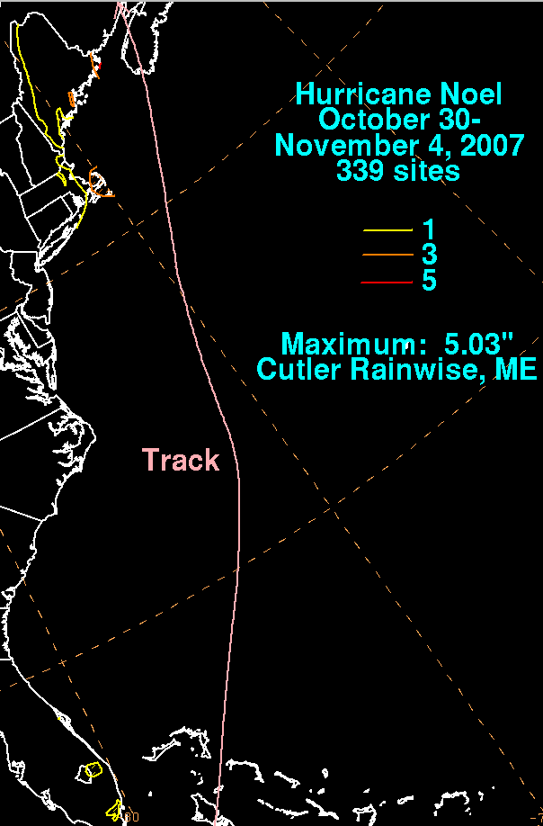
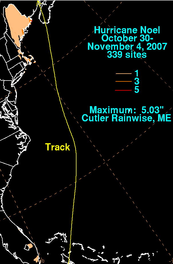
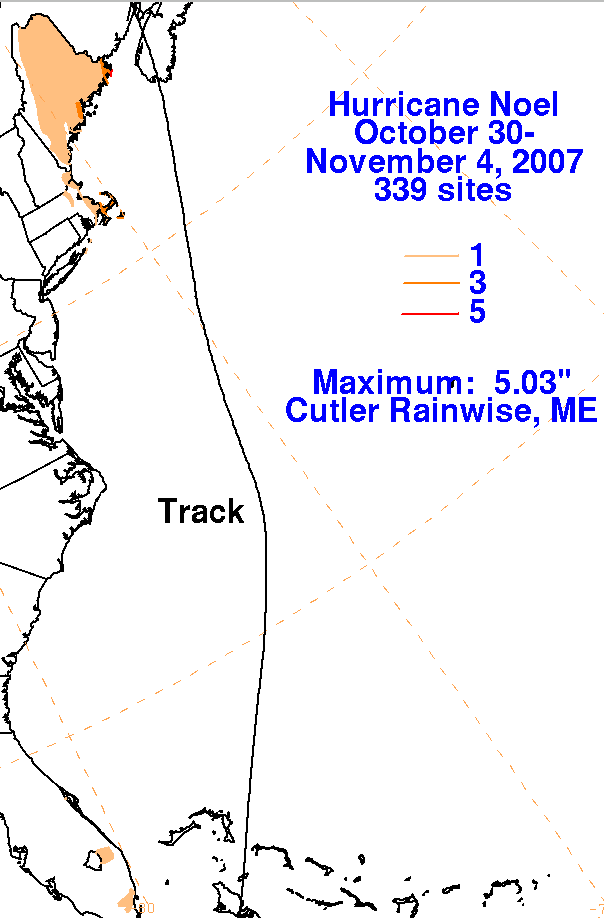
Drifting west across Cuba for a day, the system turned northward moving through the Bahamas while
strengthening into a hurricane. Soon after clearing the Bahamas, Noel underwent extratropical transition
as it interacted with a significant shortwave moving in from its west, becoming a strong extratropical
storm between Georgia and Bermuda. As a strengthening extratropical storm, ex-Noel led to wind
gusts as high as 63 mph in North Carolina, 89 mph in Massachusetts, and 66 mph in Maine. Its comma
head precipitation pattern spread across eastern New England, bringing heavy rains to Cape Cod and far
eastern Maine. Cold air funneling in to the northwest of the center of the strong low set the stage for up to
six inches of snow across Aroostook county, Maine. Below are the storm total rainfall graphics for the lower
48 United States, with data provided by NWS River Forecast Centers and public information statements from
NWS forecast offices. The combination of its outermost bands with a surface boundary across south Florida led
to local amounts of 2 inches. Rainfall measured across eastern North Carolina was under 0.20 inch.
 |
 |
 |