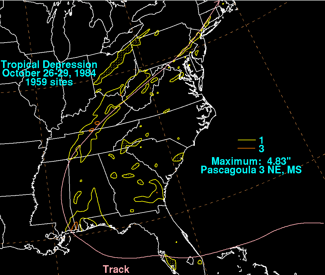
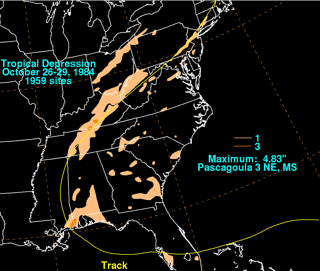
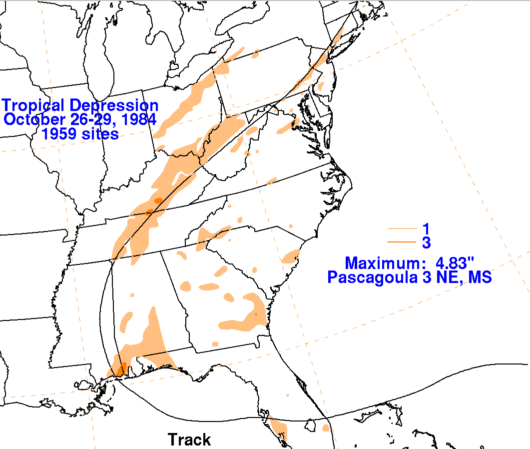
A retrograding upper level low helped spur the development of a low
east of the Bahamas coast on October 25th.
The system tracked westward with limited shower and thunderstorm
activity, crossing Florida on the 26th
before moving into the Gulf of Mexico. Once the system moved into
the north-central Gulf, deep convection
began to build near its center, expanding in intensity and coverage
near and after landfall in extreme southeast
Mississippi. The small system accelerated rapidly to the north
and northeast ahead of an approaching cold front,
moving across the Tennessee Valley and Central Appalachians before
linking up with the front and becoming a
weak extratropical low which moved through coastal New England.
The track within the graphics below was
provided by the
National Hurricane Center, then extended to the west based on the Daily
Weather Map series.
Rainfall information was provided by the National Climatic Data Center
in Asheville, North Carolina.
 |
 |
 |