Beginning on September 4, the region south of Mexico was being monitored for tropical cyclogenesis due to output from numerical
weather guidance. Thunderstorms developed in this region on September 7 due to a trough of low pressure. The system slowly organized
while moving westward, becoming a tropical depression on the morning of September 7 southwest of Acapulco, Mexico, with tropical
storm status achieved by afternoon. Very slow and uneven development occurred over the next several days, with Odile becoming a
hurricane south-southeast of Baja California on September 13 which moving north-northwest. By the next day, the cyclone had
rapidly developed into a major hurricane. During the night of September 14, Odile made landfall in southern Baja California as
a major hurricane. Slow weakening ensued as the system moving up the spine of Baja California, with the cyclone becoming a
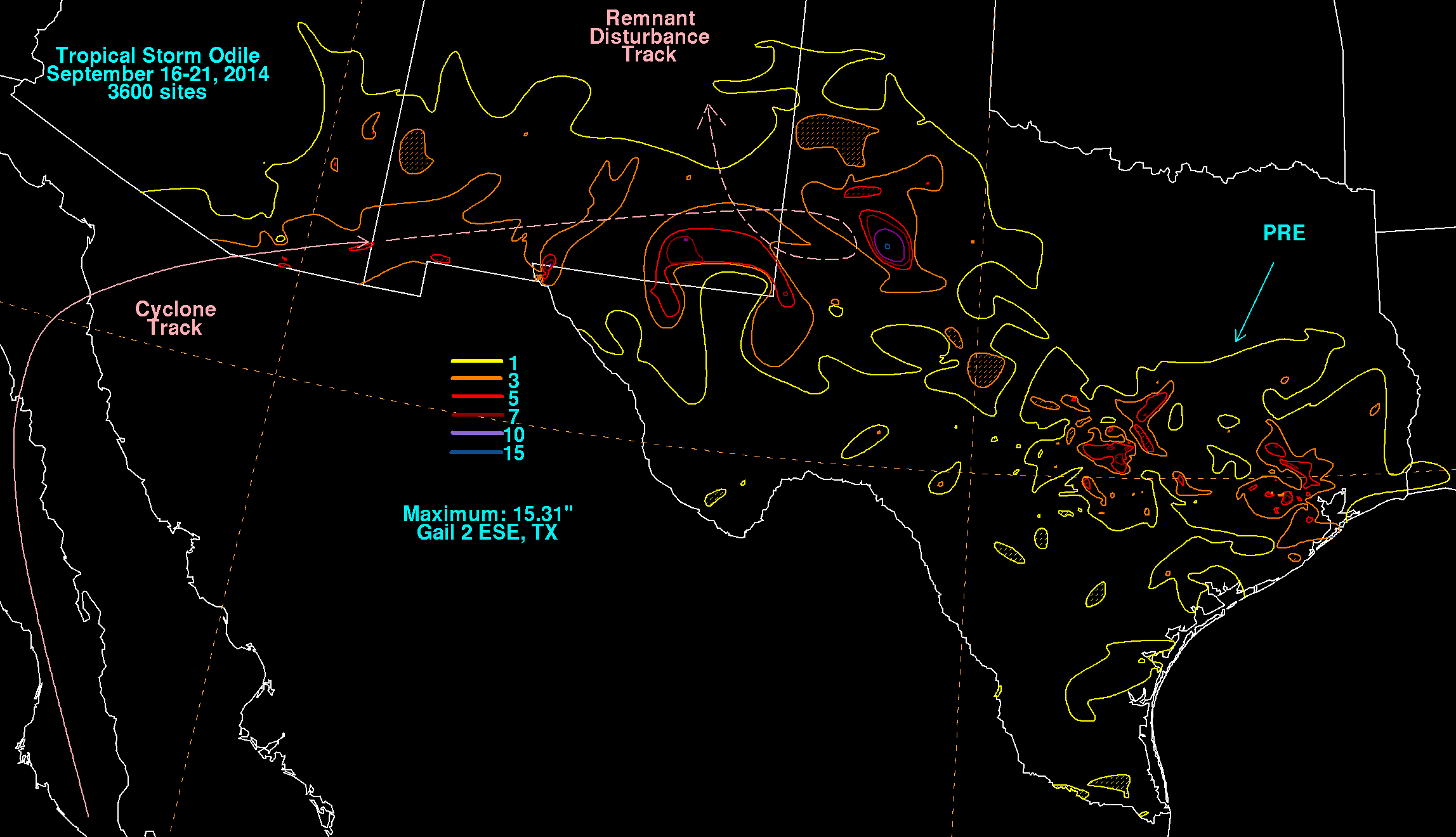
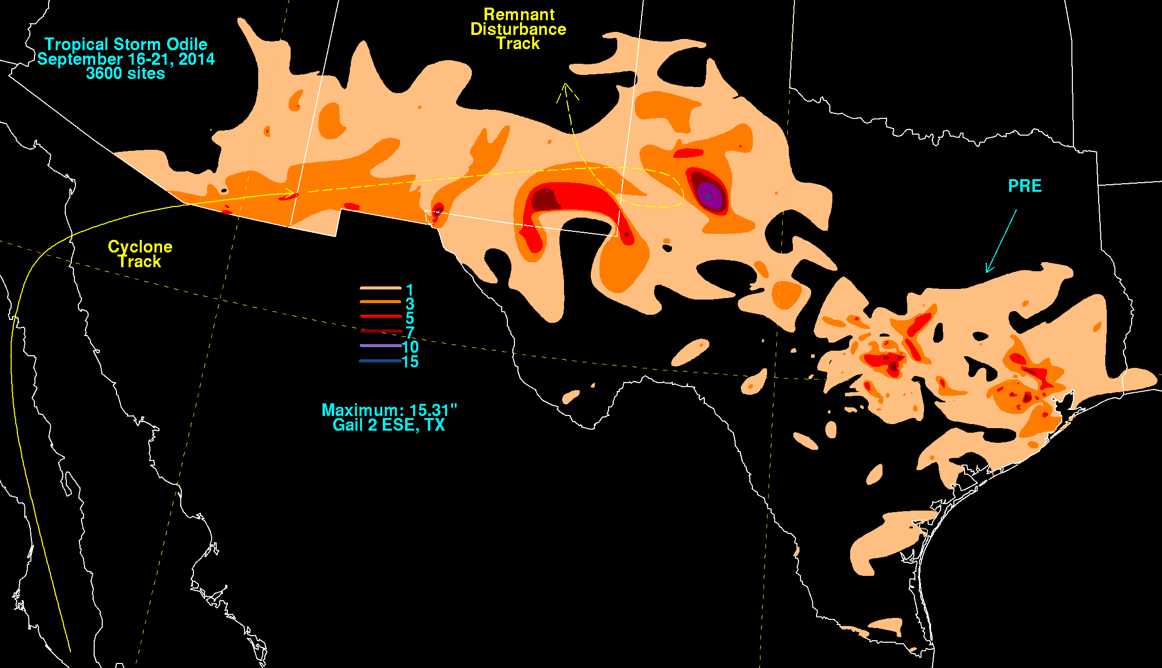
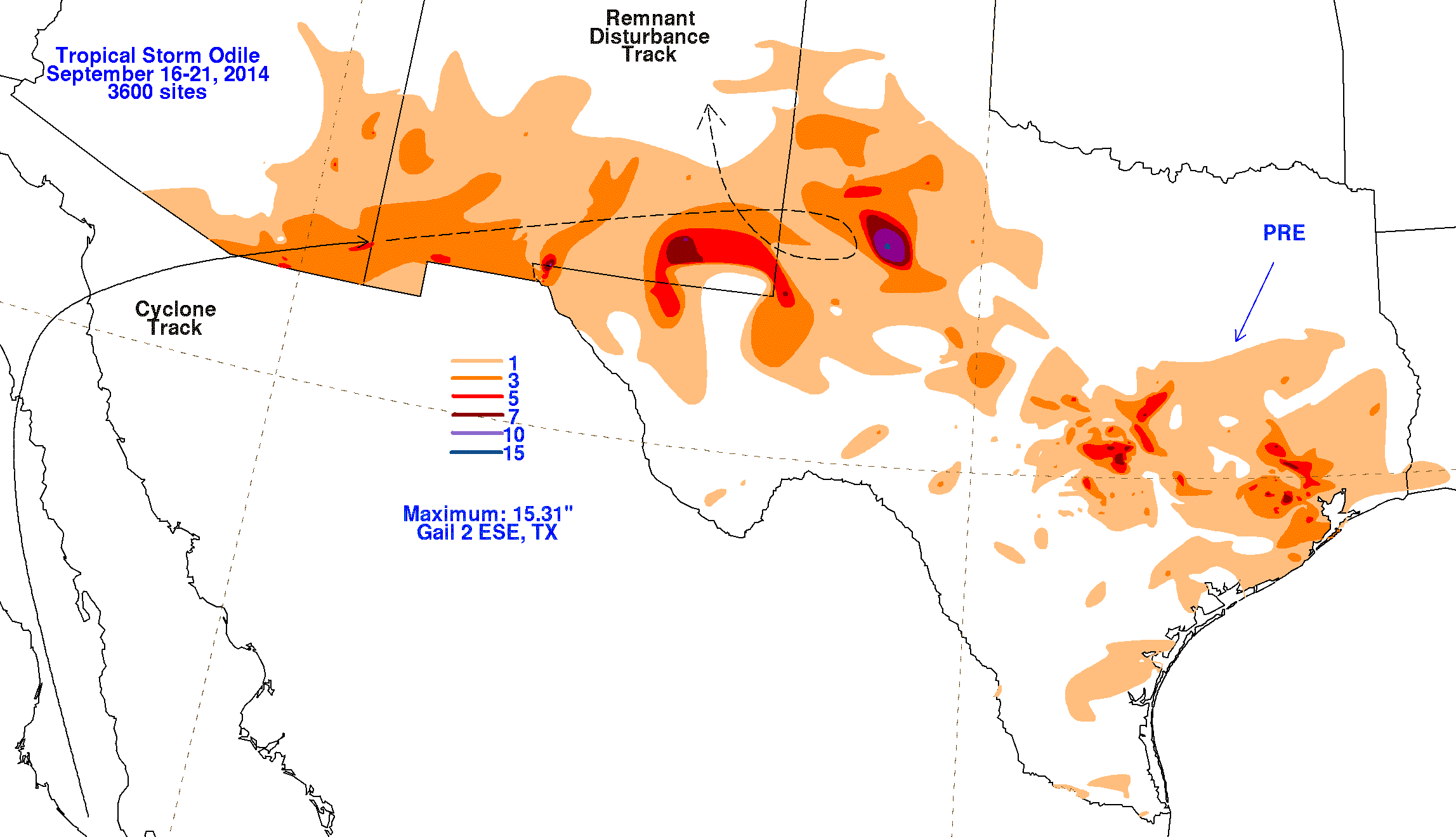
tropical storm once more on September 16. Odile moved across the Gulf of California into northwest Mexico as a tropical storm.
The resultant remnant low tracked across southeast Arizona, and as a feature aloft, across portions of New Mexico and northwest
Texas over the next several days.
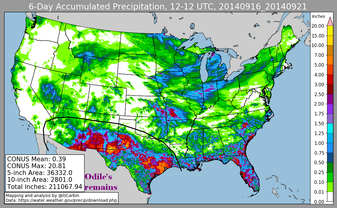
The first three graphics below show the storm total rainfall for Odile, which used rain guage information from the National Weather
Service River Forecast Centers, Forecast Offices, and CoCoRAHS. The fourth image uses multi-sensor rainfall estimates, which includes
radar-dervied information.
 |
 |
 |
 |