Olaf was spawned by a tropical wave which moved offshore Africa on
September 17, crossing into
the eastern Pacific about two weeks later. Nora was spawned by
the previous tropical wave that moved
offshore Africa on September 13. The first wave led to the
formation of a tropical depression about 525
miles south of Baja California on October 1, which became a tropical
depression that night. A low level
circulation began to form with the second tropical wave on October 2
about 400 miles south-southeast
of Acapulco. Late that night, it developed into a tropical
depression. Meanwhile, Nora was located about
650 miles west-northwest of Olaf and strengthening into a hurricane,
but the two cyclones barely interacted.
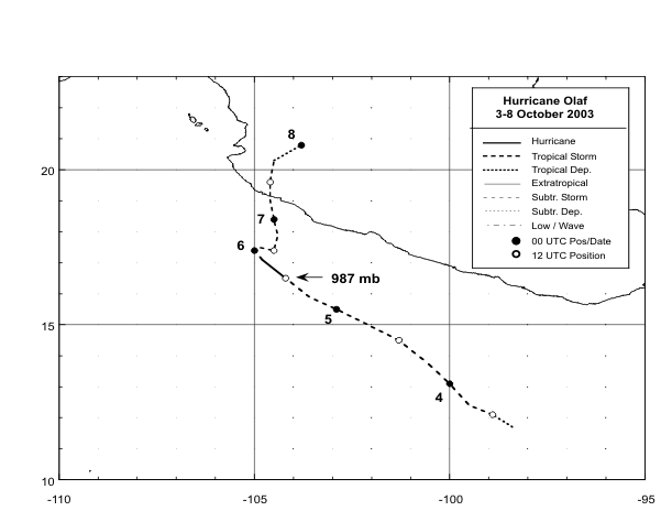
Olaf became a tropical storm on October 3 while moving
west-northwest to northwest around a weak
subtropical ridge. Turning more to the north, Olaf struck Mexico
to the west of Manzanillo on the
7th, with the surface circulation dissipating by the 8th. As Nora
began recurving ahead of a mid-
latitude trough, the upper level outflow from Olaf sheared the central
convection away, which led
to rapid weakening. As Olaf dissipated inland, Nora turned more
to the north, making landfall
just north of Mazatlan as a tropical depression late on October
8. Below is a track of
Olaf, prepared by the National Hurricane Center.
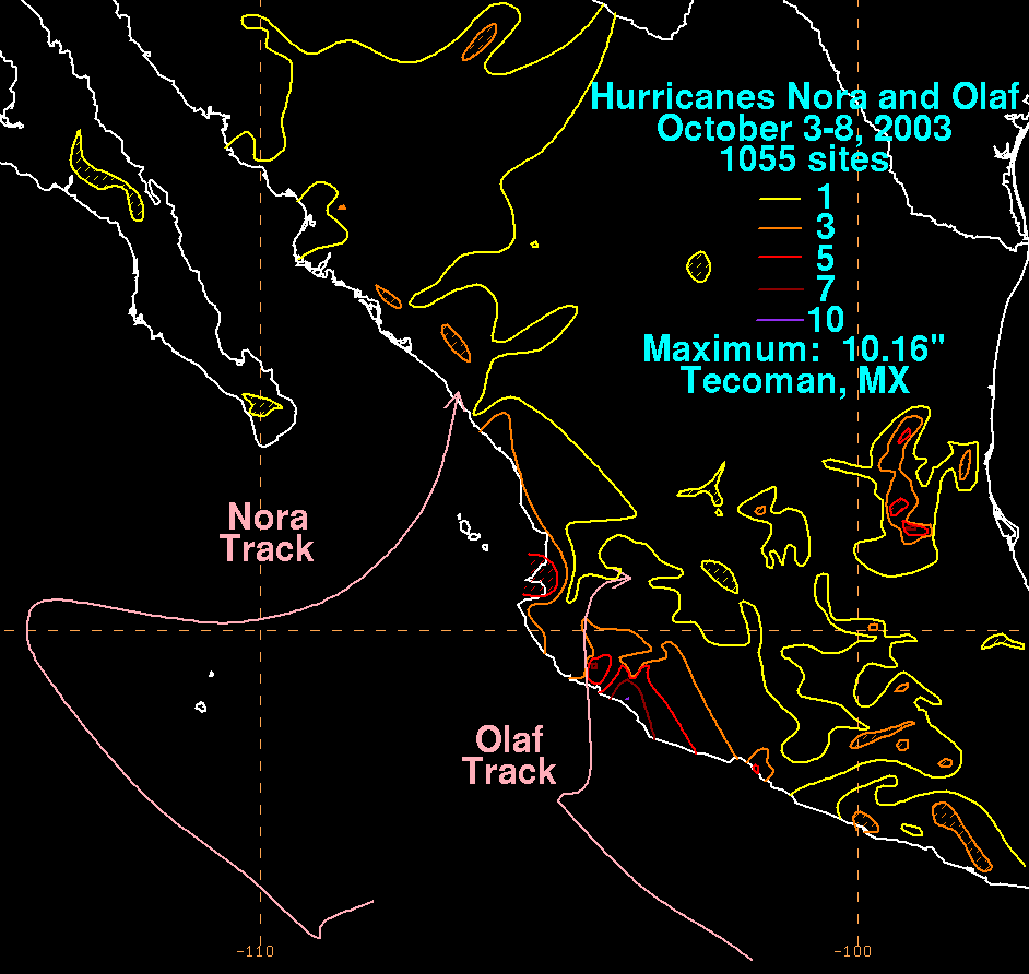
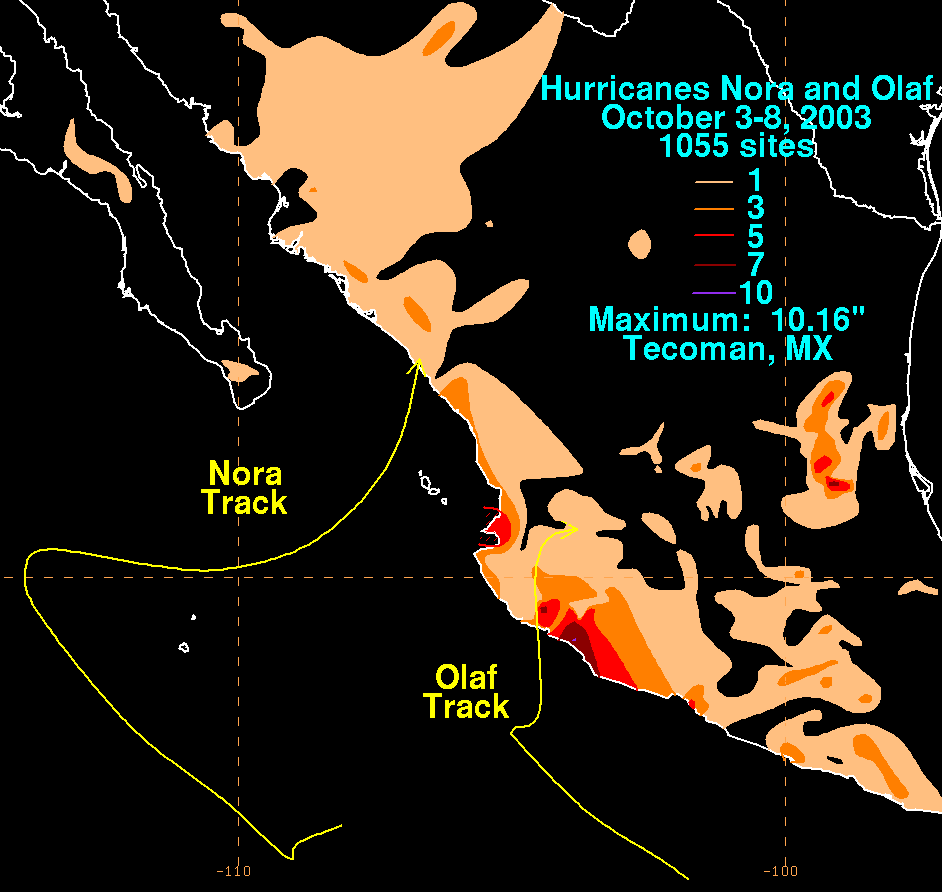
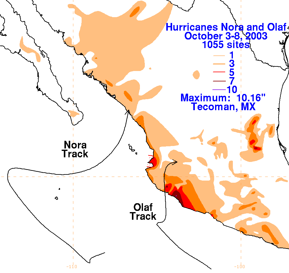
Below are the storm total graphics for Nora/Olaf. The maxima
near Olaf's point of landfall are more significant,
since it moved into Mexico with minimal wind shear. Nora moved
inland as a low-level swirl, and amounts near
its point of landfall were considerably less. Data for the maps
was obtained from the Comision del Agua, the parent
agency of Mexico's National Weather Service.
 |
 |
 |