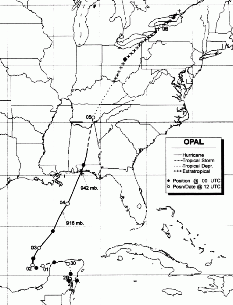
A tropical wave emerged off the African coast on September
11th.
It moved uneventfully across
the tropical Atlantic and Caribbean over the next couple weeks.
Merging with an area of low
pressure on the 23rd in the western Caribbean, the combined system
moved northwest towards
the Yucatan peninsula. On the afternoon of the 27th, it had
developed
into a tropical depression
just south of Cozumel, Mexico. Sauntering across the Yucatan,
the system strengthened into a
tropical storm just before emerging back in the Gulf of Mexico on the
morning of the 30th. Drifting
westward, it strengthened as it moved into the Bay of Campeche,
becoming
a hurricane early on
the 2nd.
A deep upper trough was approaching the cyclone from the Plains, and
the hurricane moved north
and northeast. Moving over a very warm patch of waters, at the
same time upper divergence reached
a maximum, Opal rapidly developed into a category 4 hurricane early
on the 4th. As it moved across
much cooler waters in the northern Gulf, the system slowly weakened,
making landfall as a borderline
category two/three hurricane near Pensacola around noon.
Accelerating
quickly to the northeast, Opal
became extratropical on the 5th as it entered the Ohio Valley.
It moved into southeast Canada during
the night of the 5th, and weakened as it ejected eastward across New
England. Below is the track of
Opal, created by the National Hurricane Center.
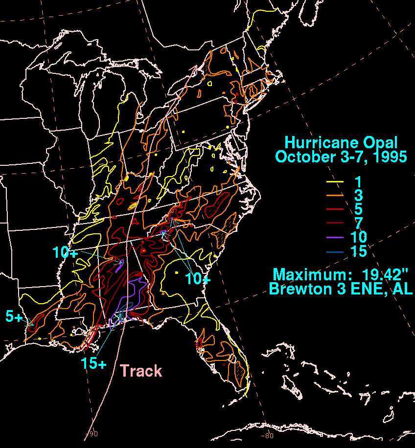
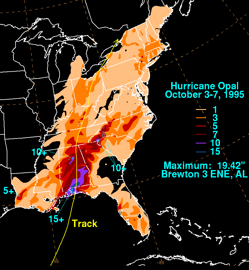
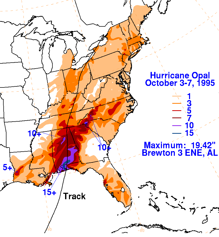
On the graphic below is the storm total rainfall for Opal.
Note
the streak of heavy rain
in the vicinity of its track until it nears the
Appalachians.
Thereafter, two paths of maxima
rainfall can be seen on either side of the mountain chain; the western
maximum coincides
with the center of the cyclone, while the eastern maximum is due to
upslope flow up the east
side of the Appalachians.
 |
 |
 |
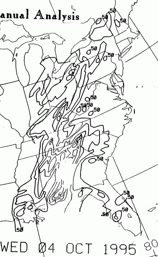
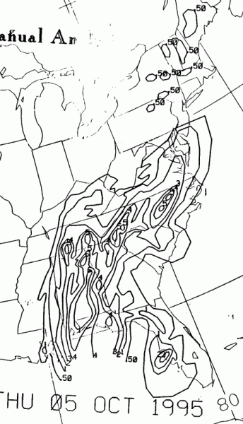
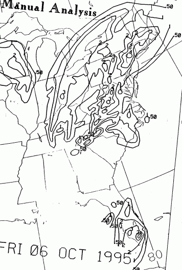
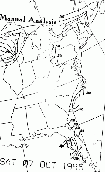
Below is the calendar for Daily Precipitation Maps. Note that
the 24-hour periods end
at 12z that morning.