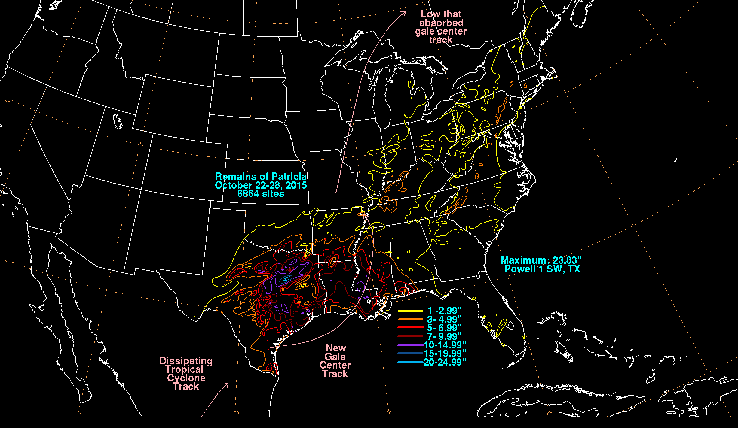
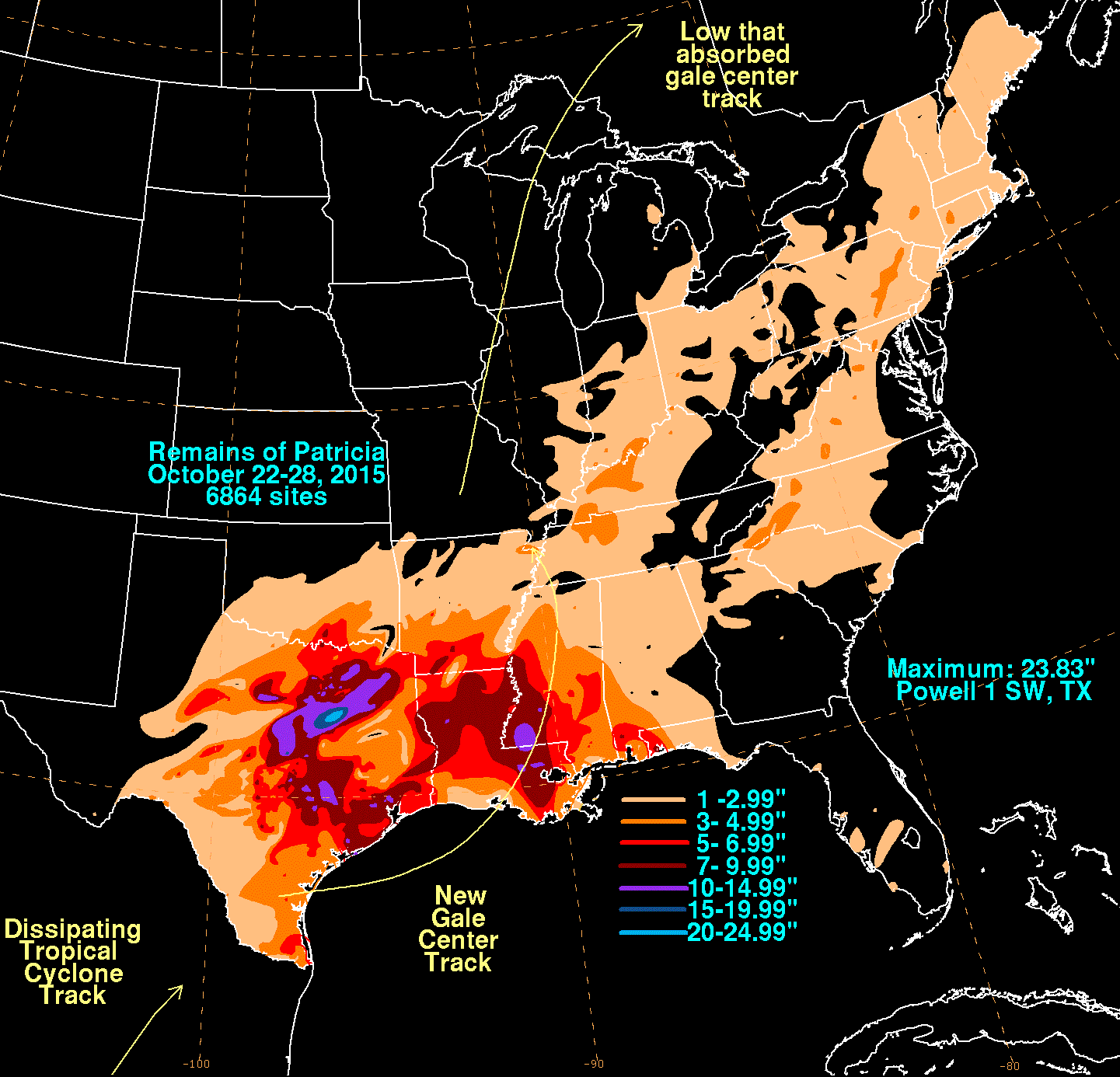
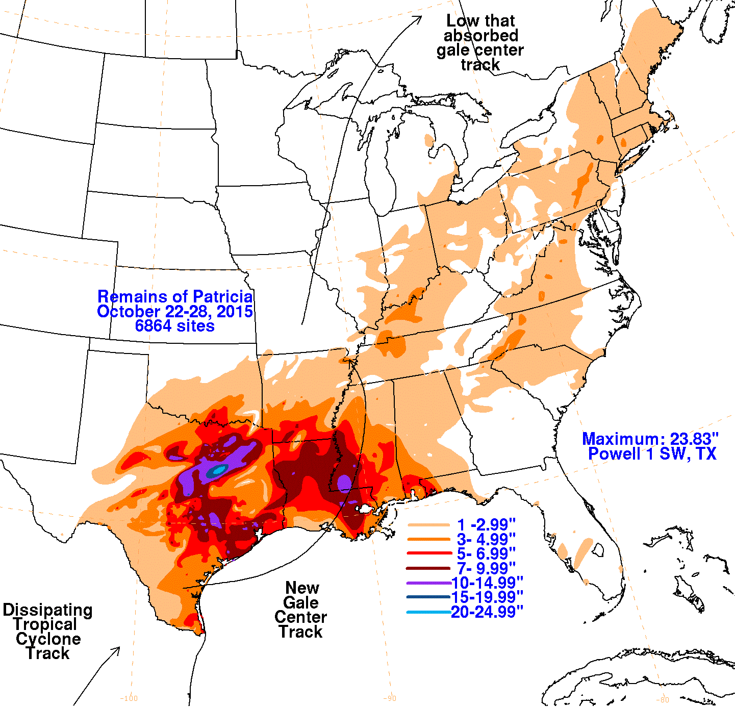
Hurricane Patricia had been an extremely strong hurricane while in the tropical eastern Pacific, making landfall in southwest
Mexico on October 23rd. While moving across Mexico, the National Hurricane Center reported that Patricia's mid-level center
separated from its surface circulation while over the Mexican Plateau. The result of this separation was the downstream
development of a new extratropical low across south Texas on the afternoon of the 24th about 300 miles northeast of Patricia's
weakening center. This new low strengthened as it moved into the northwest Gulf of Mexico, becoming storm-force on the 25th. The low
focused heavy rains across Mississippi, Louisiana, and Texas while tracking through the northwest Gulf of Mexico. Making landfall on
the morning of the 26th, the extratropical cyclone weakened and moved east-northeast until the 27th, when it turned northward in response
to a system moving through the northern Plains. By the morning of the 28th, a new low formed farther northwest in
Missouri, which absorbed its surface circulation as it was leaving Arkansas.
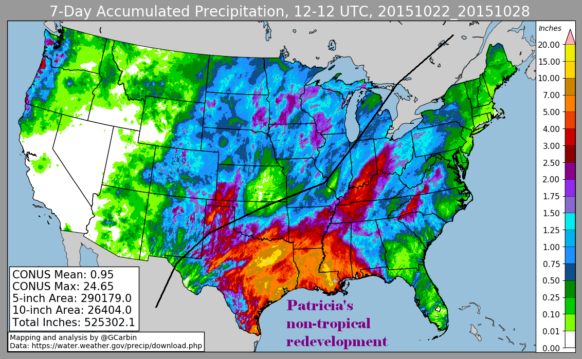
The first three graphics below show the storm total rainfall for the downstream redevelopment of Patricia, which used rain guage
information from National Weather Service River Forecast Centers, Forecast Offices, and CoCoRAHS. The fourth image is a multi-sensor
rainfall estimate, which adds radar-derived information.
 |
 |
 |
 |