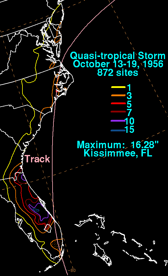
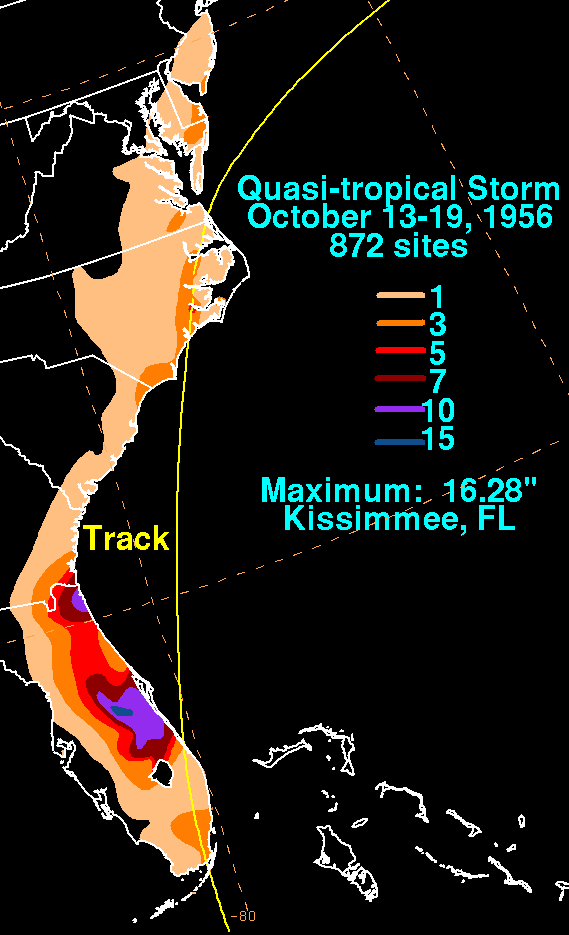
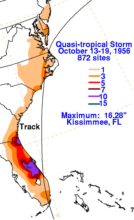
Quasi-tropical Storm - October 13-19, 1956
A frontal boundary was dissipating near and north of the Greater Antilles on the 12th.  A surface
low formed, and moved westward across Cuba into the 14th, before turning north to northeast across
Florida and North Carolina.  The system began to transition into an extratropical cyclone on the 18th
offshore the Virginia Capes, and strengthened as a non-tropical low as it streaked east-northeast offshore
New England before becoming absorbed by another storm to its northeast.  The storm total rainfall maps below
were constructed using data from data archived at the National Climatic Data Center in Asheville, North
Carolina.  Most of the rainfall in Florida fell in advance of the cyclone's center passing through.