The southern extension of the wave which spawned Hurricane Hugo in
the Atlantic continued
westward through the Caribbean Sea with no significant
development. However, as the wave
traversed Central America on the 21st and 22nd of September, there was
an increase in shower
and thunderstorm activity with the wave. Convection increased
further on the 24th to the
southeast of Acapulco, and a tropical depression formed that evening,
the 21st of the East
Pacific Season.
The system drifted west-northwest to northwest due to the presence
of a southward moving
upper-level trough over central Mexico. On the afternoon of the
26th, the cyclone became a
tropical storm. By the morning of the 27th, ridging rebuilt north
of the storm, and Raymond
resumed a more westerly track. By the afternoon of the 28th,
Raymond strengthened into a
hurricane. On the evening of the 30th, the hurricane peaked at
category 4 status. A longwave
trough approached from the west, turning Raymond back to the
northwest. By the 3rd, it was
accelerating northeast towards Mexico. By the morning of the 4th,
a combination of upper level
shear and cooler sea surface temperatures led to Raymond weakening back
into a tropical storm.
Throughout the 4th into the 5th, the cyclone quickly tracked through
Baja California, the Sea of
Cortez, and Sonora state in Mexico as a weakening tropical storm.
Raymond entered the United States in southeast Arizona as a
weakening tropical depression,
and its surface circulation dissipated in New Mexico. The upper
levels of the cyclone continued
moving eastward through the southern Plains into the Mid-Mississippi
Valley, spreading light to
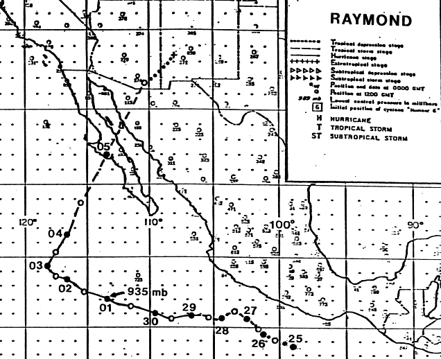
moderate rains to the right of its path. Below is the track of
this
storm, provided by the National
Hurricane Center.

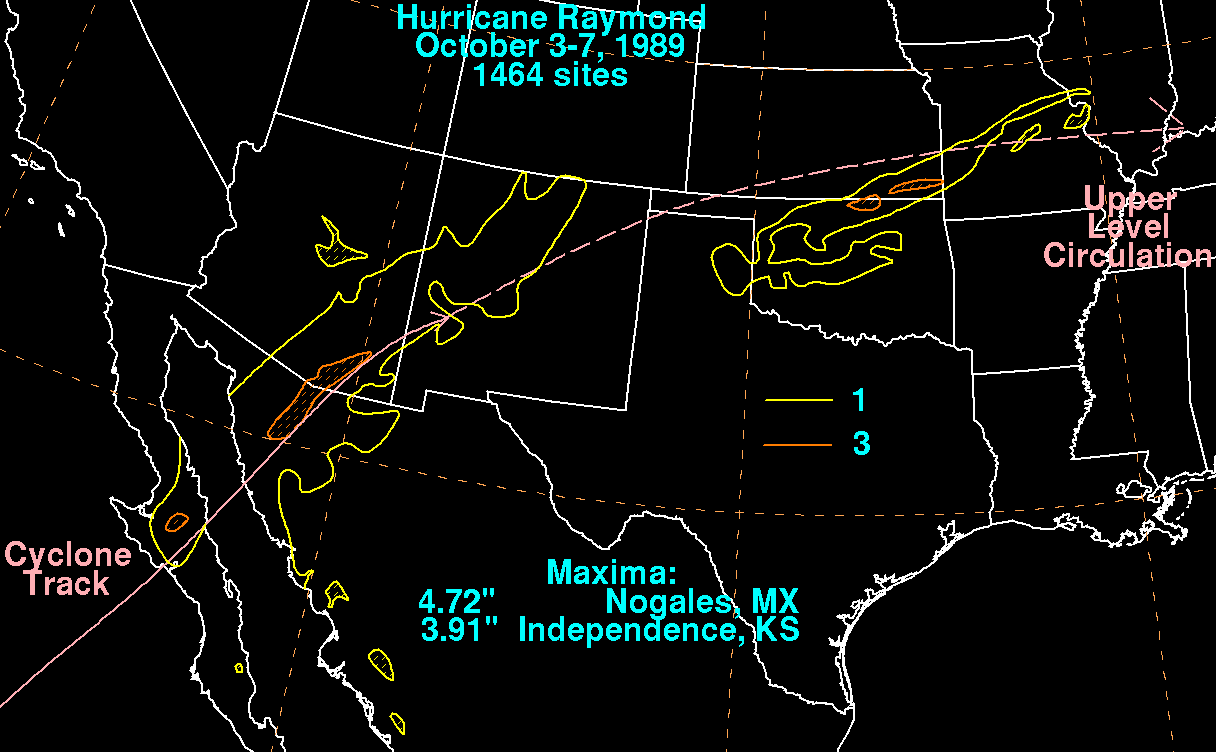
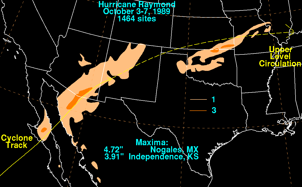
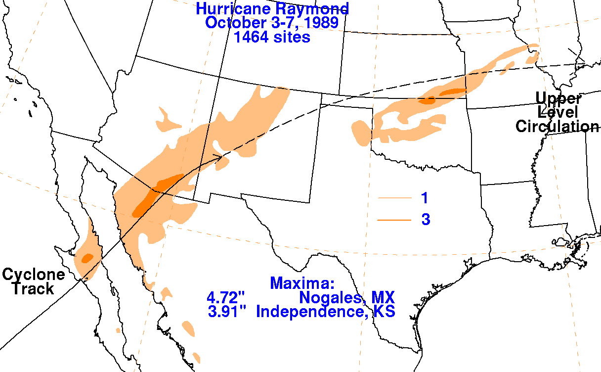
The storm total rainfall map below was constructed using data from
the
National Climatic Data Center
and the Comision Nacional del Agua, the parent agency of Mexico's
national weather service.
 |
 |
 |