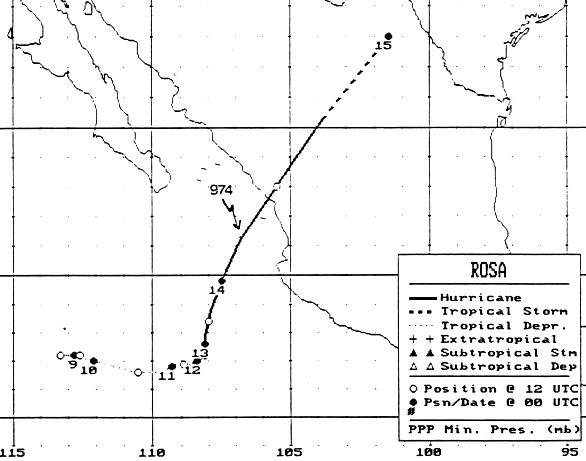
An area of disturbed weather formed 700 miles south-southwest of the
southern tip of Baja Califonia. Gradually
increasing in organization, it evolved into a tropical depression early
on the morning of the 8th. Development
halted for a few days. Another area of disturbed weather
approached the depression from the east, and the system
began to intensify. The cyclone became a tropical storm late on
the morning of the 11th, and a hurricane on the 12th,
while drifting east-northeast. A deep trough then approached
western North America, which accelerated the hurricane
northeast. Rosa became a category two hurricane before moving
ashore the Mexican coast near La Concepcion very
early on the 14th. The cyclone rapidly weakened, and its low
level center dissipated as it approached southern Texas.
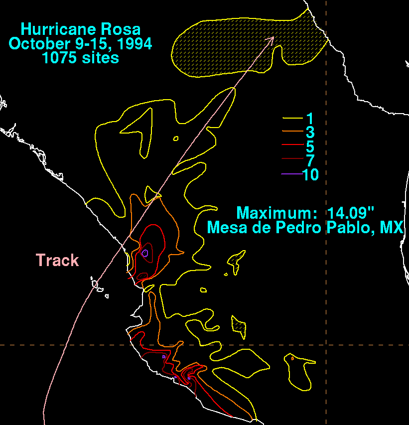
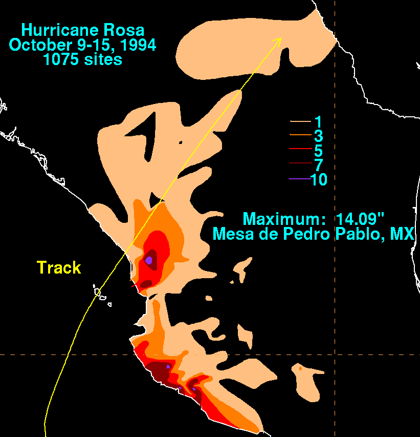
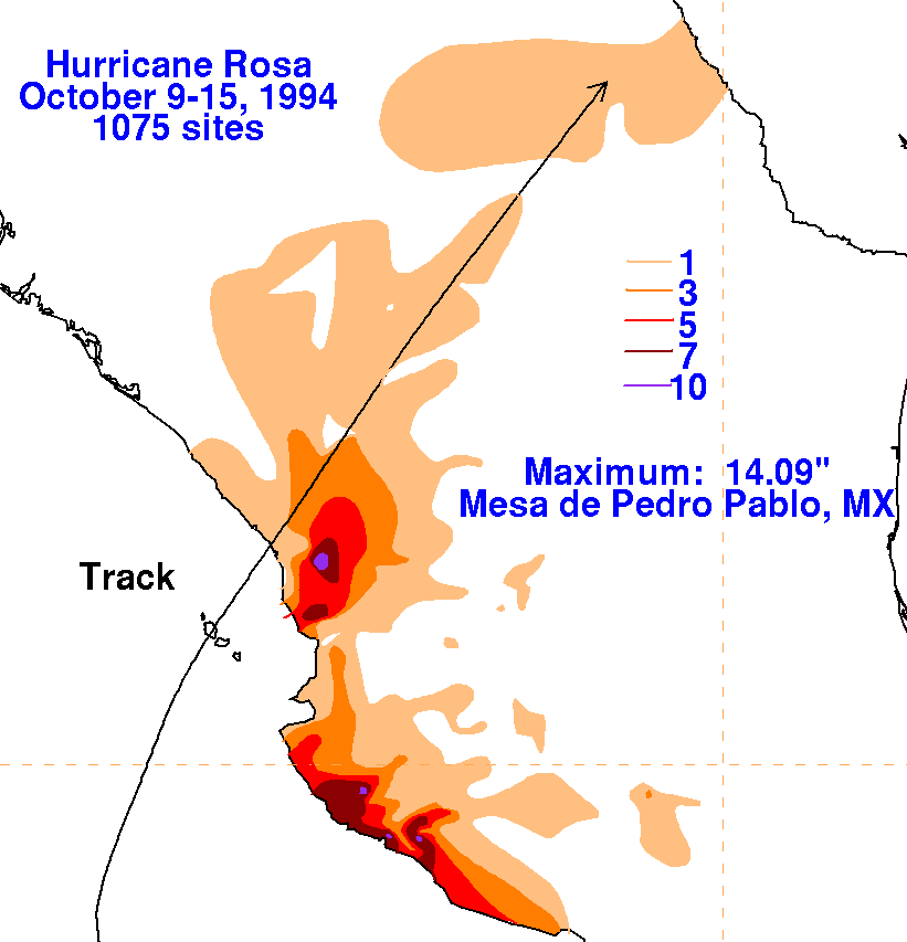
Below is its track, provided by the National Hurricane Center.
Rainfall
information for Mexico was obtained from the Comision Nacional del
Agua, the parent
agency of Mexico's national weather service.
 |
 |
 |