The tail end of a barolinic trough trailing Omar was south of Bermuda in early September. It moved west-southwest
for several days developing disorganized showers and thunderstorms as it approached the Bahamas on the 10th. Development ensued,
and a tropical depression formed between Andros and Bimini in the Bahamas on the afternoon of the 11th. It turned west and
made landfall near Culter Bay during the early morning of the 12th. Strengthening continued over land, and mid-morning, the
depression was upgraded to Tropical Storm Sally while centered west of Homestead. Sally emerged over the Gulf of Mexico late
morning and turned northwest, but northwest vertical wind shear slowed strengthening. Sally strengthened into a hurricane about
125 miles south of Pensacola on the 14th before moderate to strong wind shear resumed. The hurricane slowed to a crawl
and turned northward on the 15th. Later that day, intensification resumed. Its eyewall moved ashore Baldwin County, Alabama
that night, and the system continued to recurve northeast into the Florida Panhandle. Moving back into southern Alabama, Sally regained
tropical storm status early in the afternoon of the 16th, tropical depression status just south-southeast of Montgomery early on the
morning of the 17th, and then post-tropical/extratropical later that morning before heading into Georgia. Accelerating east-northeast,
the system crossed the Carolinas before heading into the western subtropical north Atlantic.
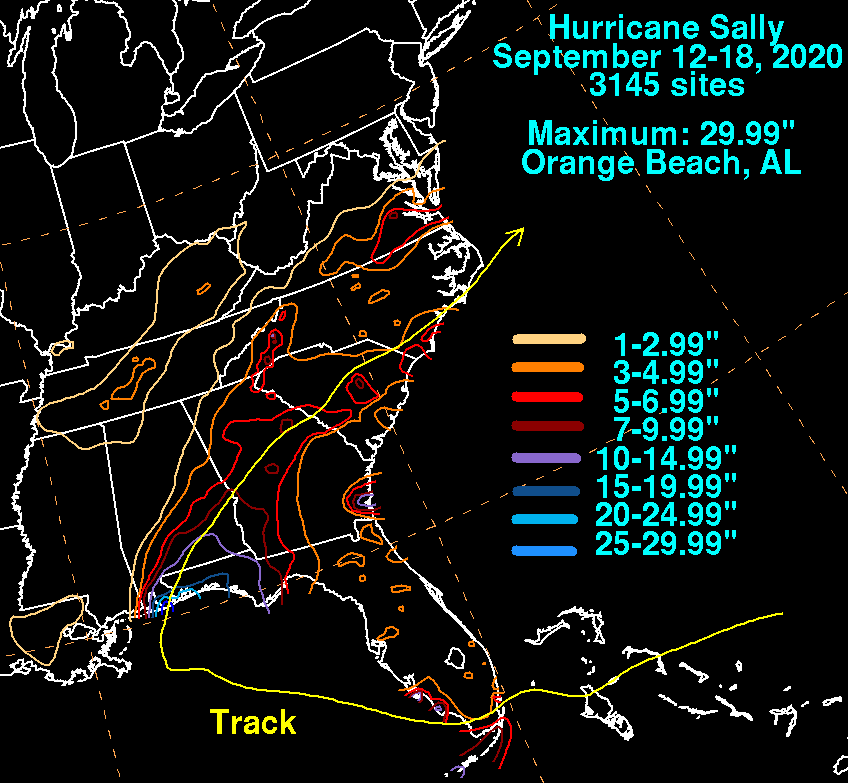
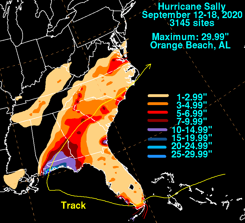
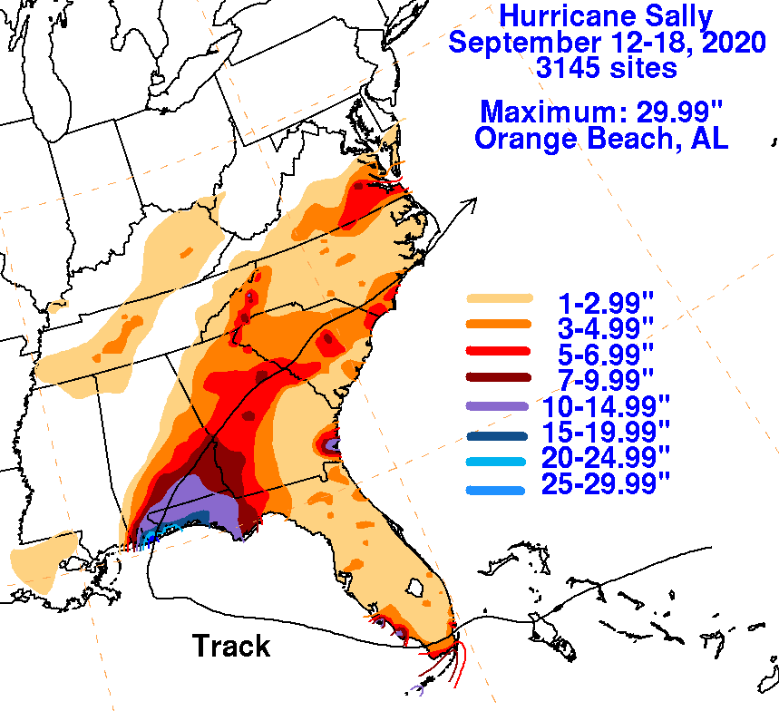
The graphics below show the storm total rainfall for Sally, which used rain gage information from the National Weather
Service River Forecast Centers, Forecast Offices, and CoCoRAHS.
 |
 |
 |