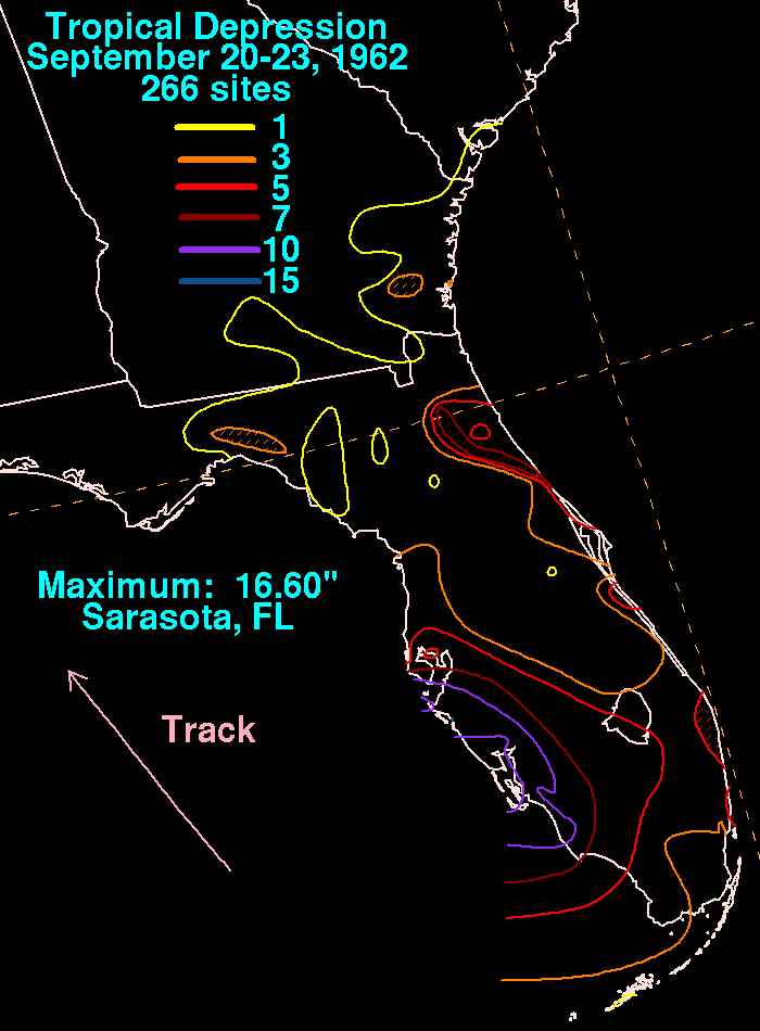
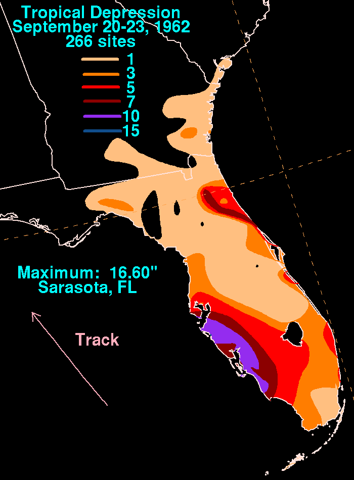
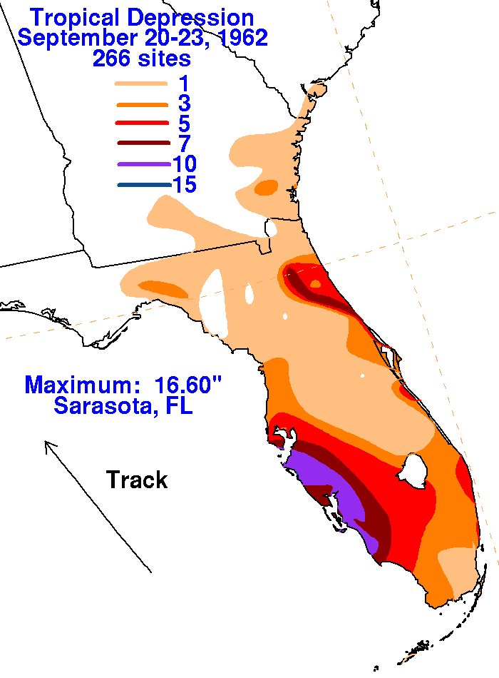
An upper level low closed off aloft in the eastern Gulf of
Mexico. This caused the formation of a low pressure area
offshore Florida's west coast. Discussed as a tropical depression
in the Weekly Weather and Crop Bulletin, this system
moved slowly north-northwest over a 2-3 day period before the formation
of a new cyclone offshore the Carolinas caused
the dissipation of this system. Heavy rains fell along both
coasts of the state, but particularly along the west coast between
Naples and Tampa. The track within the graphics below was based
upon the Daily
Weather Map series. Rainfall information
was provided by the National Climatic Data Center
in Asheville, North Carolina and the Jacksonville section of the Army
Corp of Engineers.
 |
 |
 |