A strong upper level trough developed across the southeastern United
States during the last week of
June. A large convective system formed in the eastern Gulf
of Mexico on June 24th, with a small low
pressure system developing by that evening. The low strengthened
as it moved rapidly northeast,
making landfall just north of Tampa that night and moving north of
Orlando by the morning of the
25th. As the system pulled away from Florida it became
extratropical, and its center became hard
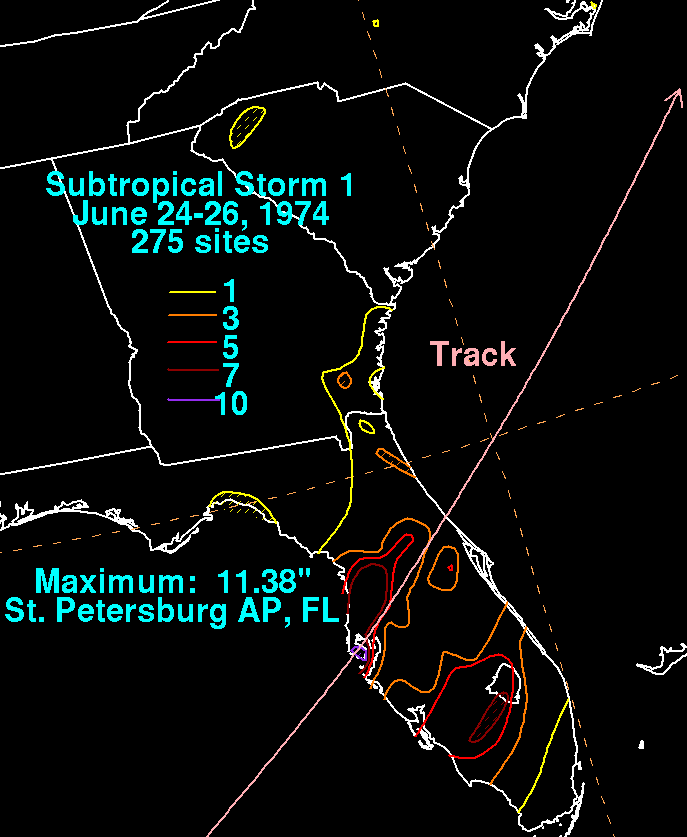
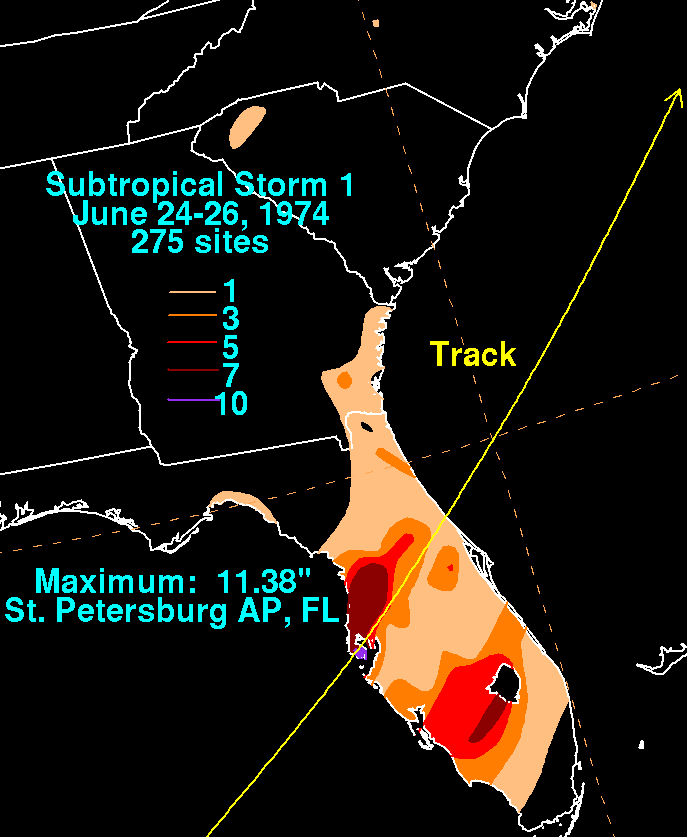
to find by that evening. Below is a storm total rainfall map for the
subtropical storm.
Note the
two maxima near and east its track through Florida.
 |
 |
|