The tropical wave which led to Tammy's development was west of the African coastline by October 11th. Taking a few days to slowly develop, thunderstorms organized and become more concentrated on the 14th as it continued moving westward through the tropical Atlantic. Organization continued to gradually improve through the 17th, with a well-defined center forming. This led to the naming of Tropical Storm Tammy. Westerly vertical wind shear hindered development to some degree, with Tammy becoming a hurricane on the 20th as it neared the Lesser Antilles. Turning north-northwest as a deep layer trough neared the system, it paralleled the Lesser Antilles while continuing to slowly strengthen. Tammy reached its peak intensity on the 25th while turning northeast. Soon afterward, Tammy's interaction with the upper level trough led it down the path of extratropical transition, with Tammy declared a post-tropical cyclone on the 26th while moving northwest. After occluding, a small amount of deep convection returned to its center while it drifted westward, leading to its reclassification as a tropical storm on the 27th. Turning eastward, Tammy became an extratropical cyclone once more on the 29th. The cyclone then turned southeast, south, southwest, then west as a weakening surface low. The low lost its surface center on the night of November 2nd well to the southeast of Bermuda.
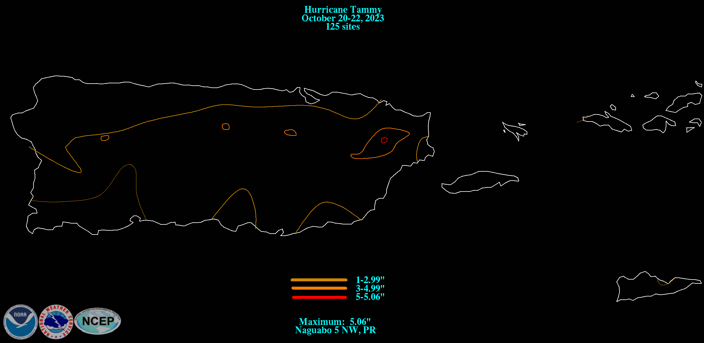
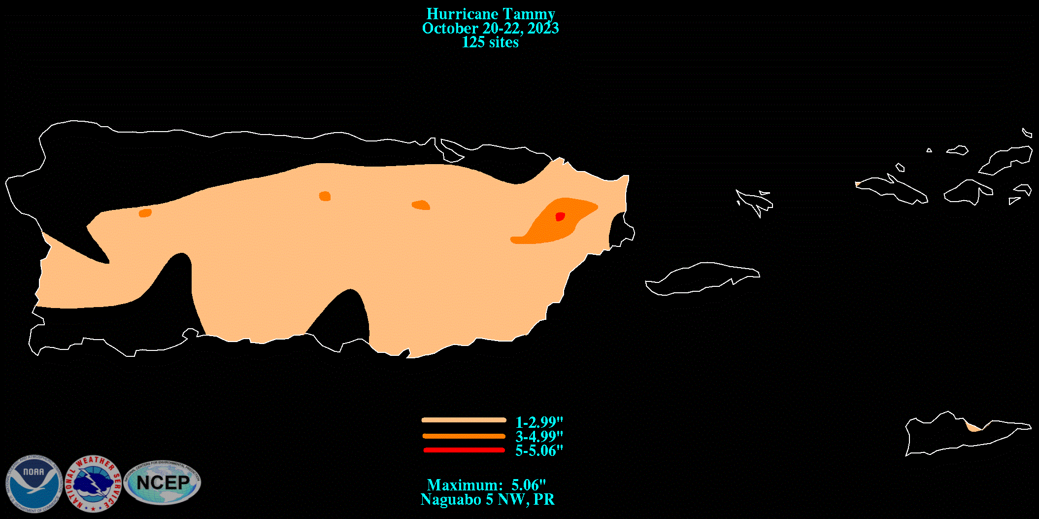
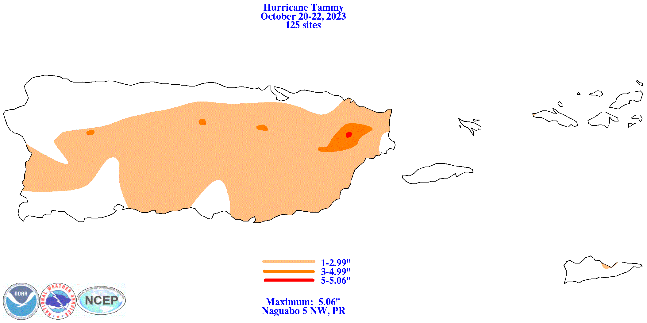
The graphics below show the storm total rainfall for Tammy, which used rain gage information from National Weather Service River Forecast Centers, xMACIS2, the San Juan National Weather Service Forecast Office, and CoCoRAHS.
 |
 |
 |