The system was designated as the first tropical depression of the
season in real-time, and the second of
the season in post-season analysis. A tropical wave moved off the
coast of Africa on May 30th. The
wave
moved westward, interacting with a stationary trough of low pressure in
the western Caribbean on
the 11th,
forming a tropical depression.
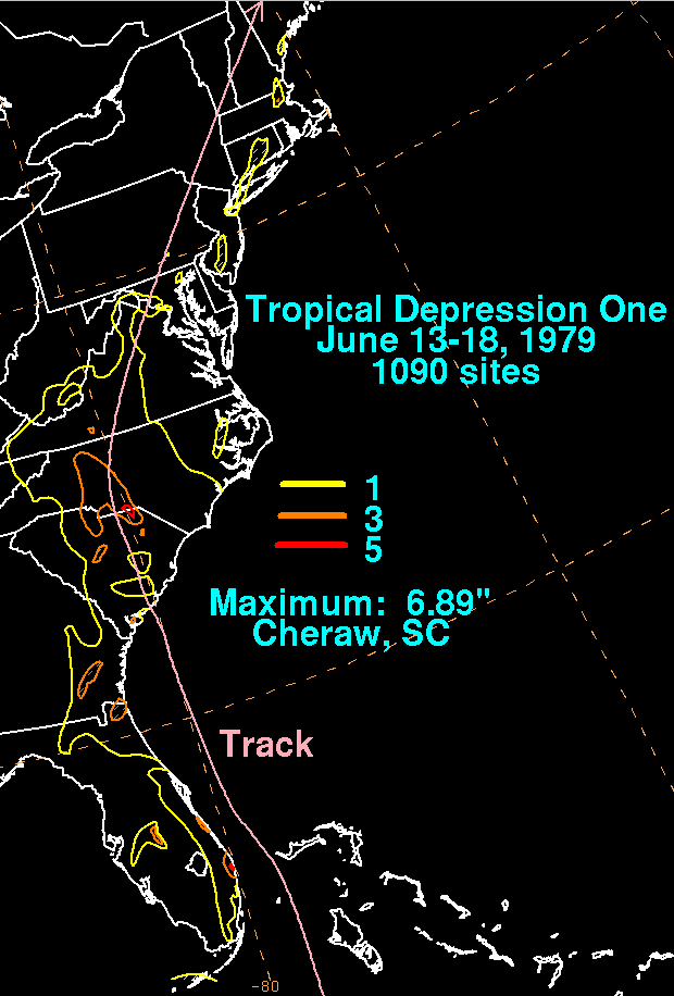
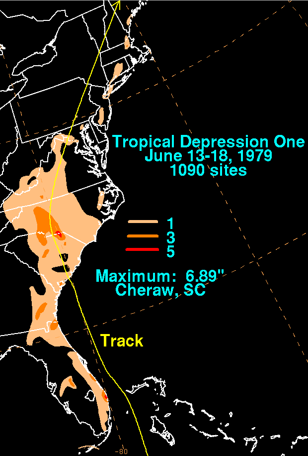
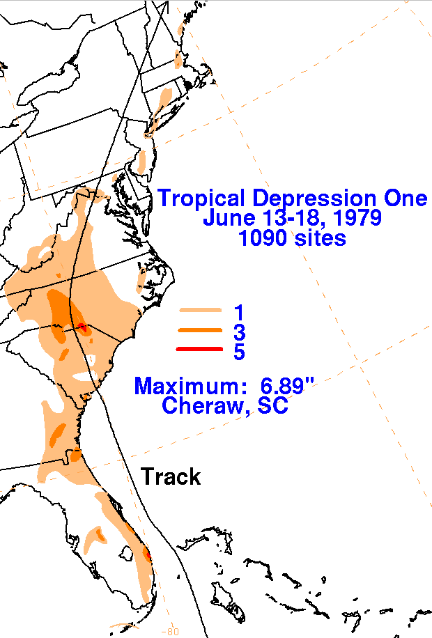
The depression moved northward, focusing rainfall across Jamaica for
two days, which led to upwards of
34 inches of rain for the mountainous country. The depression
then moved northward, moving offshore
Florida and inland into South Carolina. Moderate to heavy rain
fell near its track. The low weakened at it
moved through the Mid-Atlantic states into New England. Below are
the storm total rainfall maps for the
depression, using data
provided
by the National Climatic Data Center in Asheville, North Carolina.
 |
 |
 |