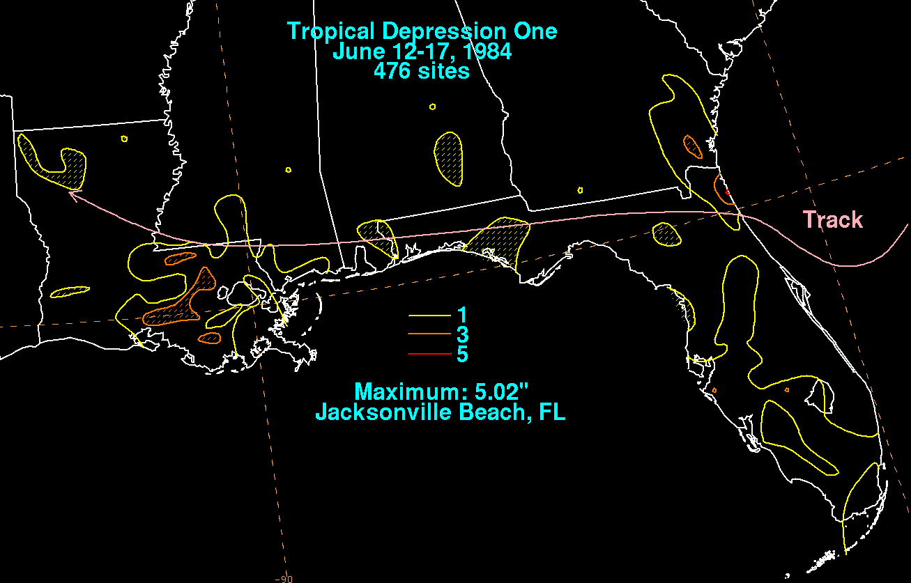
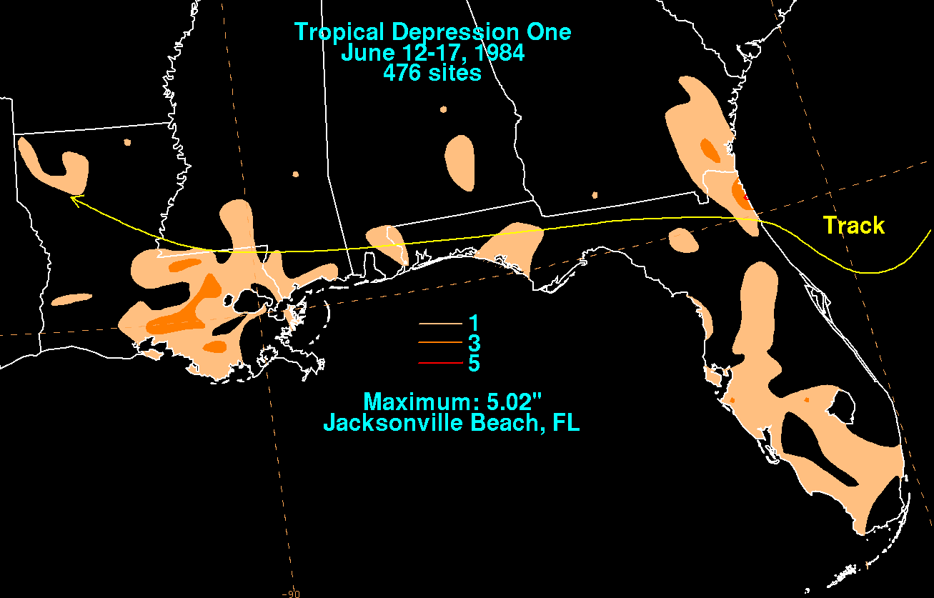
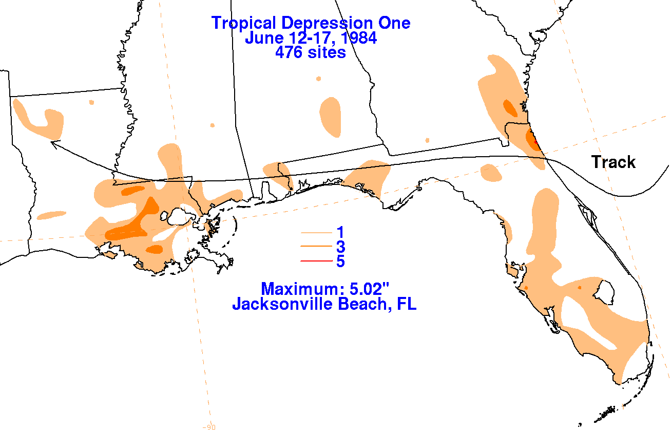
An upper level low helped spur the development of a tropical
depression off the northeast coast of Florida on June
12th. The system moved into the St. Augustine area over the next
couple days, with its main thunderstorm activity
concentrated north of the center. The system moved north of the
upper low which initially spurred development
for the next few days while tracking westward just inland of the Gulf
coast as a small area of low pressure.
Occasional increases of thunderstorm activity were seen with the
low until the system dissipated completely
across Louisiana. Below are the storm total rainfall maps for the
depression, using data
provided
by the
National Climatic Data Center. The track was provided by the
National Hurricane Center, then extended
to the west based on the Daily Weather Map series.
 |
 |
 |