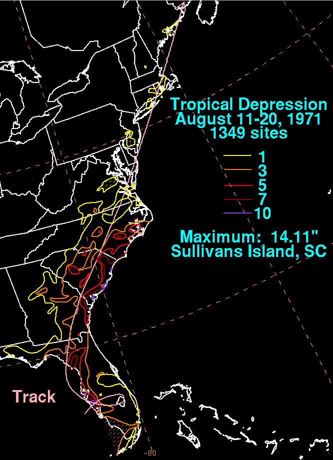
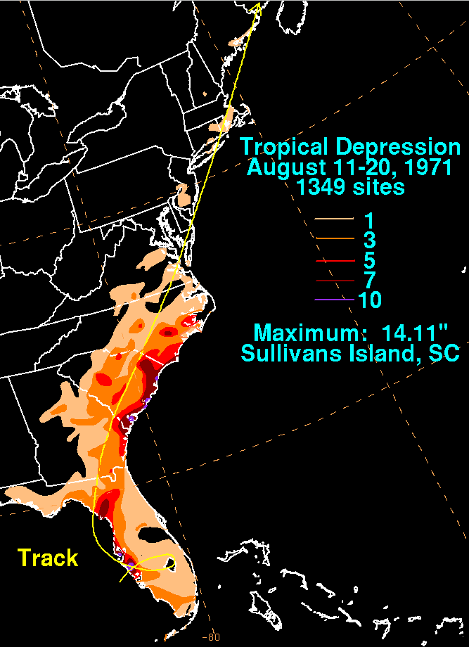
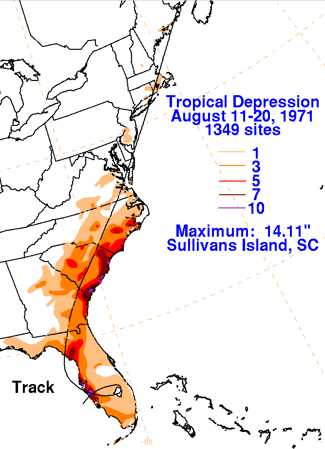
A surface low formed offshore southwest Florida and became a
tropical depression. The system looped anticyclonically
through southern Florida and slowly developed, moving back offshore
western Florida. Deepening further, the system
struck Cedar Key on the 16th and was whisked northeastward ahead of an
upper low.
The graphics below show the storm total rainfall for the tropical
depression, with
data
provided
by the National Climatic
Data Center in Asheville, North Carolina.
 |
 |
 |