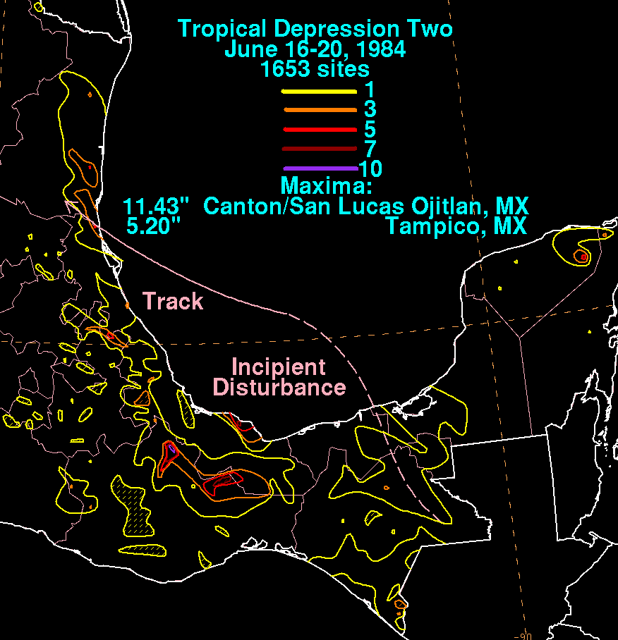
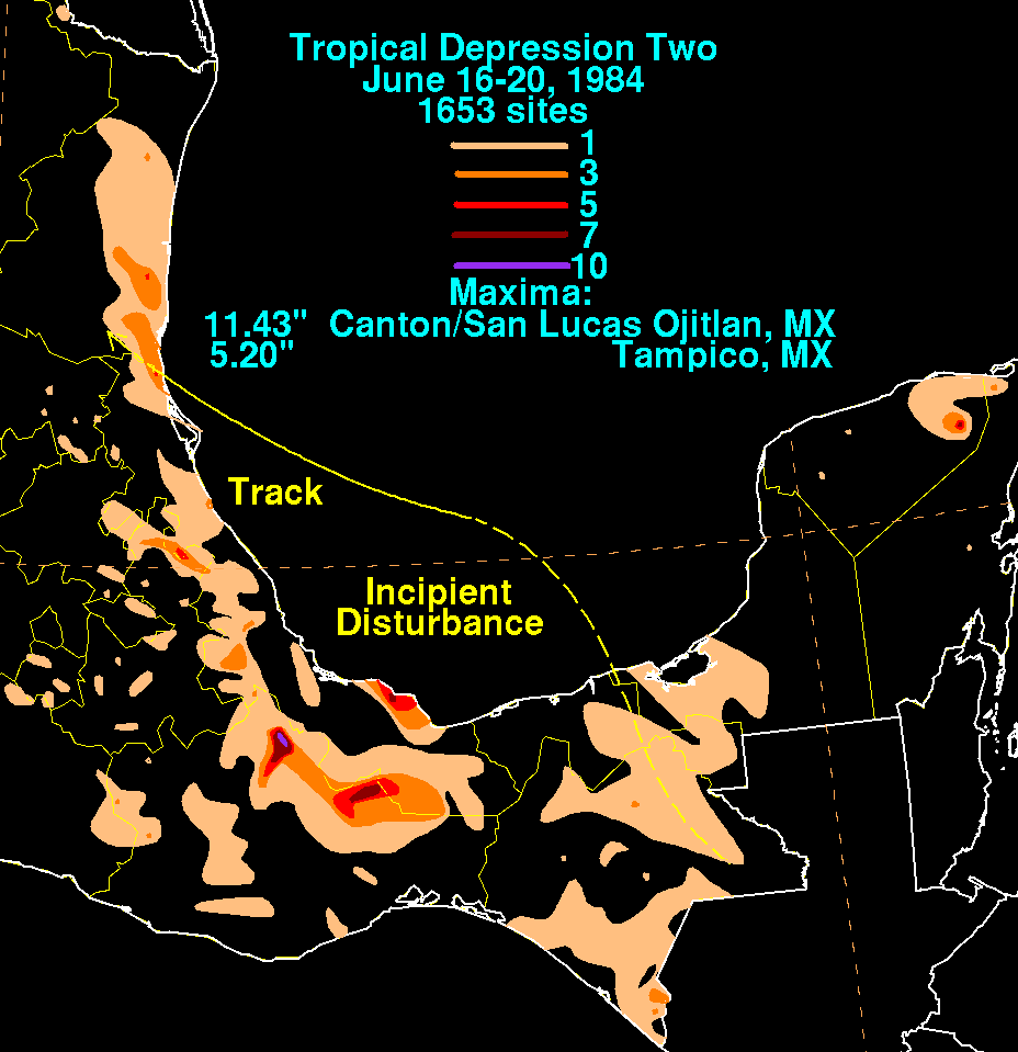
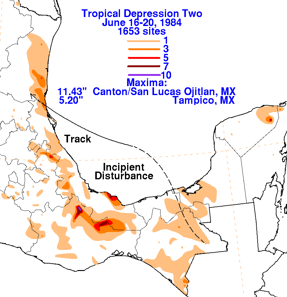
An upper level low moving across the southern Gulf of Mexico spawned
an area of thunderstorm activity over
the Mexican isthmus on June 16th. The thunderstorm area moved
northwest, pulsing in intensity, until flaring
up into a larger area of deeper convection early in the morning of
the the 18th. A surface low formed, and the
system was considered well-enough organized to de a tropical
depression, the second of the season. On the 19th,
vertical wind shear from the west-southwest stopped further
development, and began a general weakening trend
which continued past its landfall point in northeast Mexico. By
early morning of the 20th, the system completely
dissipated. Below is a storm total rainfall map for the tropical
depression, using data from the Servicio Nacional
del Agua, the parent agency of Mexico's National Weather Service.
 |
 |
 |