A tropical wave moved off the African coast on June 24th. The
system moved westward without development
until moving into the western Caribbean sea on July 3rd. Showers
and thunderstorms increased with the wave axis
prior to its movement across the Yucatan peninsula of Mexico.
Once over the Gulf of Mexico, a surface low formed
and was sufficiently well organized convectively to be considered a
tropical depression on the evening of the 7th. The
system moved northwest until just prior to landfall, before turning
westward due to a strengthening ridge to its north-
west. The depression made landfall near Port Isabel, moving
across Brownsville on the 8th. The system resumed a
west-northwest course once it moved across northeast Mexico, stalling
southeast of the Big Bend while its surface
circulation dissipated on the 9th. Over the next few days, its
remnant circulation aloft sat and spun in place before
a portion sheared northeast across western Texas while its western
section weakened while moving through northwest
Mexico.
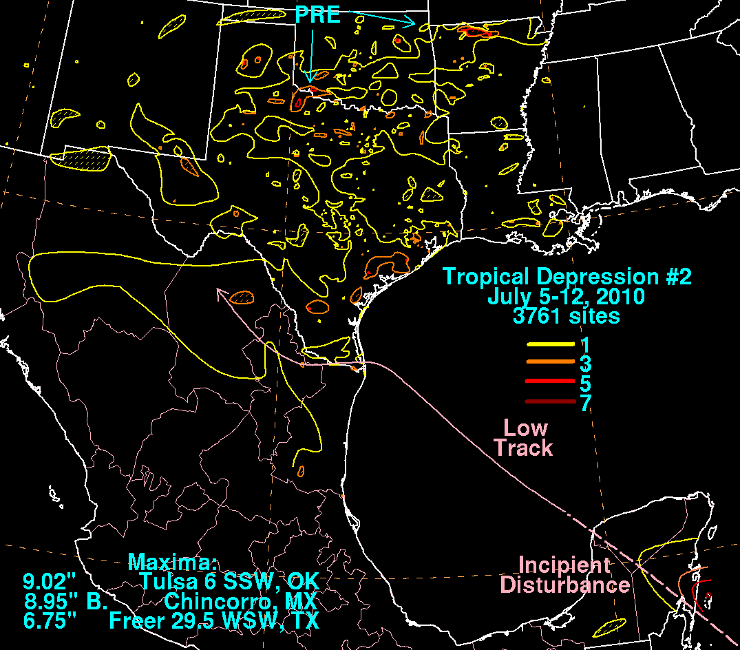
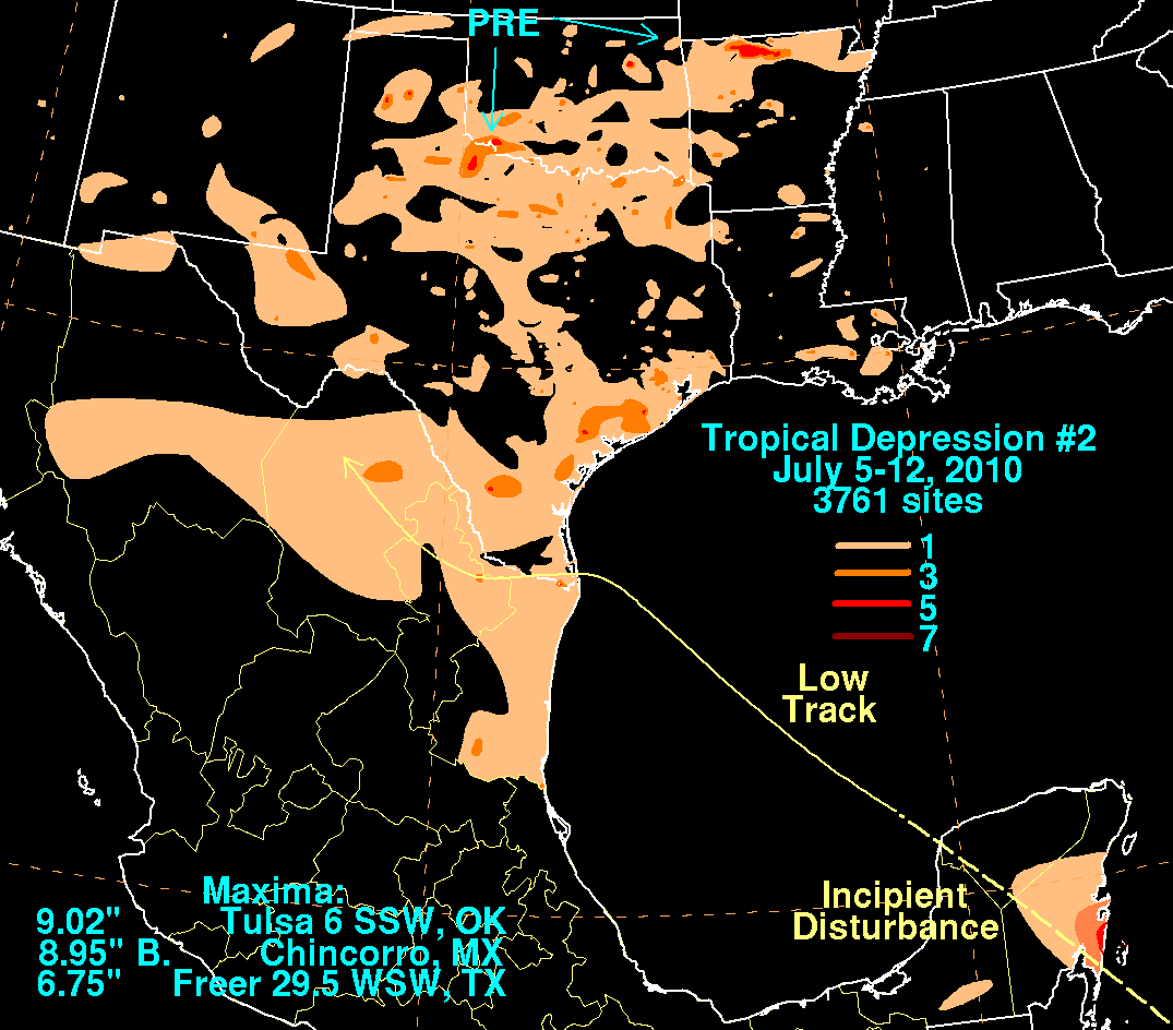
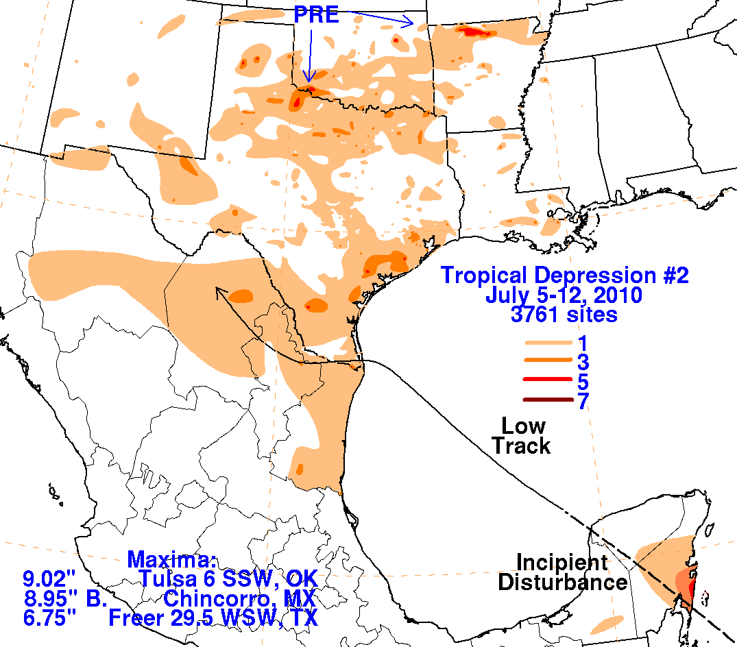
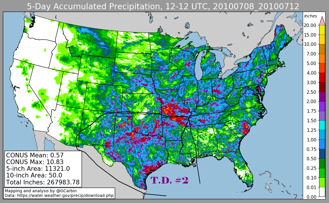
Below are the storm total rainfall maps for the depression. The first three use rain
guage data provided by data compiled by
the Climatic Prediction Center and CoCoRAHS. The fourth image includes radar-derived
information.
 |
 |
 |
 |