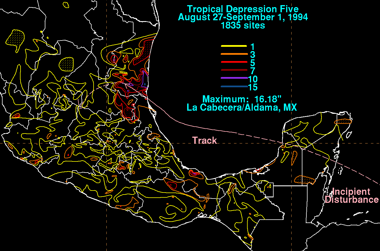
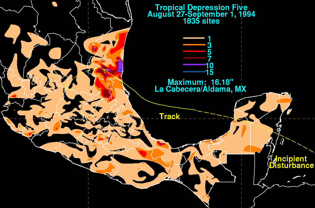
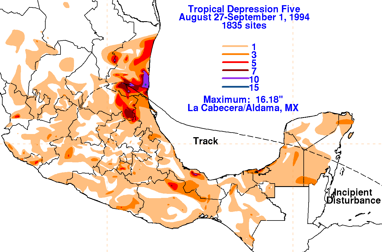
A tropical wave moved offshore Africa on August 17th. The
system moved steadily through the
tropical north Atlantic and eastern Caribbean sea without
development. As it moved into the western
Caribbean sea, an area of disturbed weather formed along the wave axis,
though surface pressures had
begun to fall. The system moved across the Yucatan peninsula,
emerging into the Bay of Campeche,
where it developed a low level circulation center and became a tropical
depression. The low moved
west-northwest, into Tampico, Mexico on the 31st. After its
center dissipated, the cloud pattern
associated with the system could be followed for an additional day
before dissipating late on the 1st
of September. Below
are storm total rainfall maps for the depression, using data provided
by
the
Comision Nacional del Agua, the parent agency of Mexico's national
weather service.
 |
 |
 |