A tropical wave moved offshore the western African coast on July
22nd. While the northern
portion of the wave spawned Tropical
Storm Erin, the southern portion moved west through
the Caribbean Sea. By August 1st, a weak low had formed over the
northwest Caribbean Sea.
The system moved westward through the Yucatan peninsula on the 2nd and
3rd, entering the
Bay of Campeche on the 4th. Meanwhile, an area of convection
formed across the Mexican
Isthmus, which moved northwest to a location coincident with the
surface low. By the 5th,
the system was well enough organized to be considered a tropical
depression. The depression
moved west-northwest, crossing the Mexican coast midway between Tampico
and Tuxpan on
the evening of the 6th. The area of low pressure associated with
the depression quickly dissipated,
but its cloud pattern retained integrity until the afternoon of the 7th
before dissipating. Below
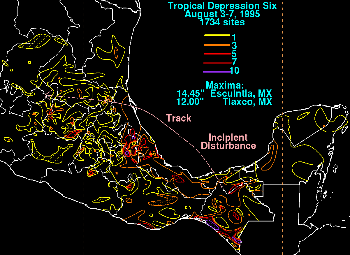
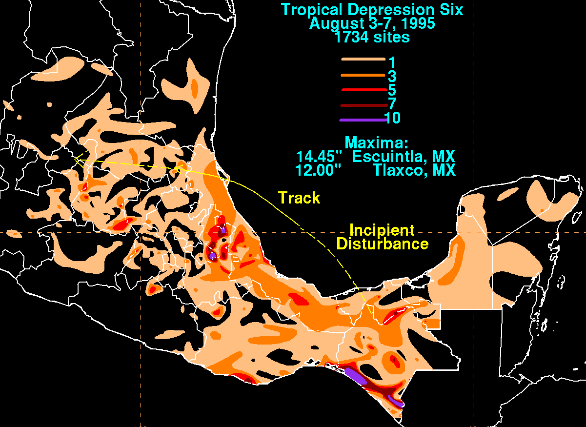
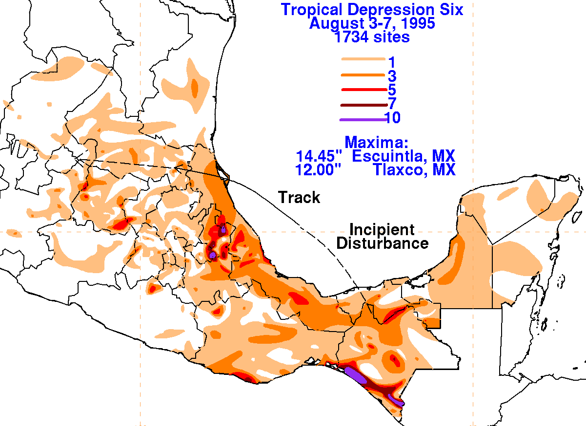
are
storm total rainfall maps for the depression, using data provided by
the Comision Nacional del
Agua, the parent agency of Mexico's national weather service.
 |
 |
 |