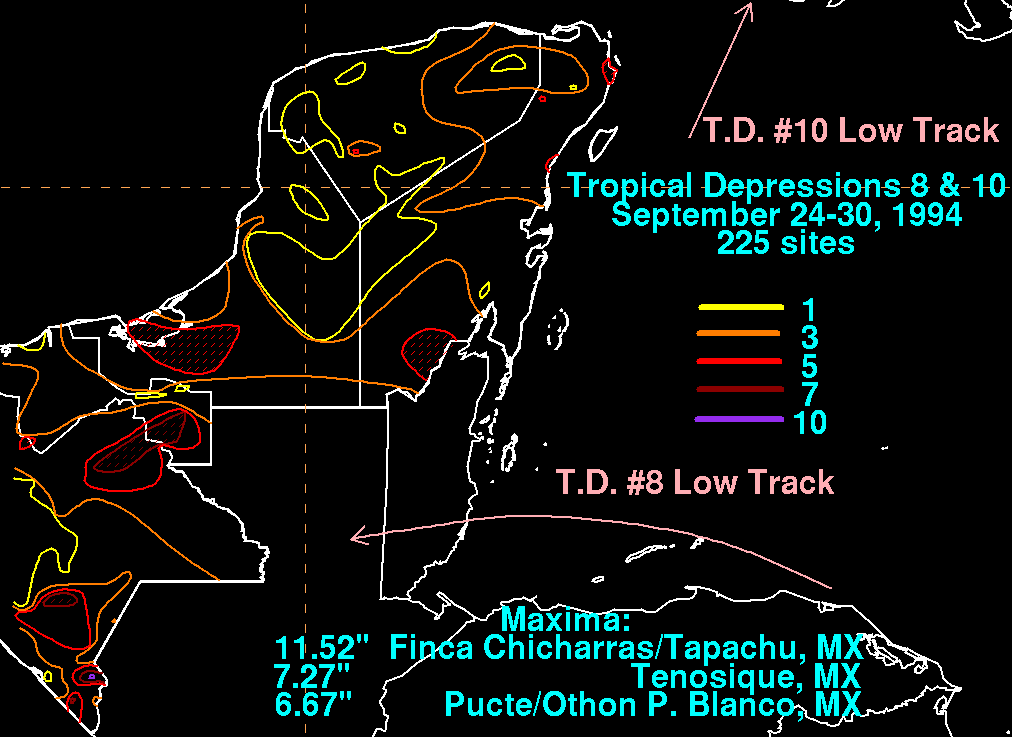
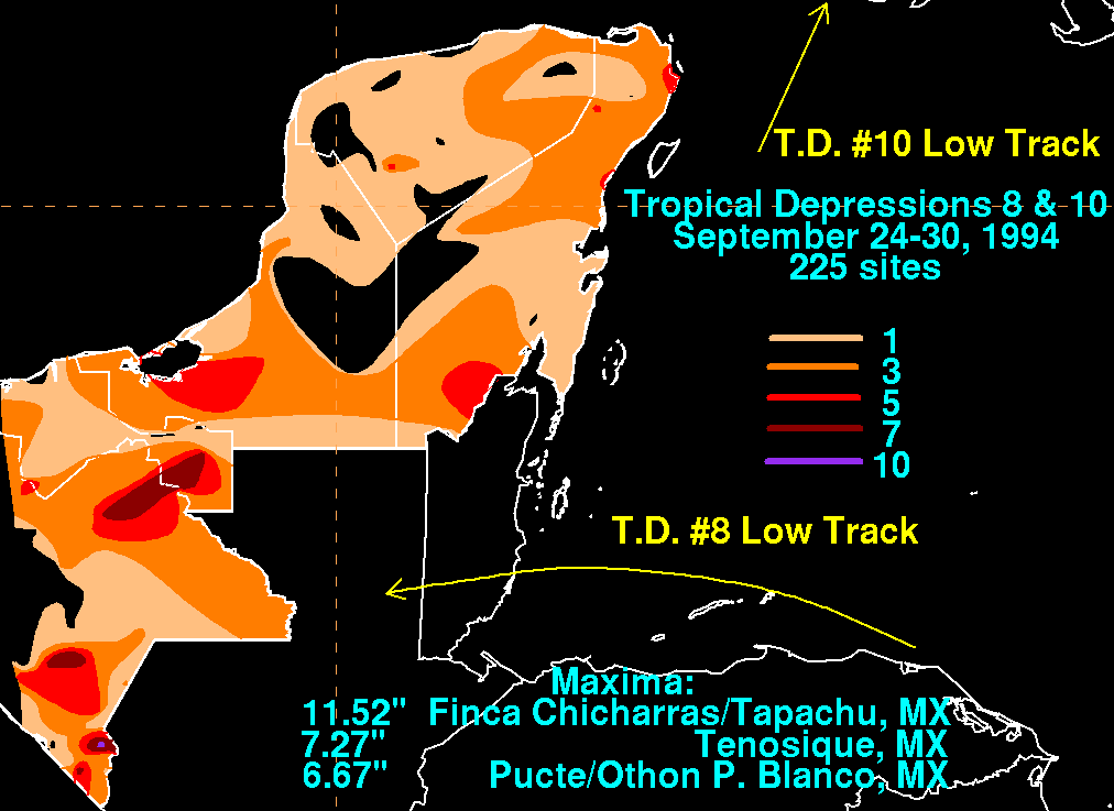
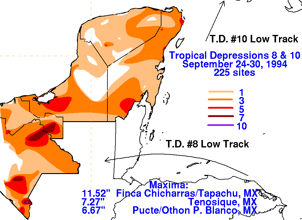
An area of distubed weather formed in the southwest Caribbean sea on
September 19th. The system moved slowly
northwest. On the 23rd, it passed along the coast of northeast
Honduras. By the morning of the 24th, the system
had become well enough organized to be considered a tropical
depression. The system turned west, moving across
southern Belize on the afternoon of the 25th. While the low level
center dissipated, disturbed weather remained near
the coast of northern Central America and southeast Mexico, which
slowly organized into Tropical Depression 10 on
the 29th, which then moved northward. The storm total rainfall
map below for the tropical depression was constructed
using data
from the National Climatic Data Center. No attempt was made to
separate out the rains from Tropical
Depressions Eight and Ten since they were the same convective system.
 |
 |
 |