A weak tropical wave crossed Dakar, Senegal on June 12th. It
moved westward across
the Atlantic uneventfully through the southern Windward Islands and
northern South
America. On the 20th, the wave became convectively active north
of Colombia. Under
the influence of Tropical Storm Celia in the eastern Pacific and an
upper low in the Gulf
of Mexico, the convective system spread northward over the northwest
Caribbean, Cuba,
the Yucatan peninsula, and Florida
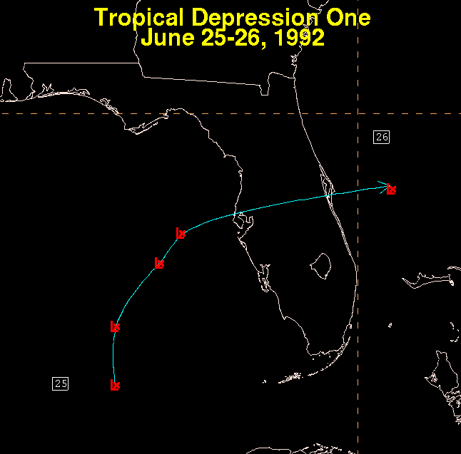
During the 23rd and 24th, raob data indicated the formation of a
mid-level low near 20N
85W. When a plane investigated the area on the 24th, no low level
center was found. By
the afternoon of the 25th, ship reports and data buoys indicated a
surface low had formed
which began the life cycle of Tropical Depression One. The system
experienced westerly
shear, as all the thunderstorm activity became well-removed from the
low level center. The
shear was caused by the upper low in the Gulf of Mexico and Celia in
the Pacific Ocean.
The system made an arc north, then eastward, across the eastern Gulf
of Mexico across
Florida before becoming absorbed into a large nontropical low in the
western Atlantic.
Its track is below, which utilized a track produced by the National
Hurricane Center.
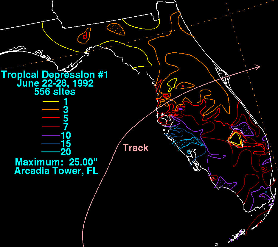
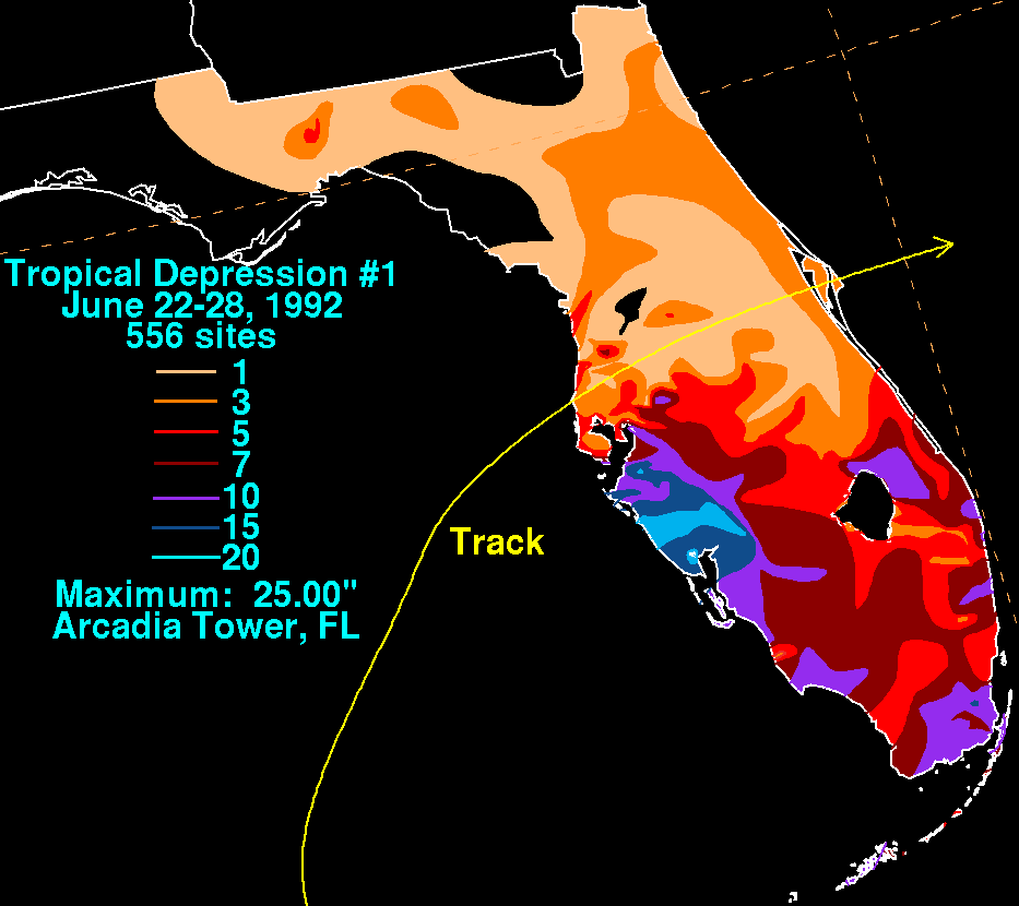
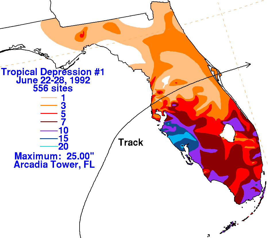
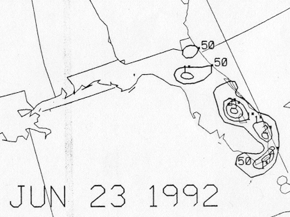
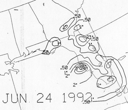
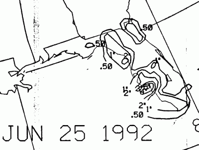
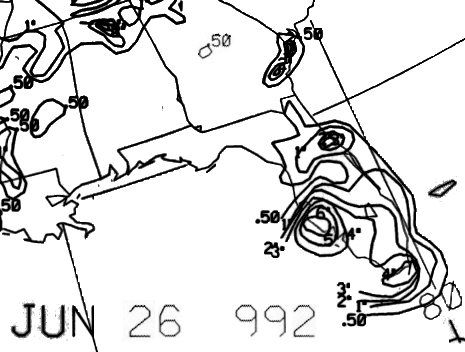
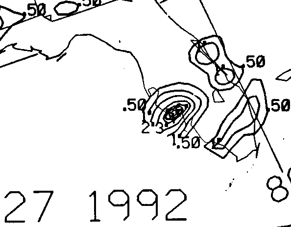
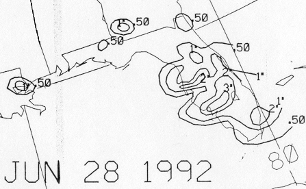
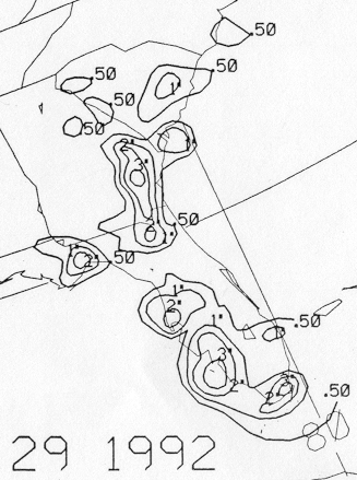
The graphics below show the storm total rainfall for T.D. #1, with
data
provided
by the National Climatic Data
Center in Asheville, NC, South Florida Water Management District,
Southwest Florida Water Management District,
Northwest Florida Water Management District, and the post-storm
report from the National Hurricane Center.
 |
 |
 |
Below is the calendar for Daily Precipitation Maps. Note that
the 24-hour periods end
at 12z that morning.