A tropical depression formed in the southern Gulf of Mexico on
October 14th. Rounding the western periphery
of the subtropical ridge, the depression strengthened while recurving
towards the central Gulf coast ahead of an
advancing cold front. Moving inland late on the 16th, the
depression became an extratropical cyclone which
moved through the Southeast and Mid-Atlantic states, before moving
offshore New England. Heavy rains
fell along the frontal boundary ahead of the system, leading to
flooding across eastern Louisiana, central
Mississippi, the western Florida panhandle, central Tennessee, western
Virginia, and eastern New York.
The heavy rains which fell upon Jackon, Mississippi established a
new daily rainfall record for October 16 and
a new 24-hour rainfall record for the month of October.
Eight bridges were damaged across Jackson county,
Tennessee due to the floods, and there was extensive damage to the
soybean and corn crops in Hickman and
Marion counties in Tennessee. Six tornadoes touched down in
association with this system, with two reported
in Alabama, two across northwest Florida, and two across North
Carolina. One died due to flooding in Mississippi.
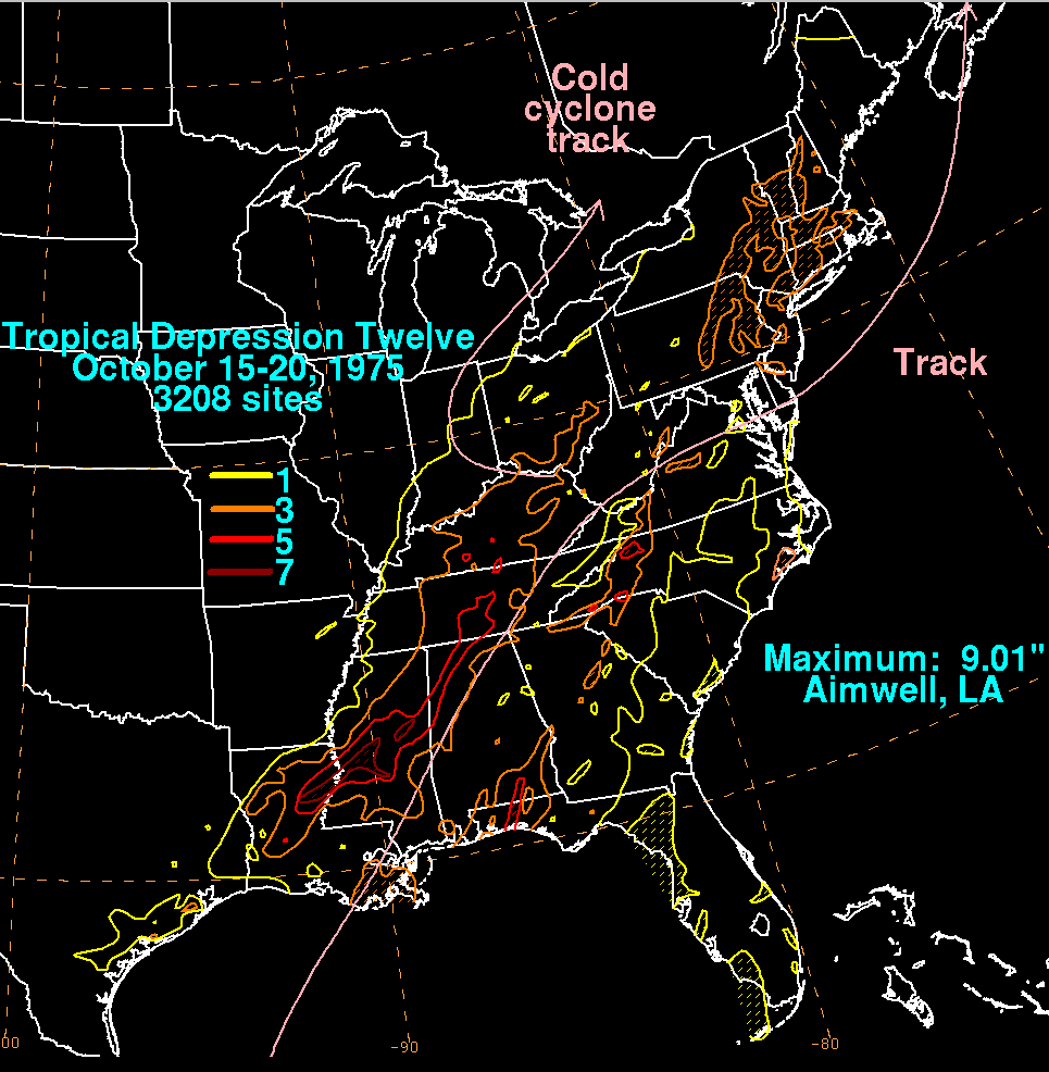
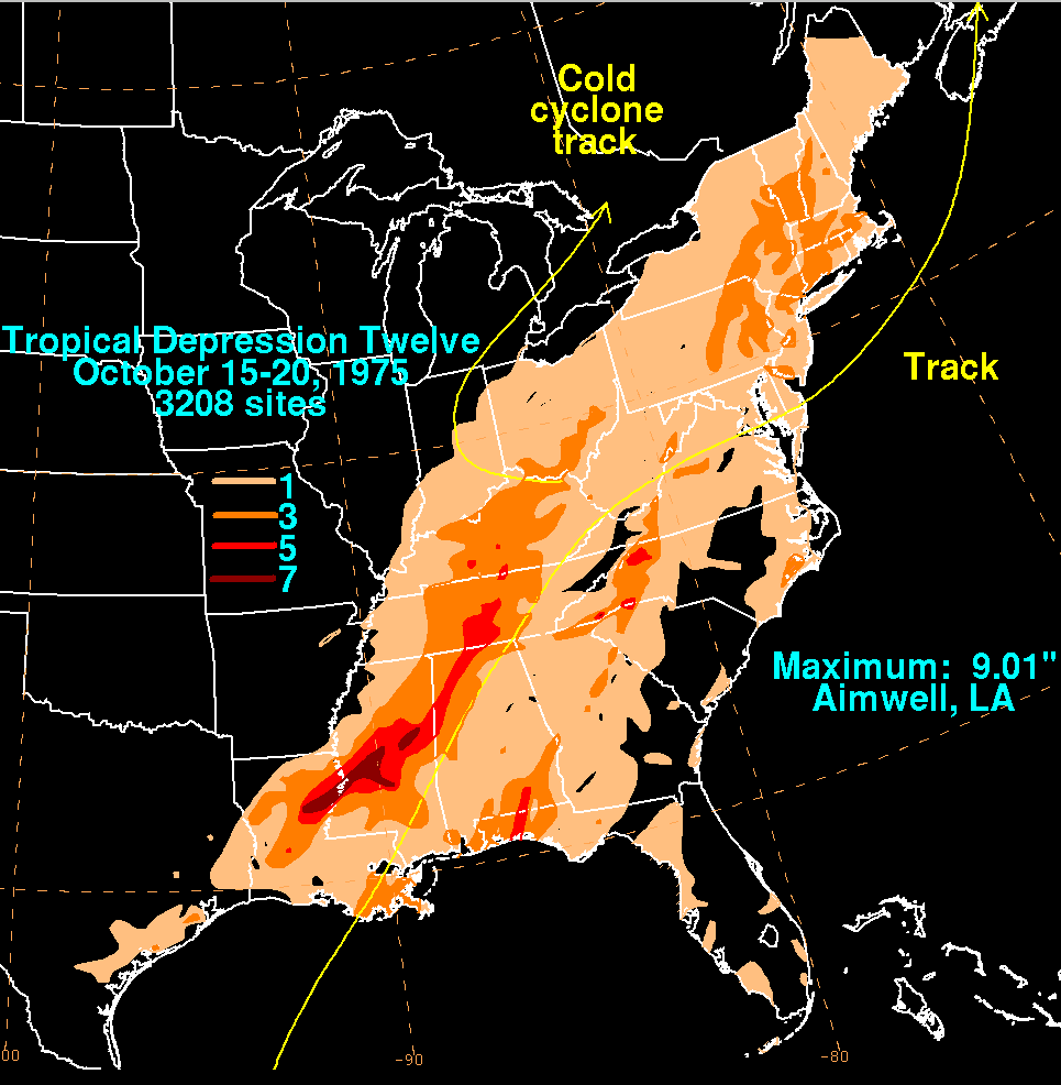
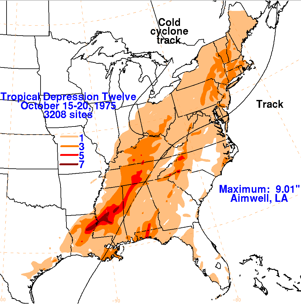
Below are the
storm total rainfall
maps for the
depression, using data provided by the National Climatic Data
Center and the Comision Nacional
del Agua, parent agency of Mexico's national weather
service. The main
portion of the track was provided
by the
National Hurricane Center, then extended based upon the Daily Weather
Map series.
 |
 |
 |