A low pressure system developed early on September 9th offshore the Southeast coast in response to
a shortwave moving northeast from the Gulf coast. Satellite imagery revealed a small convective system
isolated from frontal zones, and its relatively small size indicated the system had tropical characteristics.
The depression moved north-northeast ahead of a mid-level cyclone which dropped south-southeast into
the central Appalachians. The cyclone deepened as it moved northward, and the depression evolved into
an extratropical cyclone as it moved into Long Island on September 11. Wind gusts of 30 to 40 knots (33
to 46 mph) were felt between New York and Boston from this system. The extratropical low then moved
northeast into southeast Canada, becoming absorbed by a larger extratropical cyclone before reaching the
Gulf of St. Lawrence.
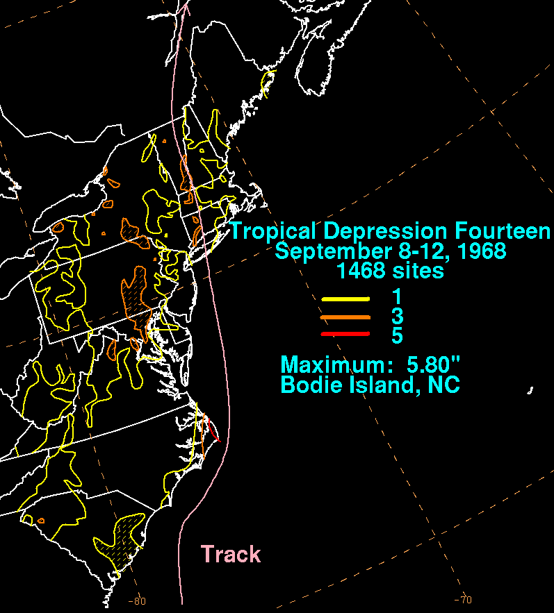
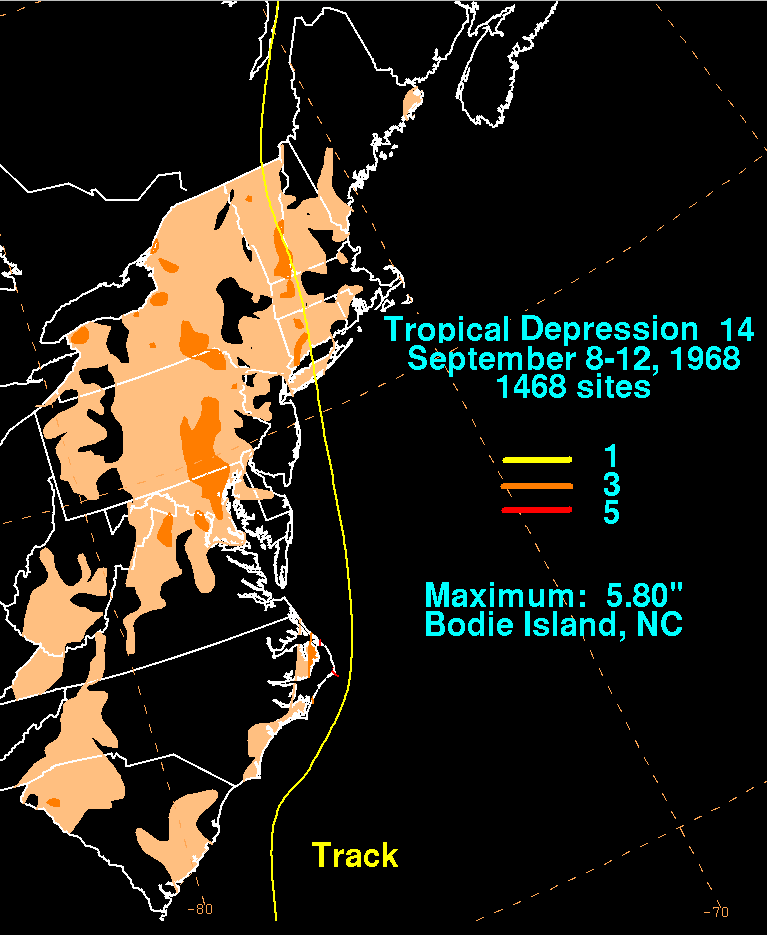
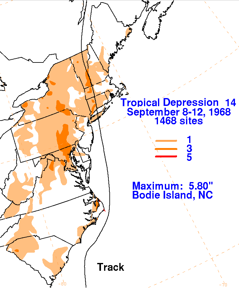
Below are the storm total rainfall
maps for the
depression, using data
provided by the National Climatic
Data Center through their daily rainfall
totals. Its track was provided by the National Hurricane
Center
and the Climate Prediction Center. A convergence line set up in
advance of the cyclone near the Baltimore/
Washington D.C. metropolitan area, which led to locally heavy
rains. The heaviest rainfall was reported
from the Outer Banks of North Carolina as the system passed just east
of the area.
 |
 |
 |