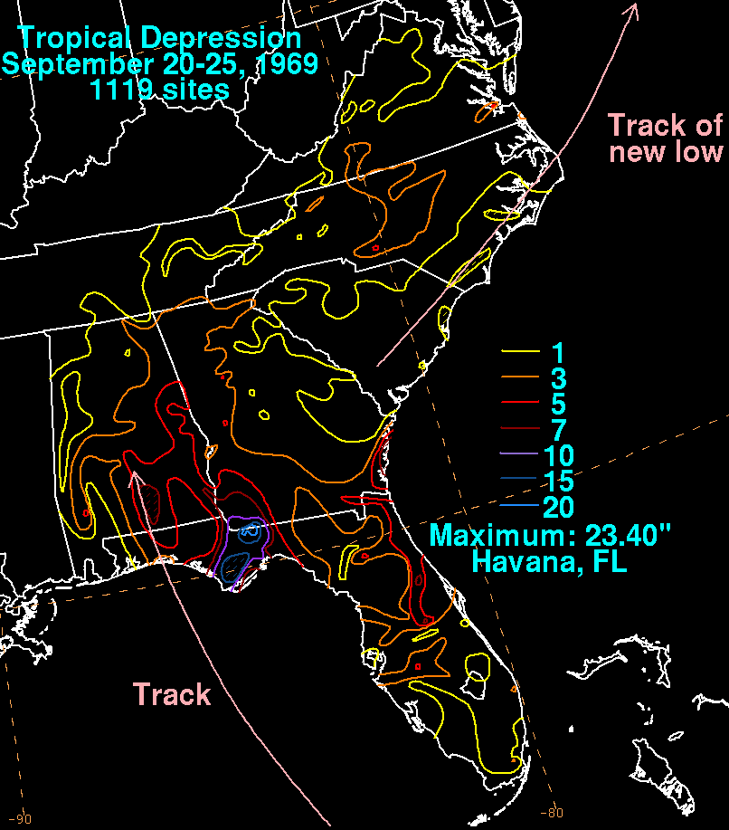
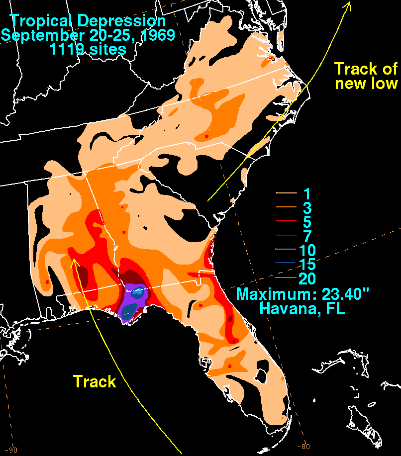
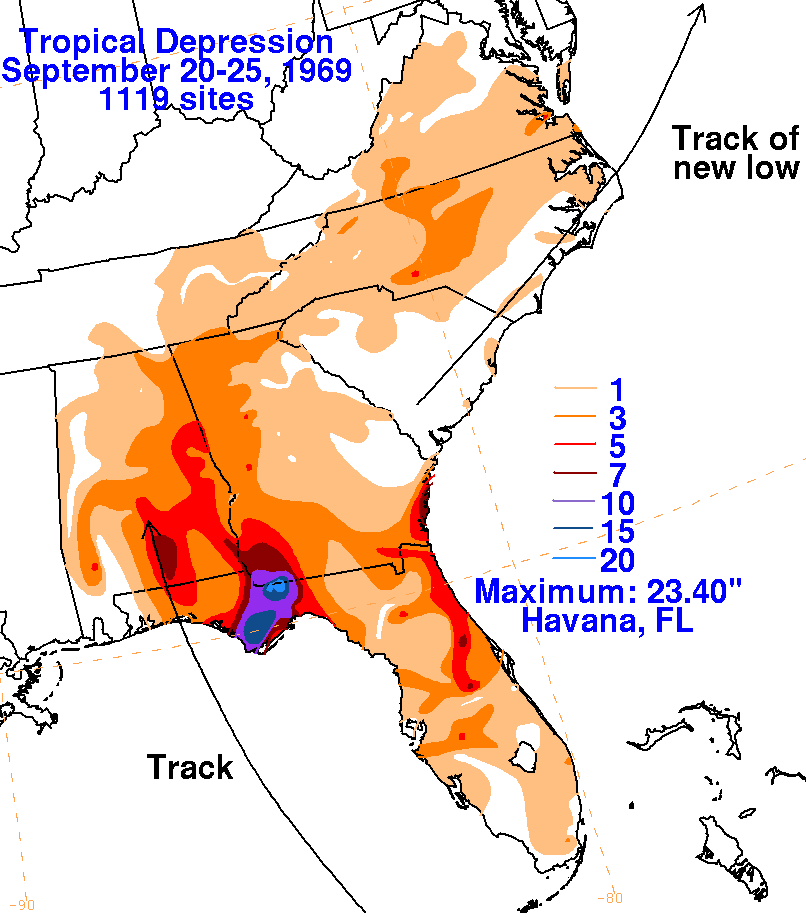
Late on September 19th, a ship report indicated the presence of a low pressure area 300 miles west-
northwest of Key West. The tropical depression moved northward, reaching the coast between Panama
City and Port St. Joe at 4 am on the 21st, and linked up with a pre-existing frontal zone. A high pressure
ridge to its northeast blocked the system's movement and it remained quasi-stationary for about 48 hours.
By the 23rd, the surface low had broadened into a surface trough. Upper level winds moved the circulation
aloft east-northeast, which appears to have formed a new low in South Carolina on the 24th which then moved
east-northeast out into the western subtropical Atlantic.
The graphics below show the storm total rainfall for the tropical depression...data was provided by the National
Climatic Data Center in Asheville, NC and from the reference below. This cyclone is the wettest known
tropical cyclone for the eastern Florida panhandle.
 |
 |
 |
Reference
D. R. Davis and W. C. Bridges. Weather Note: Minimal
Tropical Depression Produces Record Rains and Unprecedented Floods.
Monthly Weather Review, Volume 100 No. 4, p. 294-297.