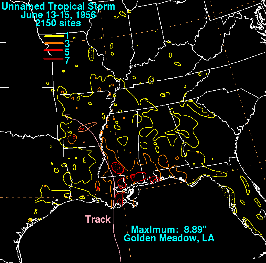
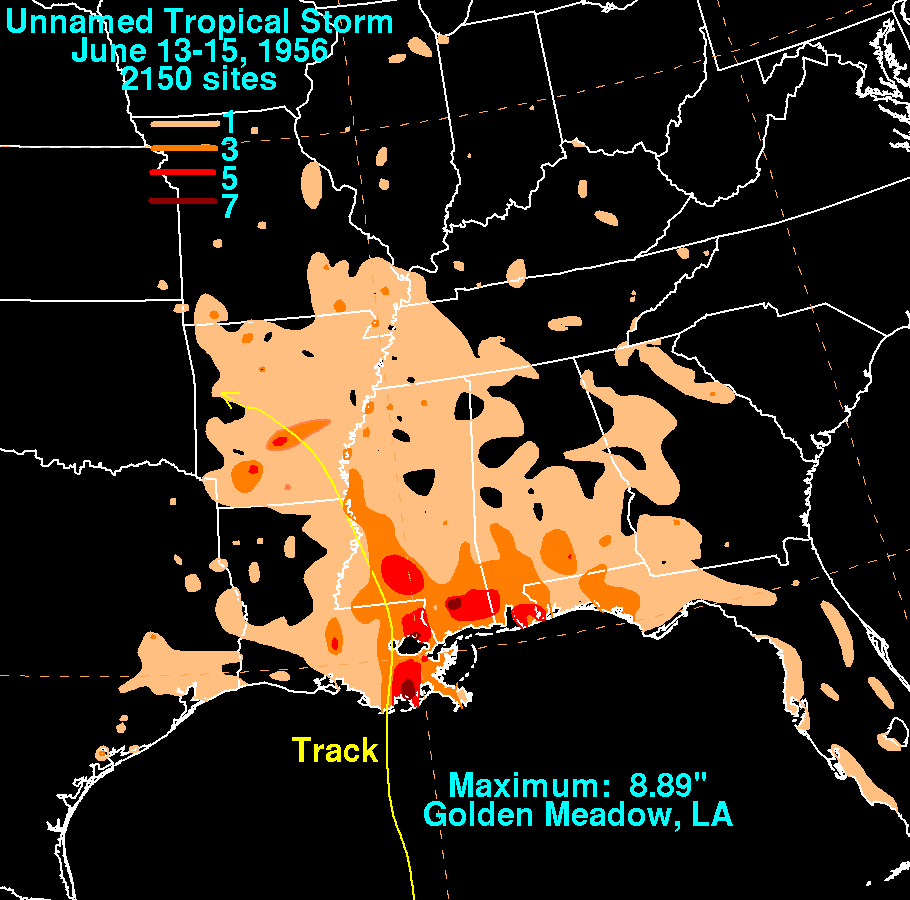
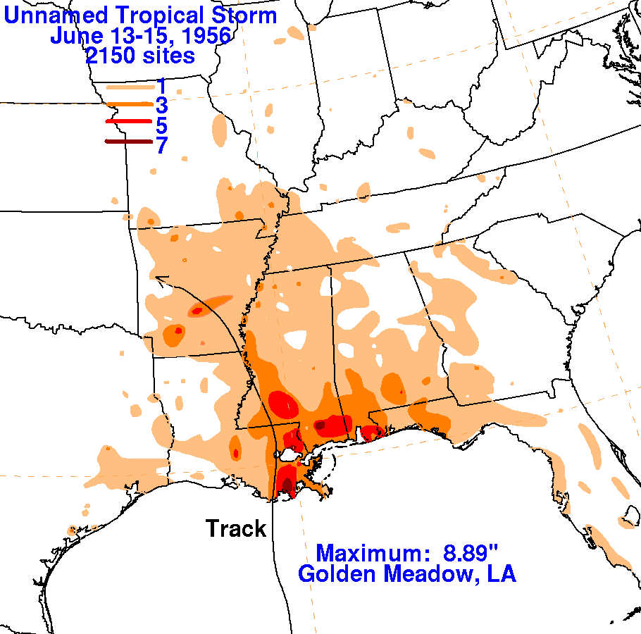
An upper low aloft cut off from the main belt of the Westerlies and
retrograded westward from Florida into the Gulf
of Mexico. By the 12th, a depression formed in the Bay of
Campeche in connection with this upper level low. The
depression moved northward, becoming a tropical storm, and made
landfall across southeast Louisiana on the 13th.
Heavy rains fell east of its track across southeast Louisiana and the
remainder of the central United States Gulf coast.
The graphics below show the storm total rainfall from the
storm. Rainfall data was provided by the National Climatic
Data Center in Asheville, North
Carolina.
 |
 |
 |