A low developed offshore the southeast Bahamas on September
9th. Moving slowly northwest, the system moved to a position east
of the
northwestern Bahamas on the 12th. Rounding the western side of
the subtropical ridge, the depression accelerated northward, making
landfall
as a strengthening tropical depression. Good divergence aloft
within a region of high dewpoints allowed the cyclone to continue to
deepen into
a tropical storm after moving into North Carolina.
Intensification continued as the small cyclone moved up the coast of
New England, with locations
reporting hurricane-force winds across eastern New England. The
system evolved into an extratropical cyclone as it moved into Atlantic
Canada.
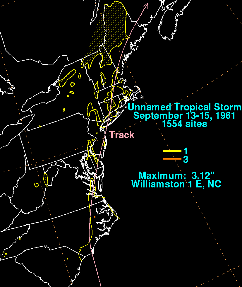
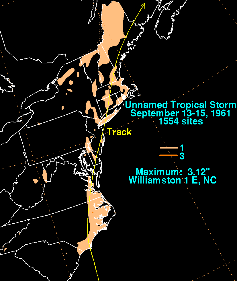
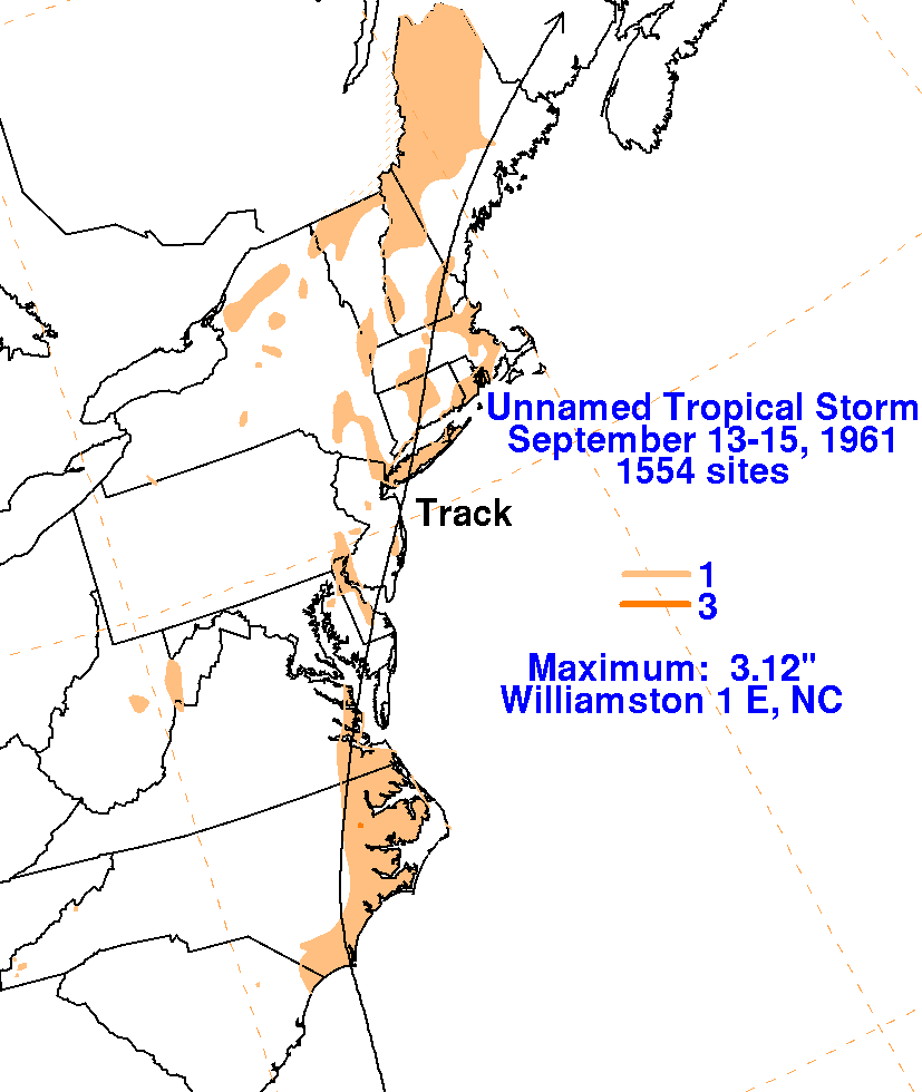
The graphics below use rainfall information from the
National Climatic Data Center in Asheville, North Carolina.
Despite its good radar and satellite
appearance, its accelerated forward motion combined with the lack of a
substantial upper trough upstream of the cyclone kept rainfall amounts
light...among
the lightest seen within this rainfall climatology with a landfalling
tropical cyclone of good structure and minimal vertical wind shear.
 |
 |
 |