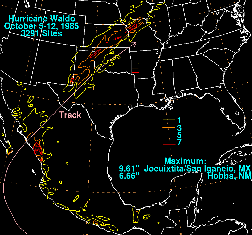
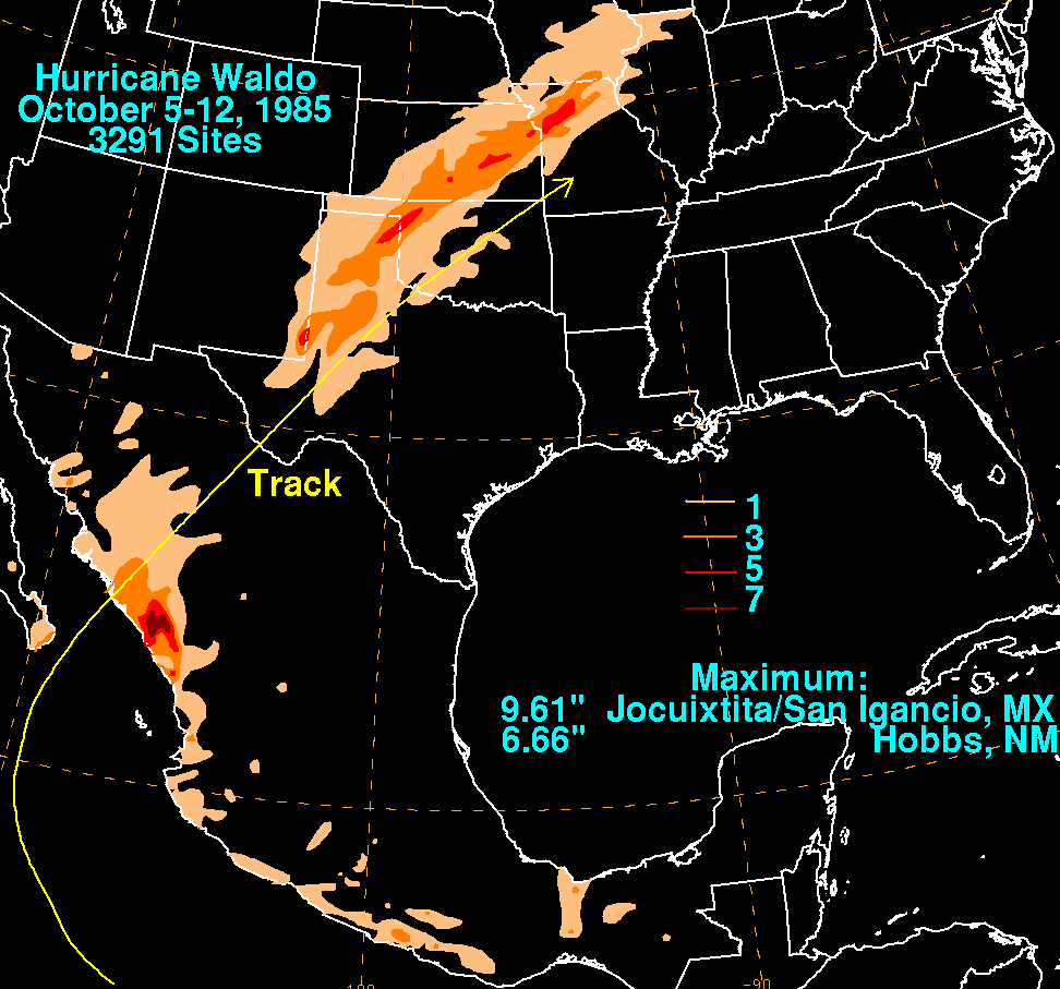
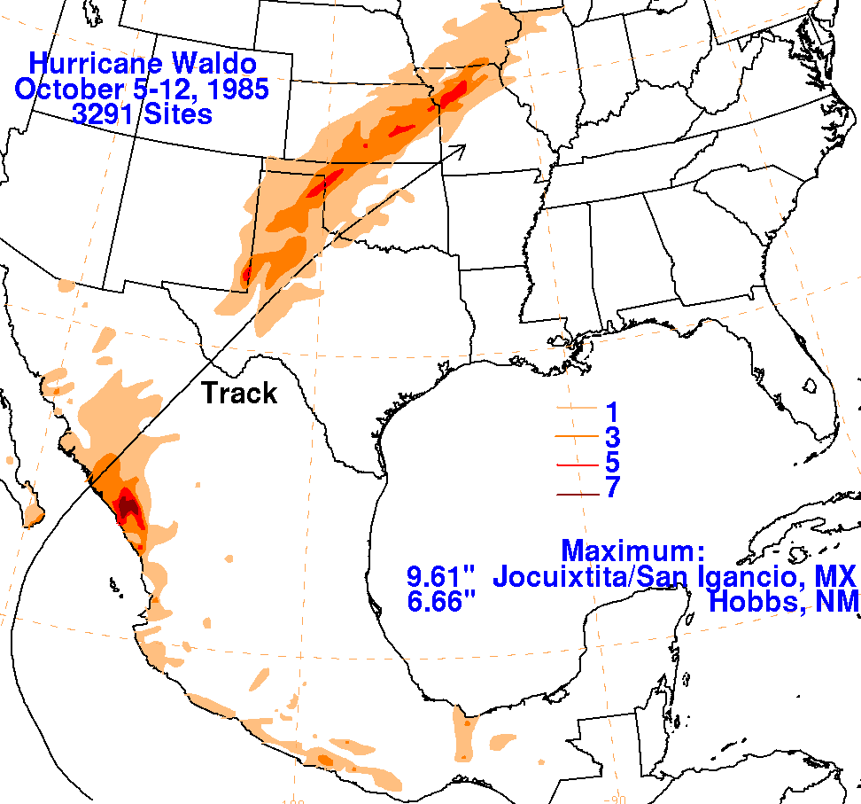
A tropical disturbance evolved into Tropical Depression #23-E on
October 7, and rapidly developed
into a tropical storm later that day to the southwest of Mexico.
Peaking as a category two
hurricane, Waldo
came ashore Mexico southwest of Culiacan, and its surface low
pressure area weakened
rapidly over
northwest Mexico. It appears Waldo's surface circulation linked
up with the front that helped aid its
recurvature. As a frontal wave, Waldo doused the southern Plains
and Mid-Mississippi Valley with
3-5
inches of rainfall along the frontal zone in advance of the low.
The wave dampened out during
the
day on the 11th. Below is a storm total rainfall map for
Waldo. Data from the United States was provided
from the National Climatic Data Center. Data from Mexico was
obtained by Servicio Nacional del Agua,
parent agency of Mexico's national weather service.
 |
 |
 |