|
|
Domain 1. Eastern United States
Algorithms use 1° GFS Model Output
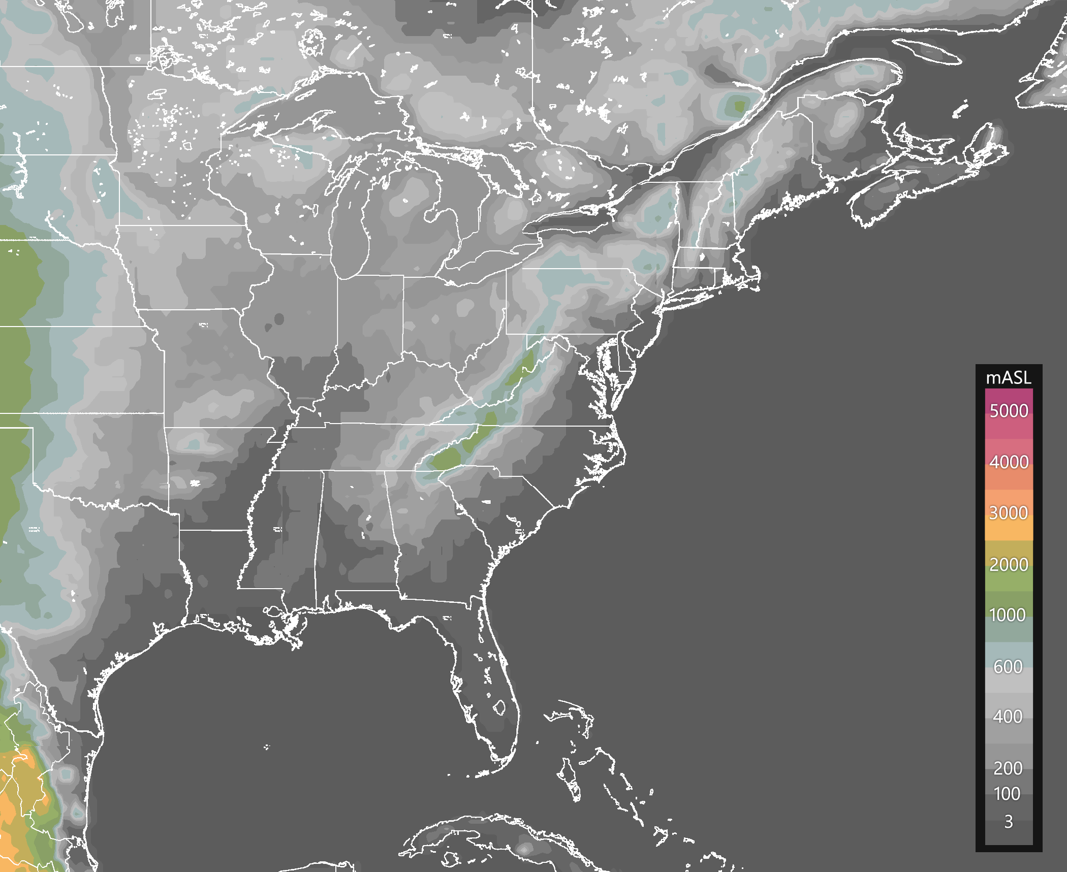
Terrain elevation in meters above sea level.
Source: GFS0.25°(NOMADS-NOAA).
|
|
ALGORITHM
|
GFS 00Z
|
GFS 12Z
|
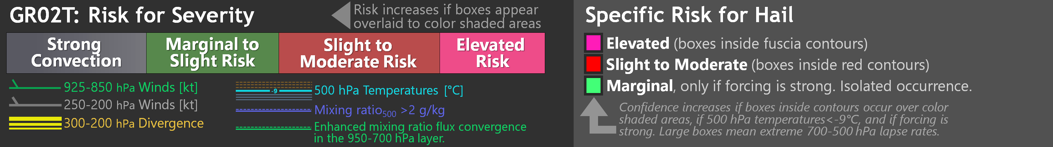
Potential for severity and hail -
GR02T.CMD
GR02T highlights regions with the potential for severe weather
using shades of color, and specifically, detects a potential for hail
where colored boxes appear inside colored contours.
|
|
|
Enhanced GDI and flow -
EGDI.CMD
Very similar to the GDI, the Enhanced GDI (EGDI) diagnoses the
potential for convection and rainfall accumulations. Loops include low- and
upper-tropospheric flow and other variables to evaluate if atmospheric
dynamics are favorable for triggering and/or sustaining convection.
|
|
|
|
Note: These algorithms are only forecast tools, not official forecasts.
|
|
|


