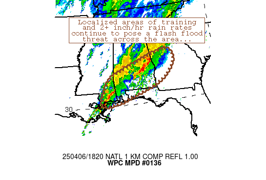
Mesoscale Precipitation Discussion 0136
NWS Weather Prediction Center College Park MD
1154 PM EDT Mon Apr 08 2024

Areas affected...northeastern TX to AR/LA border

Concerning...Heavy rainfall...Flash flooding likely

Valid 090353Z - 090920Z

Summary...A threat for flash flooding is likely to continue for
parts of northeastern TX into northern LA/southern AR and possibly
western MS. Rainfall rates ranging between 1-3 in/hr and
additional totals of at least 3-5 inches are expected through 09Z.

Discussion...0330Z radar imagery from northeastern TX into
northern LA showed ongoing heavy rain with rainfall rates via
local Wunderground networks showing hourly accumulations of 1 to 3
inches over the past couple of hours. There was an axis of higher
reflectivity observed to be oriented roughly west to east across
the region near and just south of I-40, located just north of an
elevated convergence axis centered near 850 mb as seen on area VAD
wind plots at 03Z, supported by 850 mb peak southerly winds near
50 kt as sampled by KLCH, converging toward southeasterly 850 mb
winds at KSHV near 20 kt. PWATs varied across TX into LA but were
2+ standardized anomalies above average, measuring 1.9 inches on
the 00Z KLCH RAOB.

The Arklatex and nearby locations were, and are expected to
remain, under a favorable upper level divergence max positioned
within the right entrance region of a 110 to 130+ jet extending
from northern AR/southern MO into the OH Valley, and...to a lesser
extent...left exit region of an upper jet max crossing the Rio
Grande Valley into eastern TX. Latest RAP forecasts and infrared
satellite trends indicate some potential for the low level axis of
convergence to migrate northward over the next few hours, but
steering flow nearly parallel to that convergence axis will
support an extended period of training with heavy rain. MUCAPE is
currently highest over western locations, but some expansion of
instability to the east is possible through the overnight. Hourly
rainfall of 1-3 inches should be expected at times along with
additional totals of at least 3 to 5 inches in some locations by
~09Z. Areas of ongoing flash flooding are expected to expand in
coverage overnight as these higher rates overcome drier antecedent
conditions, with an immediate focus along the I-40 corridor from
near Tyler, TX into Ruston and perhaps Monroe, LA.

Otto

ATTN...WFO...FWD...JAN...LZK...SHV...

ATTN...RFC...ABRFC...LMRFC...WGRFC...NWC...

LAT...LON   33629358 33599191 33349096 33109057 32519061
            32189147 32029268 32009465 31879663 32409688
            33059606
Download in GIS format: Shapefile
| KML
Last Updated: 1154 PM EDT Mon Apr 08 2024
