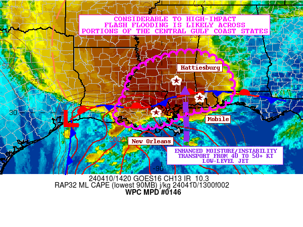
Mesoscale Precipitation Discussion 0146
NWS Weather Prediction Center College Park MD
530 PM EDT Sat Apr 19 2025

Areas affected...west-central TX into east-central OK

Concerning...Heavy rainfall...Flash flooding likely

Valid 192130Z - 200245Z

Summary...Repeating and training of cells over west-central TX
will pose at least a localized but increasingly likely flash flood
threat over the next several hours. The flash flood threat is
expected to expand northeastward into northern TX and east-central
OK after 00Z. Rainfall rates of 1-2 in/hr will be likely and
totals in excess of 4 inches through 03Z will be possible.

Discussion...Surface observations and radar imagery from 21Z
showed 3 or 4 supercells between MAF and SJT located near a
quasi-stationary front with movement toward the northeast.
Additional development was occurring northeast of these stronger
cells. The cells were located near and northeast of a triple point
low located just east of FST within a very unstable but modestly
moist environment with 2000-4000 J/kg MLCAPE and PWATs near 1 inch
(via recent SPC mesoanalysis data). Cell coverage will increase
over the next few hours as forcing for ascent increases ahead of
an approaching mid-level low over western NM and as continued low
level moisture advection into/across the Red River helps to boost
instability.

Individual cells are likely to continue a northeastward motion
following the deeper-layer mean flow and frontal orientation but
organized supercells are likely to move right of the mean wind.
There will likely be elements of short term training as cell
alignment matches the steering flow but as cells advance off
toward the northeast, additional development is expected near the
triple point as low level southerly/southeasterly flow advects
unstable airmass back into the region.

Beyond 00Z, 850 mb winds are forecast to increase over
central/eastern TX above 40 kt, increasing low level moisture
northward across the Red River with pockets of CIN eroding across
OK (via recent RAP forecasts) likely supporting convective
development and expansion through 03Z. Given similarly oriented
storm motions and boundary orientation at the surface, training is
expected to become increasingly likely. Rainfall rates of 1-2
in/hr are expected to develop with areas of flash flooding
becoming likely. Potential for localized totals greater than 4
inches will exist and may overlap with the northern edge of 1-2
inches of rain which fell over the past 24 hours over portions of
TX/OK.

Otto

ATTN...WFO...FWD...LUB...MAF...OUN...SJT...TSA...

ATTN...RFC...ABRFC...WGRFC...NWC...

LAT...LON   35669666 35639576 35269554 34579577 33069725
            32169859 31650003 30690195 30730263 31280247
            32370115 33459966 34869821
Download in GIS format: Shapefile
| KML
Last Updated: 530 PM EDT Sat Apr 19 2025
