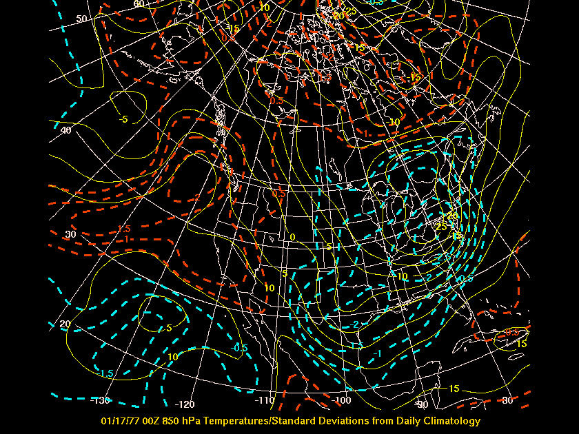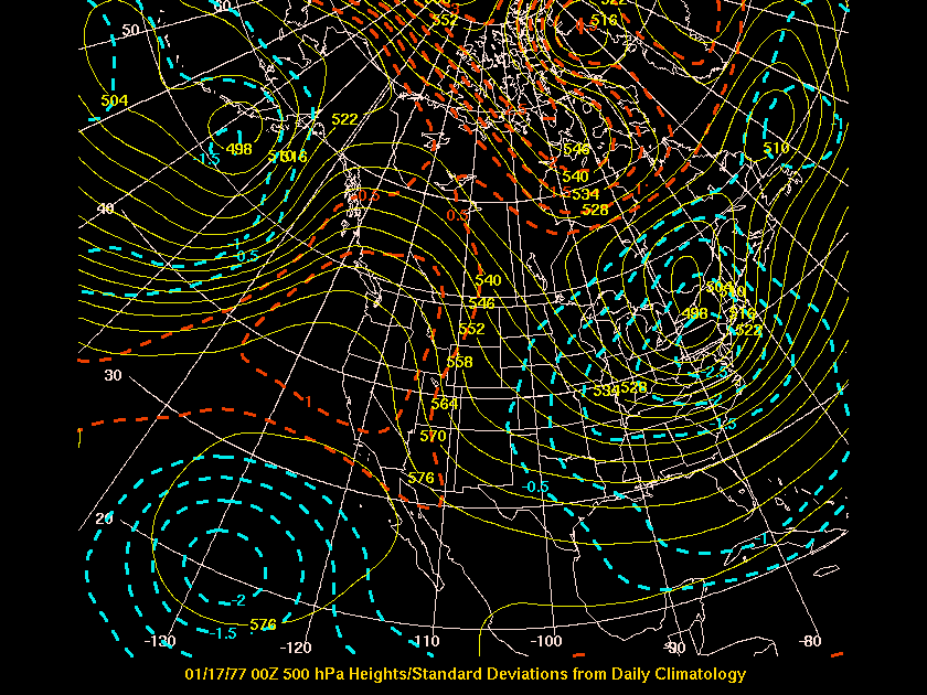
Persistent cold gripped the eastern half of the U.S. during January 1977. On January 16-17, a direct shot of arctic air produced record cold in many locations, particularly over the Ohio Valley and East Coast. The 500 hPa height regime indicated some similarities to the arctic outbreak of January 17, 1982 over the Great lakes and Northeast. However the January 1982 event was characterized by a colder 850 hPa temeprature regime (which is probably why many of the records set in 1977 were broken in 1982).
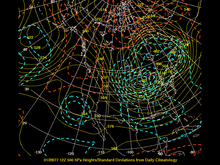
As mentioned, the cold was more persistent during January 1977 than January 1982. By contrasting the 500 hPa images between the two years, you will be able to see that there was stronger high latitude blocking in 1977. While the 1982 episode was characterized by a stronger cross polar flow regime (Siberian Express).
The blocking persisted another 11-12 days
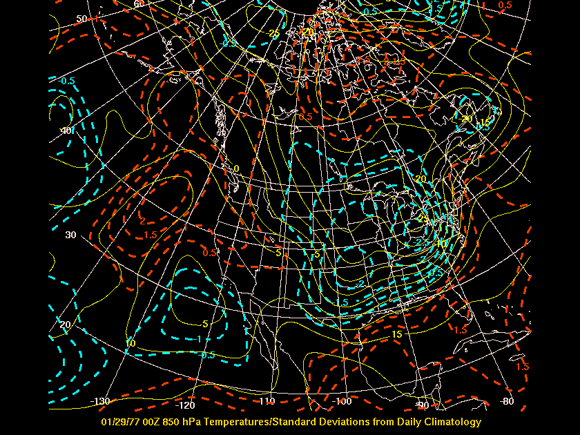
and on January 28, another strong short wave trough at 500 hPa rotated
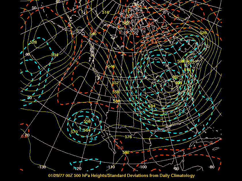
around the southward displaced polar vortex. This led to another surge
of arctic air which tracked from the upper midwest into the eastern states.
The cyclonic flow around this deep vortex helped maintain the severe lake
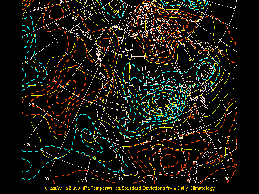
effect event over the Buffalo, NY region. The thrust of the cold
air advection in the lower troposphere depicts the frontogentic forcing
at 850 hPa which may have enhanced the "white out" conditions as this front
progressed across the Ohio Valley and into the eastern states.