During Summer 2004, there was a persistent trough over the central and eastern U.S. On 4 occasions after the June 21 solstice, negative height and temperature anomalies were associated with surface cold fronts that advanced southward to Florida or to the Rio Grande in south Texas.
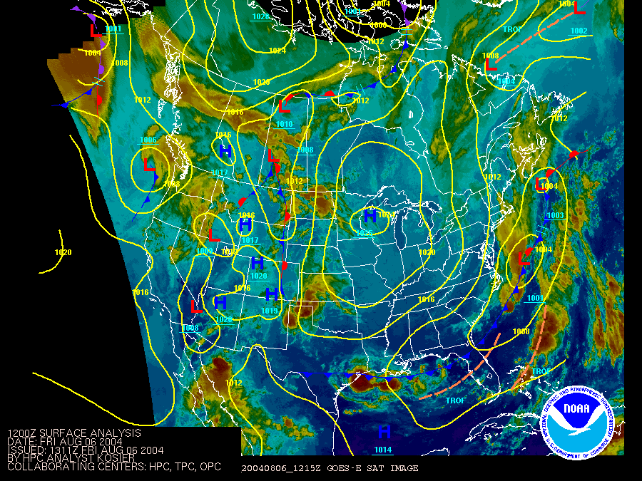
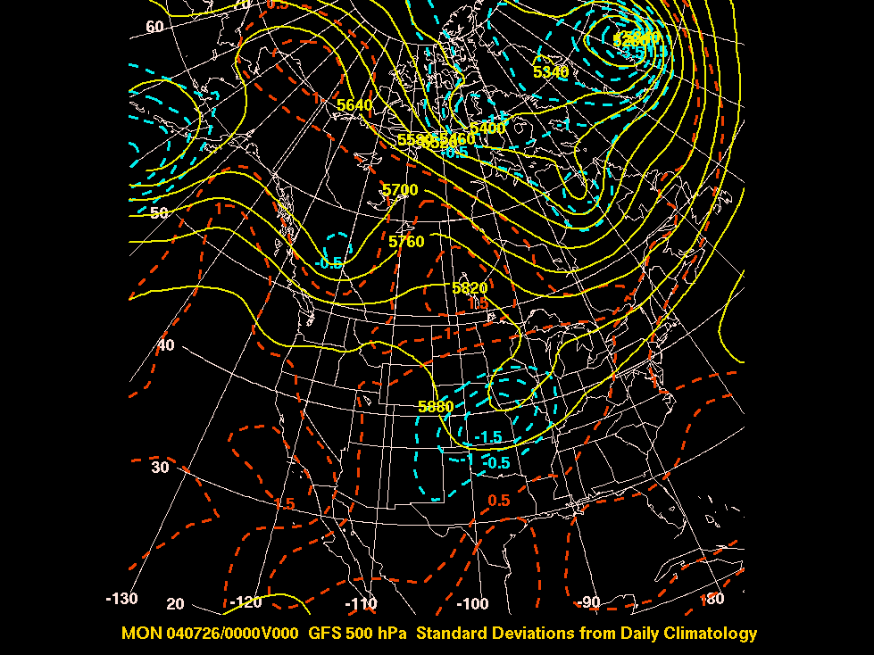
The first scenario depicted below is the 500 hPa heights and standard deviations from climatology on August 6, 2004 at 12Z. A deep east coast trough at 3 standard deviations from climatology drove record cool conditions into the southeast. The surface analysis beneath the 500 hPa graphic shows the advancement of the cold front into Florida and the northern Gulf Coast.
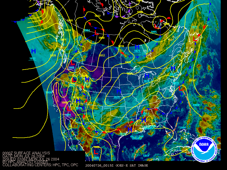
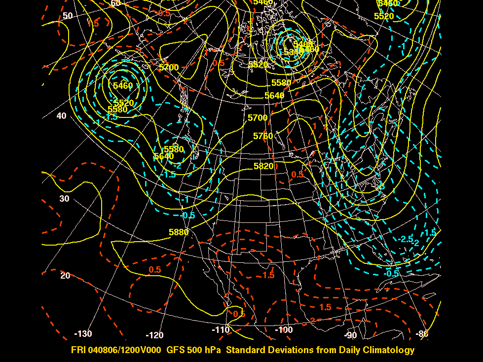
The second case (scroll down below case 1) shows a central U.S. trough scenario on July 26, 2004. In this case the anomalous trough was associated with a cold front that pushed through TX and just south of the Rio Grande River. This front became a backdoor cold front which pushed very close to the NAME Tier 1 region during the summer field campaign.