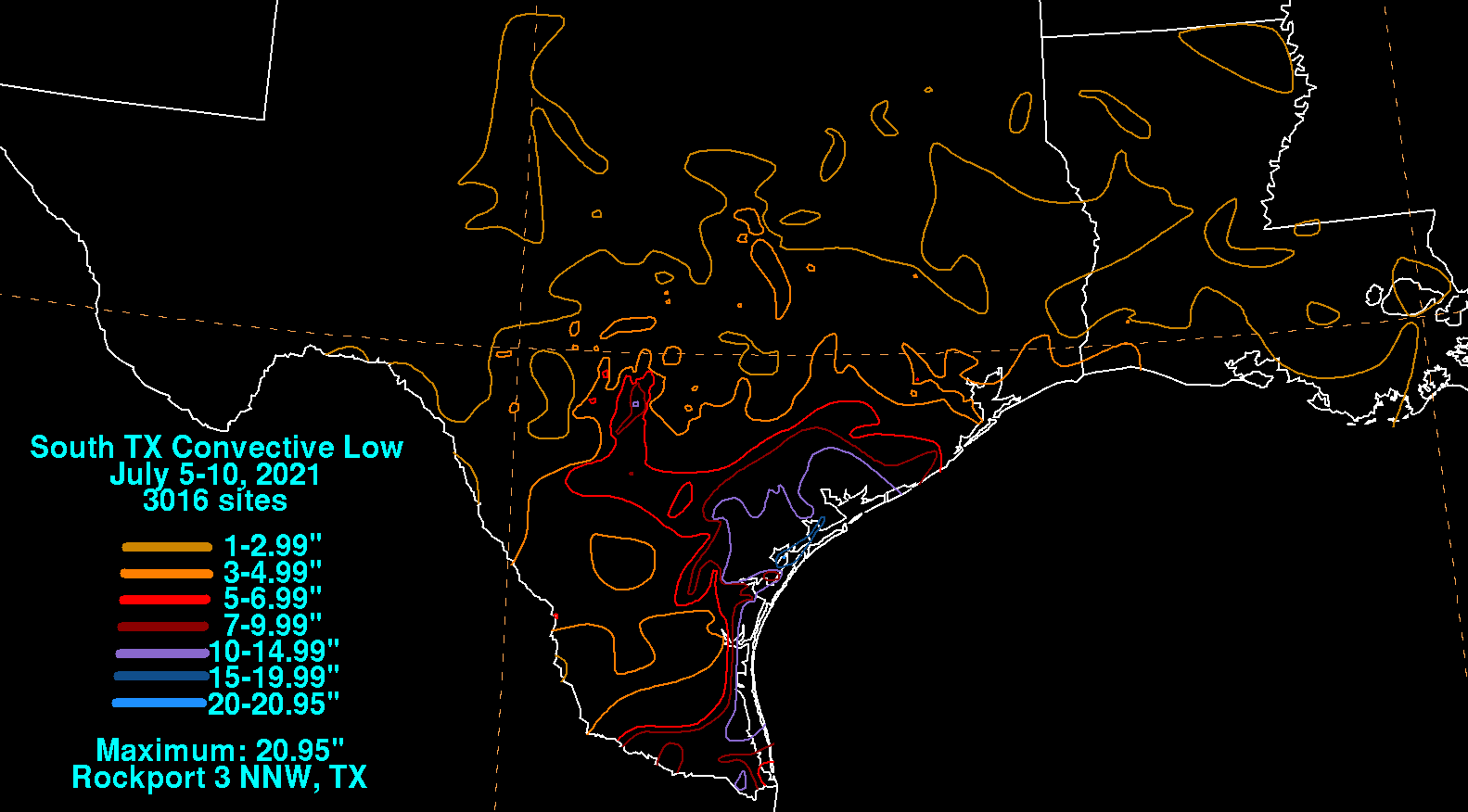
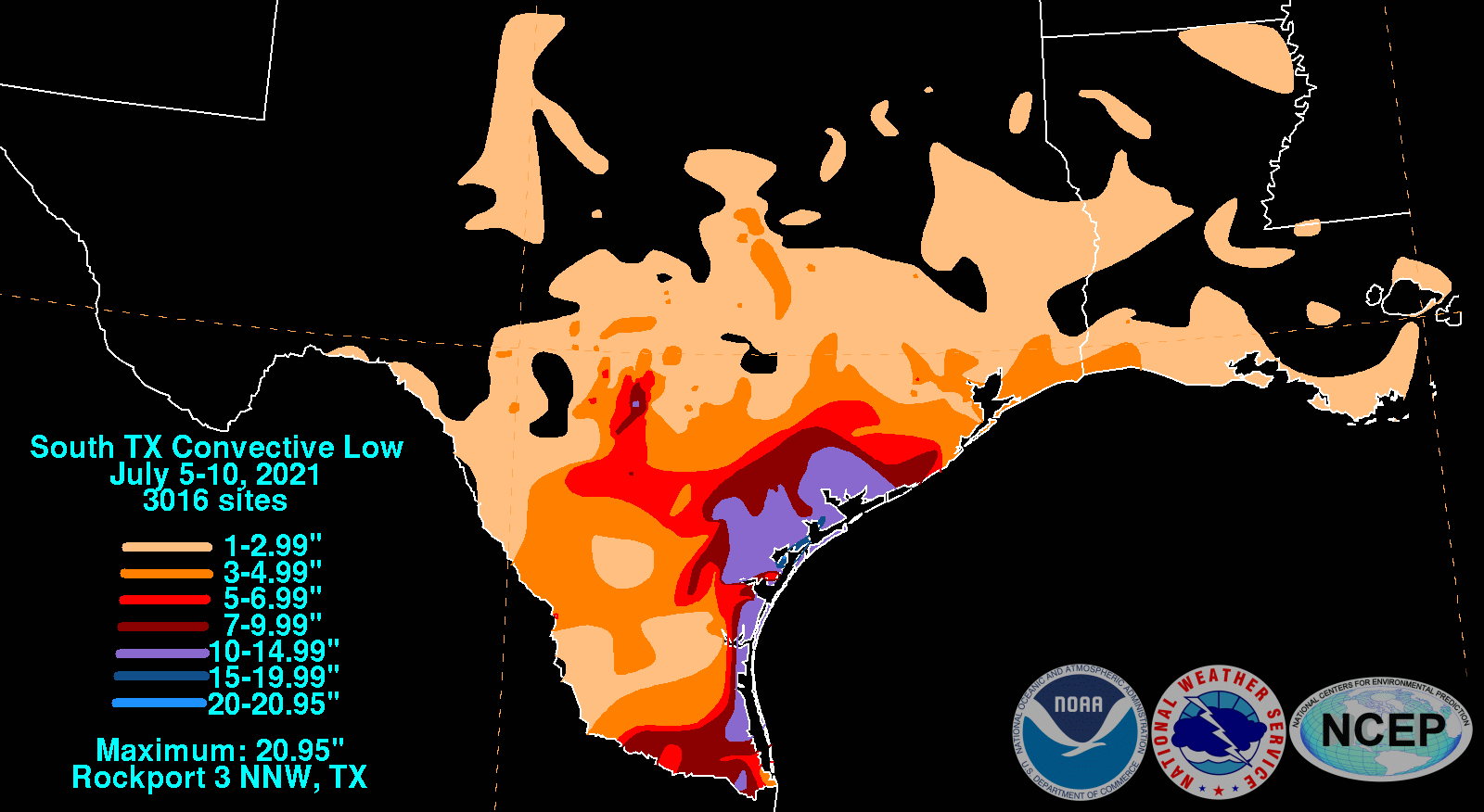
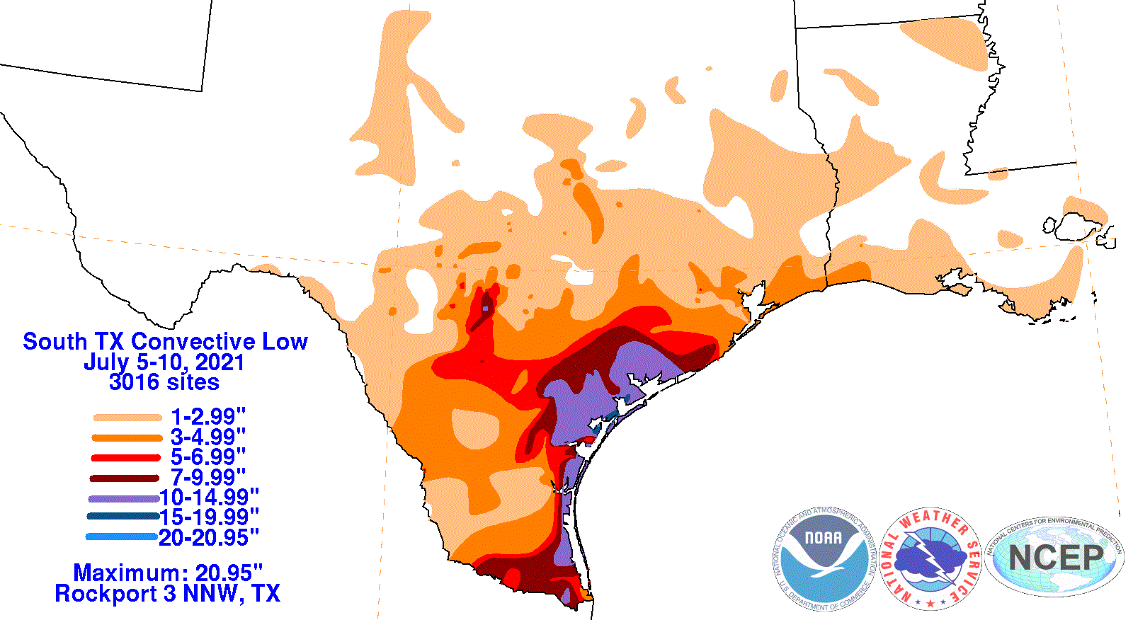
An upper level disturbance led to the formation of a low in South Texas. The system remained stationary for 3-4 days
before retrograding into northeast Mexico, spurred by a strengthening high pressure system to its north and northeast.
Onshore flow brought ample moisture and instability off the northwest Gulf of Mexico, which led to days of heavy rainfall
across the Lower and Middle Texas coasts. This rainfall caused flash flooding, particularly in and around Corpus
Christi, and river flooding across 12 rivers and creeks across South Texas.
The graphics below show the storm total rainfall for the South Texas convective low, which used rain gage information from
the National Weather Service River Forecast Centers, Forecast Offices, and CoCoRAHS.
 |
 |
 |