For several days, an area of disturbed weather persisted near the west coast of Florida beginning on August 21st. A
surface low formed in association with the disturbance early on the 25th which drifted northeast across Florida,
entering Atlantic waters by the 28th. The National Hurricane Center was concerned that the low pressure area could
develop a well-defined circulation, so advisories were initiated on Potential Tropical Cyclone Ten when its center
was near the northeast Florida coast on the 27th. The system was near a front at this point and never developed a
well-defined circulation, but did acquire tropical storm-force winds east of the center on the 28th. The system
began to accelerate northeast, developing into a hurricane force extratropical low by the 30th as it passed between
Bermuda and Atlantic Canada. The cyclone became absorbed into a larger system in the North Atlantic on September 2nd
about 600 miles west of Ireland.
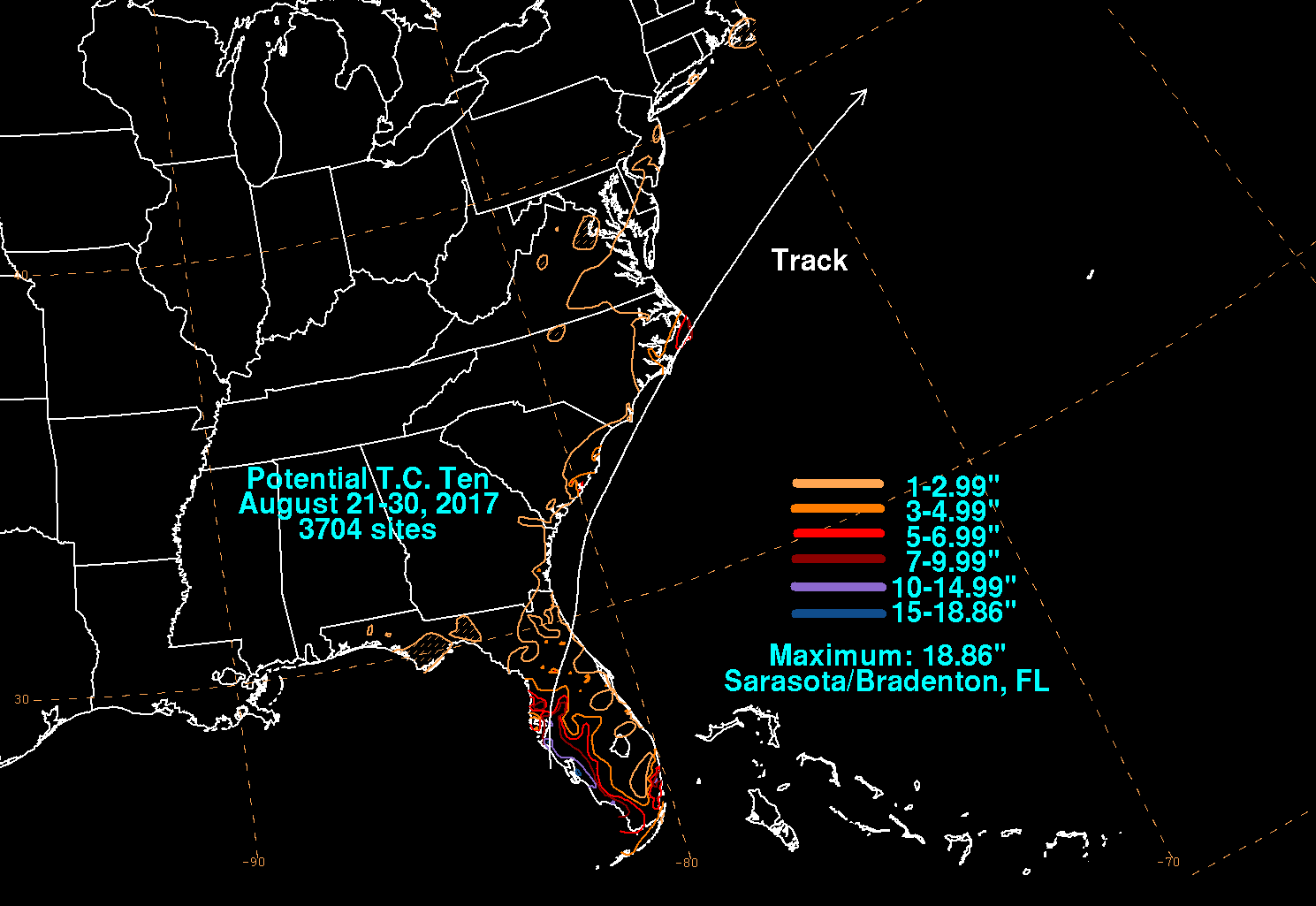
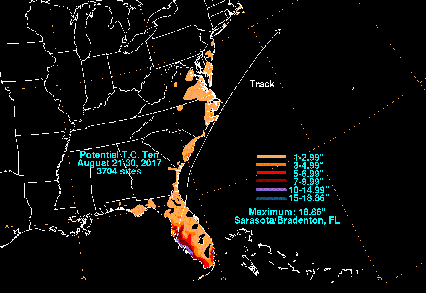
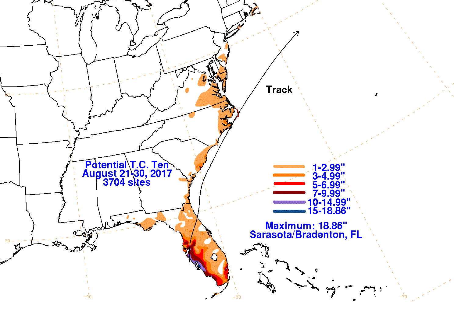
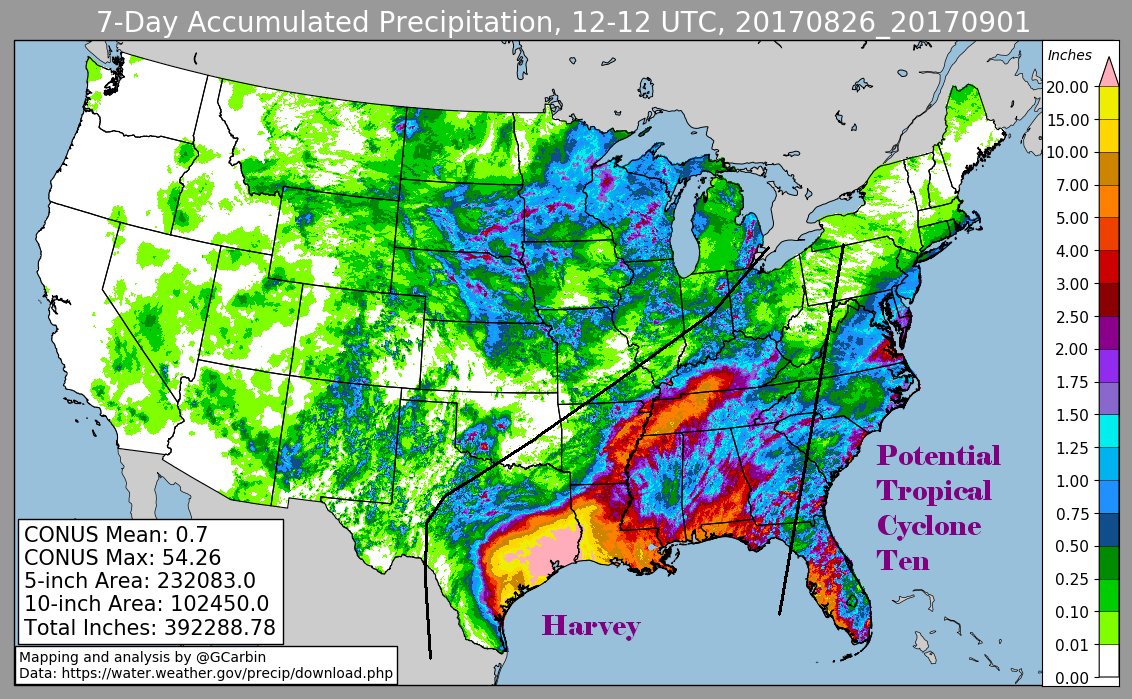
The first three graphics below show the storm total rainfall for Potential Tropical Cyclone Ten, which used rain guage information from the
National Weather Service River Forecast Centers, Forecast Offices, and CoCoRAHS. The fourth graphic uses the official National Weather
Service multi-sensor rainfall estimates, which includes radar-derived information.
 |
 |
 |
 |