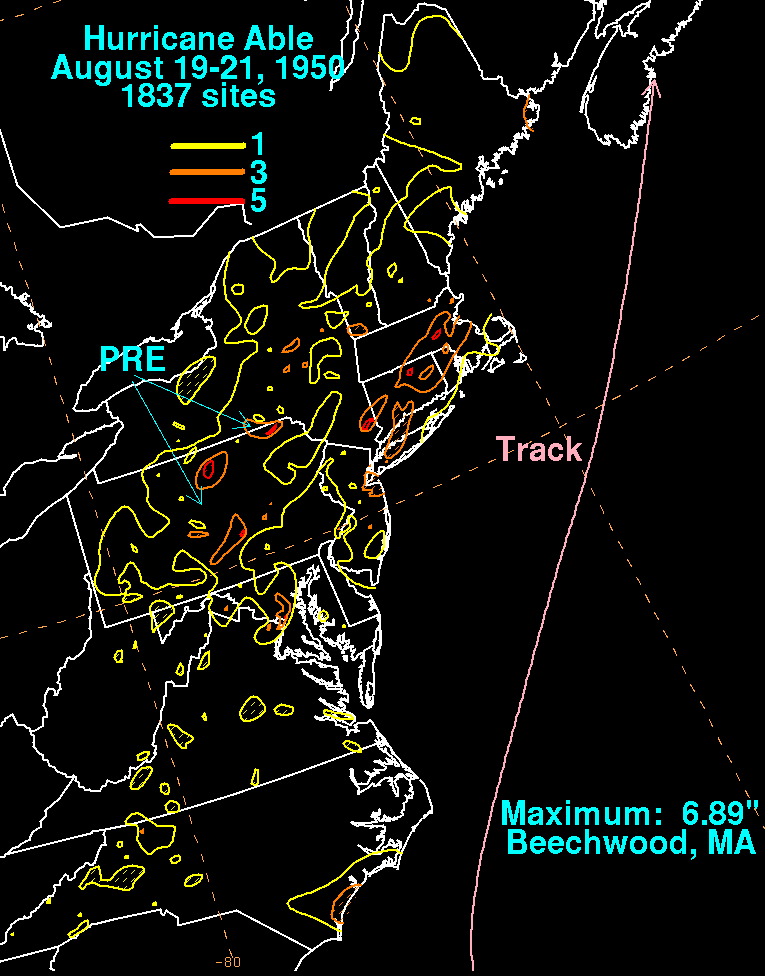
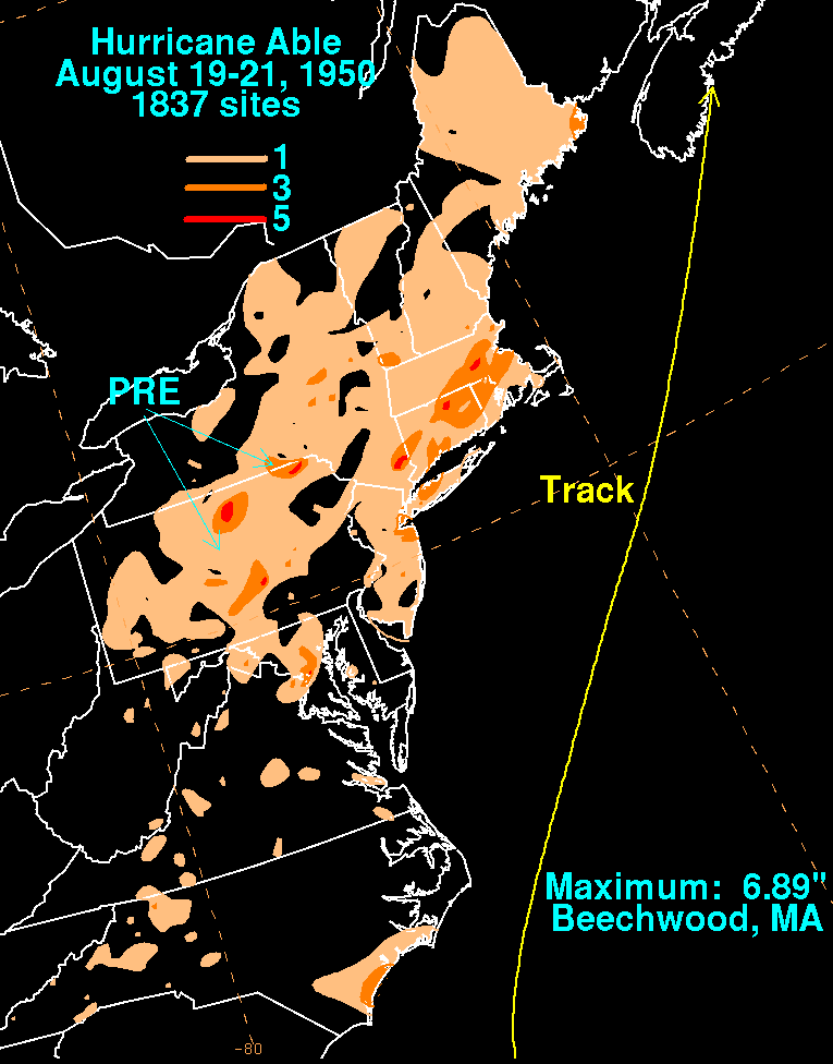
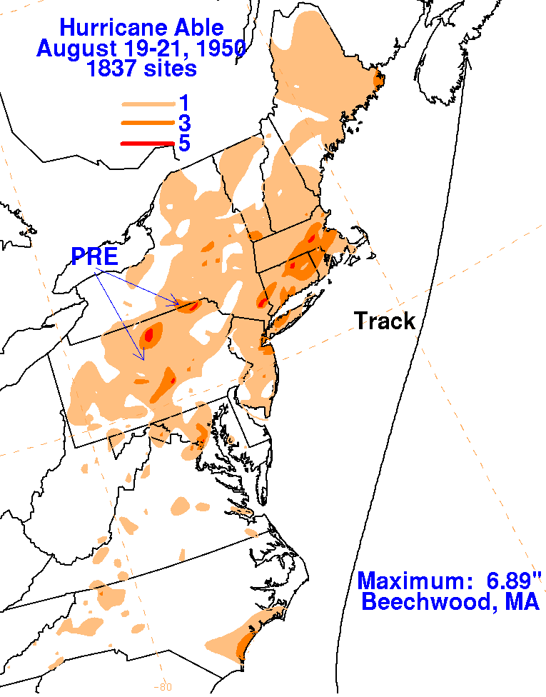
This system was first noted severeal hundred miles northeast of the
Leeward Islands on August 12th.
When reconnaisance aircraft investigated the area on the 13th, they
found a hurricane. The storm moved
generally to the northwest, and recurved just offshore the East coast
of the United States before making
landfall in Nova Scotia. Moisture from the storm focused along a
pre-existing frontal boundary across the
northern Mid-Atlantic states, causing locally heavy rainfall.
Rains across New England were directly related
to Able. Below are the rainfall graphics
for Able, which used data from the National Climatic Data Center in
Asheville, North Carolina.
 |
 |
 |