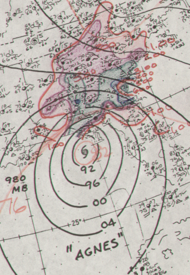
Agnes was one of the largest June hurricanes on record. Banded convection was first noted in the
northwest Caribbean Sea on June 11. A polar front dropped into region from the northwest. As the
front approached, a depression formed over the Yucatan on the 14th and moved eastward into the
northwest Caribbean Sea. The system strengthened into a tropical storm during the night of the 15th,
and a hurricane on the 18th as it moved northward in the Gulf of Mexico. Moving into the Florida
panhandle as a hurricane, the system quickly weakened into a tropical depression as it moved through
Georgia on the 20th.
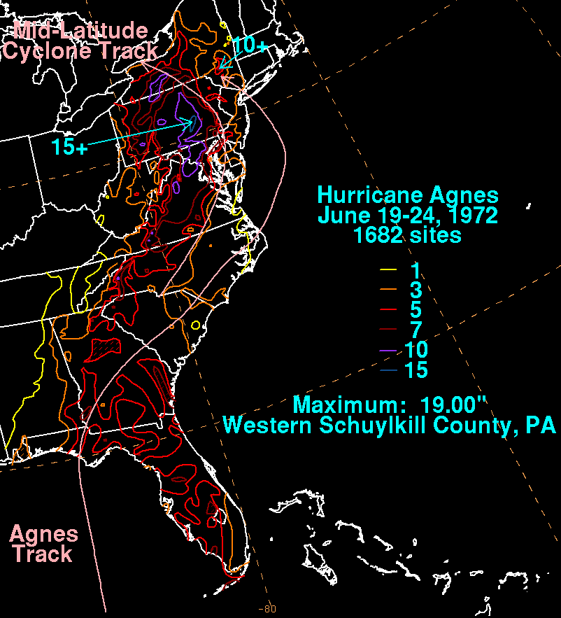
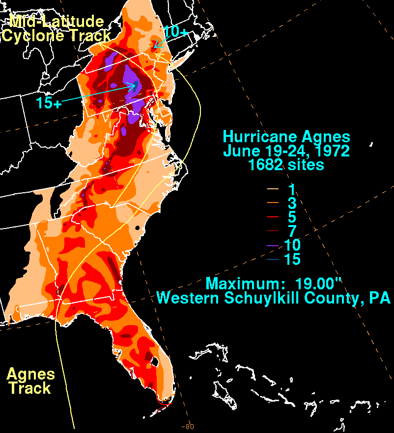
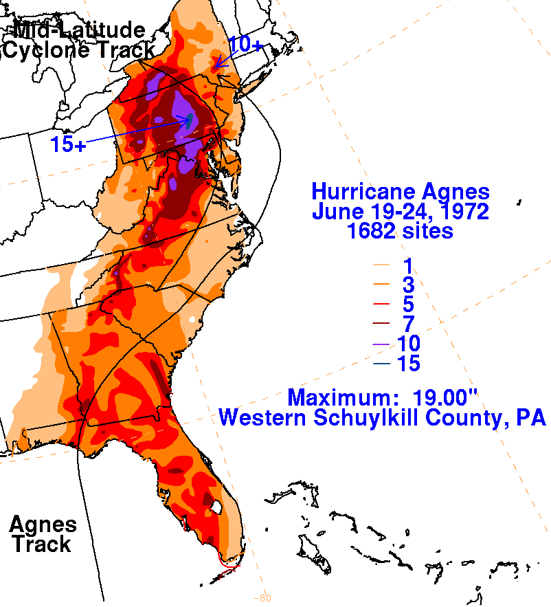
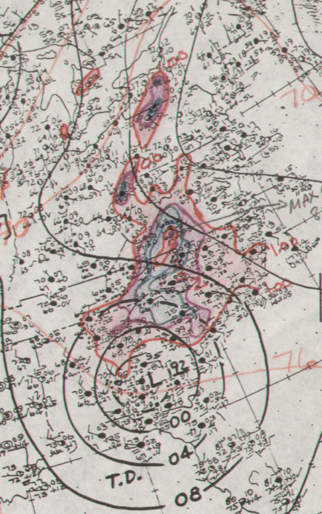
A significant trough in the Westerlies approached Agnes, which led to a second low developing west
of Agnes. The two cyclones moved in tandem and strengthened, with Agnes regaining tropical storm
strength over North Carolina and moved offshore Norfolk, Virginia. While offshore New Jersey,
Agnes became a strong tropical storm again before it swung back inland near the western tip of Long
Island, becoming absorbed into the extratropical cyclone over Pennsylvania soon after. It is virtually
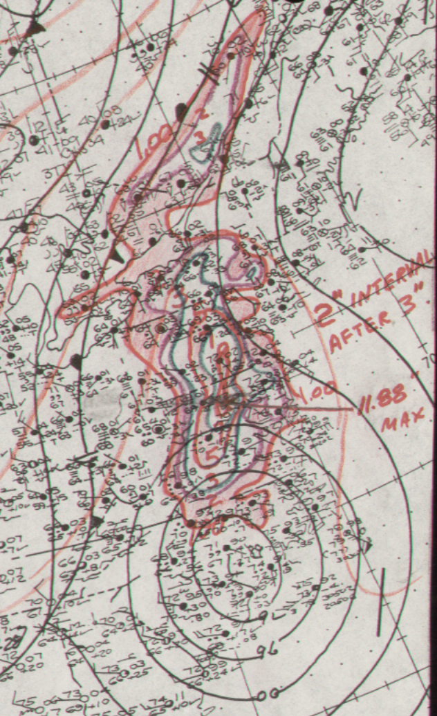
impossible to determine how much of the rain that fell in the Mid-Atlantic would have fallen had
Agnes not existed as a moisture source for the cyclone, but Agnes was likely a major player in the
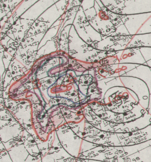
rain event that ensued. The graphics below show the storm total rainfall for both Agnes and the
extratropical cyclone to its west, using data provided by the National Climatic Data Center in
Asheville, North Carolina.
 |
 |
 |
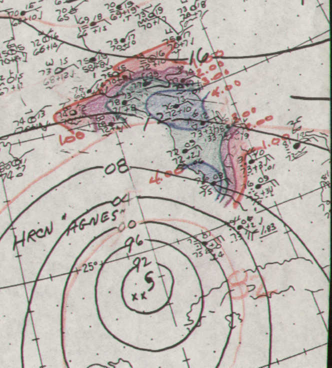
Below is a calendar of days showing the surface analyses and the succeeding 24 hours of rainfall,
originally prepared by Wes Junker.
| Sun. |
Mon. |
Tue. |
Wed. |
Thu. |
Fri. |
Sat. |
| 18 |
19 |
20 |
21 |
22 |
23 |