Alberto's origin is traced to a tropical wave detected in Dakar,
Senegal
rawinsonde data on the 18th of June.
The wave progressed steadily westward for several days, eventually
bringing showers to the Lesser Antilles.
A cluster of thunderstorms developed north of the Virgin Islands on
the 26th before being sheared apart across
the central Bahamas on the 28th. An upper trough across Florida
and the eastern Gulf of Mexico led to a flare-
up of thunderstorm activity across Cuba on the 29th, which caused a
surface low to develop. It became a tropical
depression, and moved westward across the extreme northwest Caribbean
Sea.
Deep southerly winds caused Alberto to track to the northwest and
north.
Stronger upper level winds caused
thunderstorms to shear to the north and northeast side of the
center.
As an upper cyclone across the south central
Gulf moved away into the southwest Gulf, outflow increased over the
system, which became a tropical storm on
the evening of the 1st. As it made landfall near Destin, Florida
on the 3rd, it was a strong tropical storm as an eye
was attempting to develop. By the evening of the 3rd, the cyclone
weakened back into a tropical depression as it
moved into southeast Alabama.
Steering currents weakened, and Alberto slowed to a crawl across
eastern
Alabama and western Georgia for a
two day period. Torrential rains fell near the center of the
still well-defined center. It eventually drifted off to the
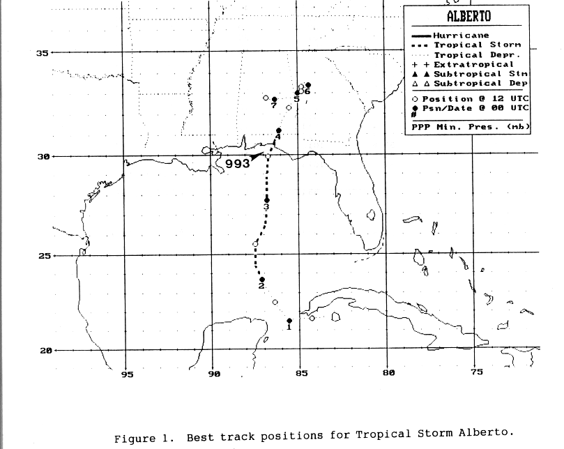
west-southwest, devolving into an open trough on the 7th. Below
is the track of this storm, provided by the
National Hurricane Center.
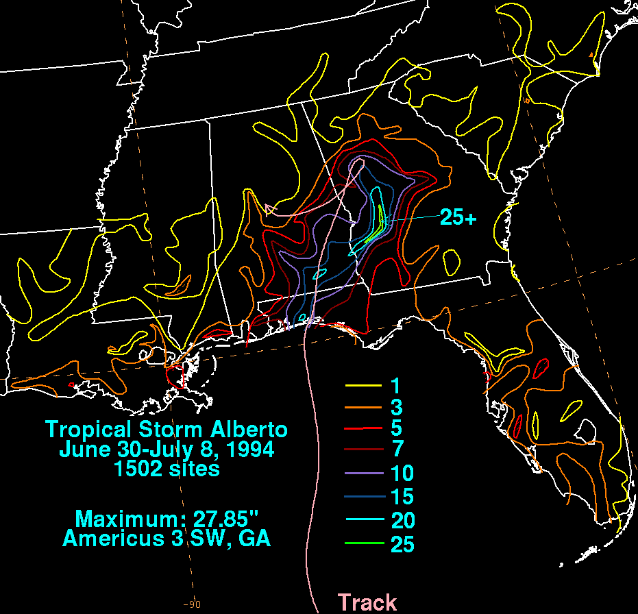
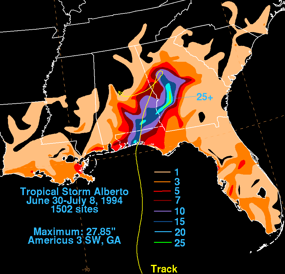
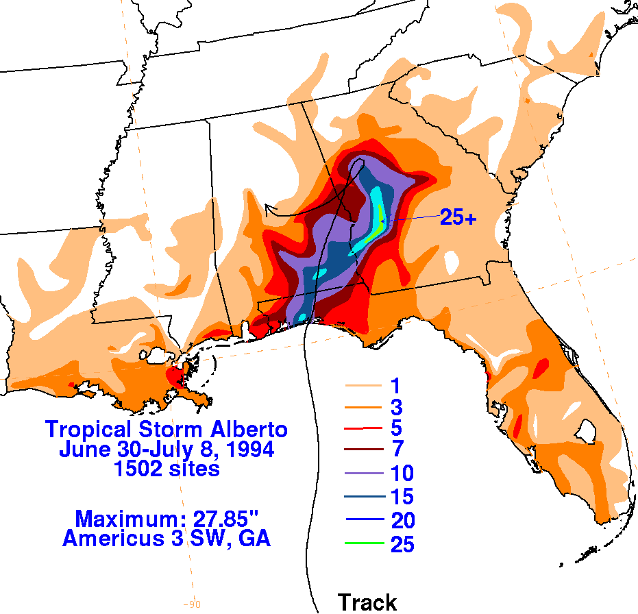
The storm total rainfall masp below were constructed using data from
the
National Climatic Data Center. The
maximum was located near to just to the east of its track.
 |
 |
 |
Below are the calendar for Daily Precipitation Maps. Note that the 24-hour periods end at 12z that morning.
