Three distinct weather systems may have played a role in the genesis of Alex. On 26 July, shower
activity increased several hundred miles to the east of the northwestern Bahamas. This activity was
associated with a weak surface trough, likely of mid-latitude origin. Disorganized showers persisted just
to the east of the Bahamas, in the diffluent region to the east of an upper-level low, for the next couple
of days. On 28 July, when a tropical wave reached the area, the extent and organization of the convection
began to increase. Analyses show that a broad area of surface low pressure formed early on 30 July just
northeast of the central Bahamas. The low moved northwestward and over the next 36 hours the
circulation slowly became better defined. By the afternoon of 31 July, when the low center was located
about 175 n mi east of Jacksonville, the system had enough convective organization to be classified as
a tropical depression.
As the depression
approached a break in the subtropical ridge early on 1 August, its
forward motion
slowed, and the cyclone remained nearly stationary
for the next day or so about 115 n mi east-southeast
of Savannah. The depression remained poorly organized
initially, due to
northeasterly shear and
an environment characterized by subsidence
and dry air. However, an upper-level trough was
approaching from
the west, and in advance of this trough the northeasterly flow
over
the
cyclone began to relax. During this transition the depression
was able to strengthen, and it
became a tropical storm early on the afternoon of
1 August.
Alex began to move northeastward early on 2
August, taking a track that would slowly approach the
coastline of
the Carolinas over the next 36 hours. The northeasterly shear
continued to diminish
during the day as upper-level southwesterlies
approached. The deep convection, which had
previously been confined
to the southwest quadrant of the circulation, was now able to
organize
in bands to the east of the center. Alex strengthened,
becoming a hurricane just past midnight on 3
August, when it was centered
about 65 n mi south-southeast of Cape Fear.
Aided by warm Gulf Stream waters and light
shear, Alex continued to strengthen on 3 August as it
neared the
North Carolina Outer Banks. The hurricane's maximum sustained winds
reached 100 mph
(category 2 on the Saffir-Simpson Hurricane Scale) that morning, and
the minimum pressure fell to
972 mb early in the afternoon. Alex
made its closest approach to land just after noon, with its center
located about 9 n mi southeast of Cape Hatteras, while the western
eyewall of the hurricane raked the
Outer Banks with sustained
Category 1 hurricane force winds.
After passing the Outer Banks, Alex turned
away from land and accelerated as it became embedded in a
deep
layer of west-southwesterly flow. Alex strengthened and became a
major hurricane (Category 3) on
the evening of 4 August, with winds of
120 mph and a minimum pressure of 957 mb. At this time Alex
was at
38.5° N (385 n mi south-southwest of
Halifax, Nova Scotia), moving east-northeastward near 25
mph, and
over waters just above 26°C - not factors
normally associated with major hurricanes. Only
Hurricane Ellen of
1973 attained major hurricane status farther north. While the basic
environmental
surroundings around Alex was low in shear, the cause
of this unexpected strengthening remains
unknown.
By late on 5 August Alex had moved north of
the Gulf Stream over sub-20°C waters and
was weakening
rapidly. Moving at 50 mph, Alex weakened to a
tropical storm after midnight on 6 August and became
extratropical a
few hours later about 830 n mi east of Cape Race Newfoundland. The
circulation of Alex
was absorbed into a larger extratropical low by the evening of 6
August.
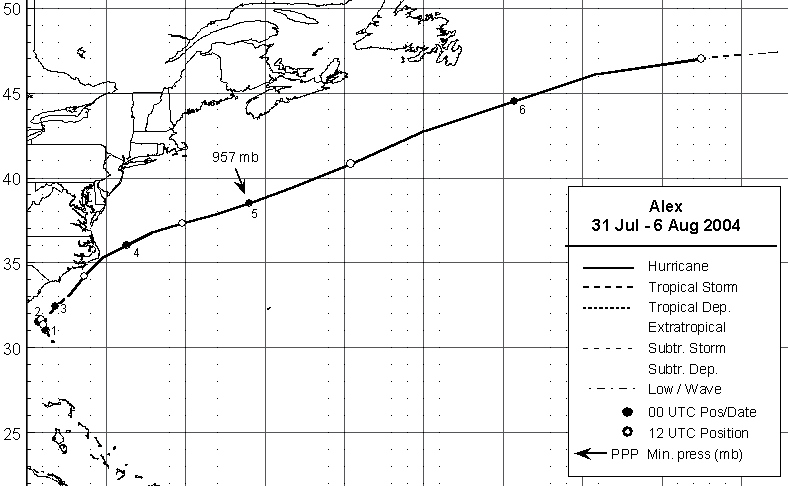
Below is a track of the cyclone
provided by the National Hurricane Center.
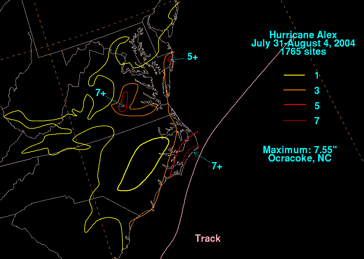
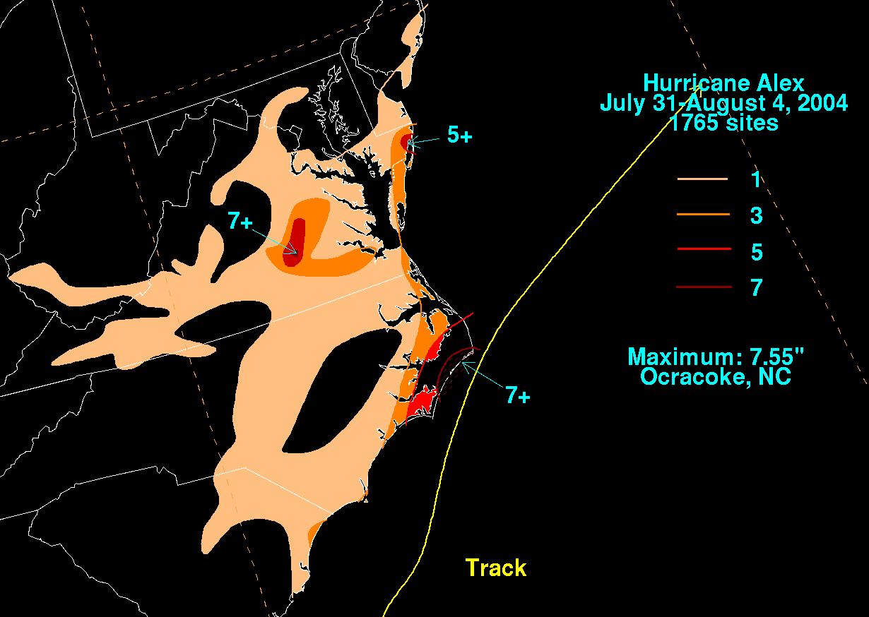
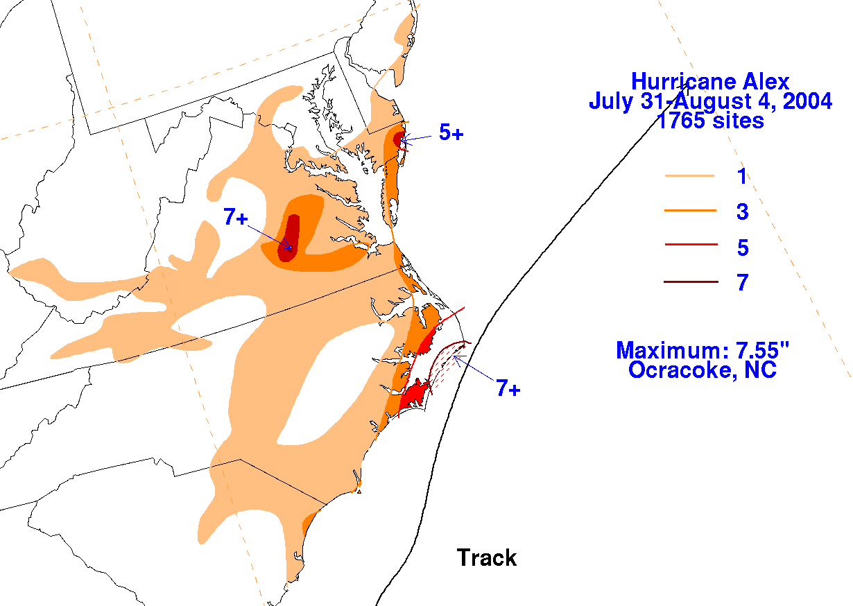
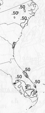
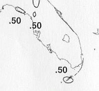
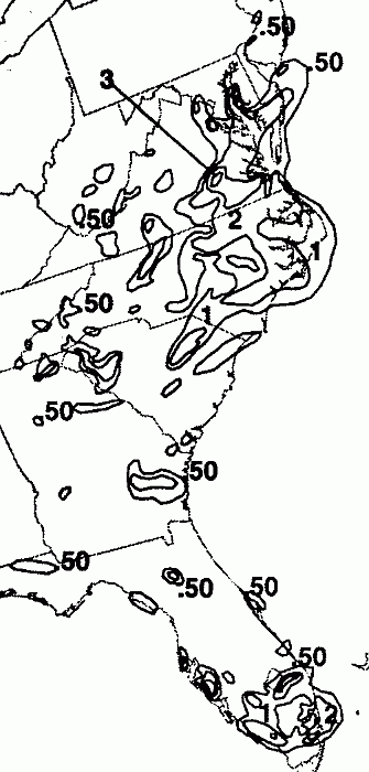
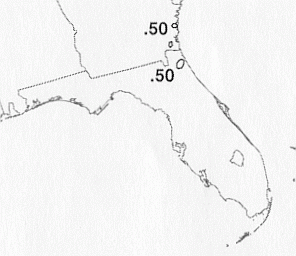
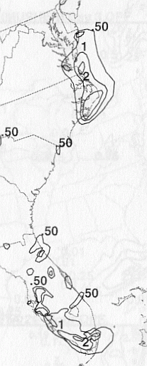
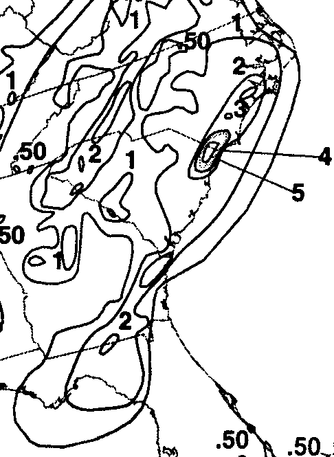
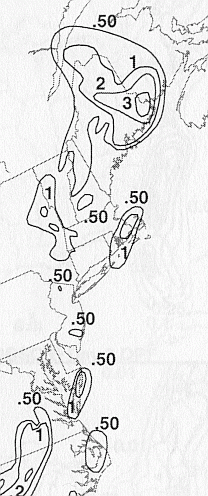
The storm total rainfall map below was constructed using data from
data
provided from NWS River
Forecast Centers, as well as additional reports received
by the
National Hurricane Center.
 |
 |
 |
Below are the calendar for Daily Precipitation Maps. Note that
the 24-hour periods end
at 12z that morning.