A tropical wave emerged from the African continent on June 12th. The system moved slowly westward,
crossing the tropical Atlantic. Thunderstorms became enhanced with the wave as it moved into the eastern
Caribbean sea on the 20th. By the 24th, a surface low developed south of Jamaica, and the system became
well enough organized on the 25th to be considered a tropical depression. The depression moved west-
northwest, becoming a tropical storm by the 26th. The system continued organizing as it made landfall in
Belize City on the 27th, and formed an eye feature as it moved into southeast Mexico. The system weakened
to a tropical depression as it emerged into the Bay of Campeche. Alex regained tropical storm strength early
on June 28, and continued to strengthen despite issues with convective organization. By the night of the 29th,
Alex reached hurricane strength.
The large hurricane continued to move generally westward, becoming a category 2 hurricane just prior to landfall
late on the 30th. Alex moved west-southwest into central Mexico, weakening along its way. Even after its surface
circulation dissipated, its mid-level circulation persisted for days and turned north then northeast, approaching the
United States/Mexican border.
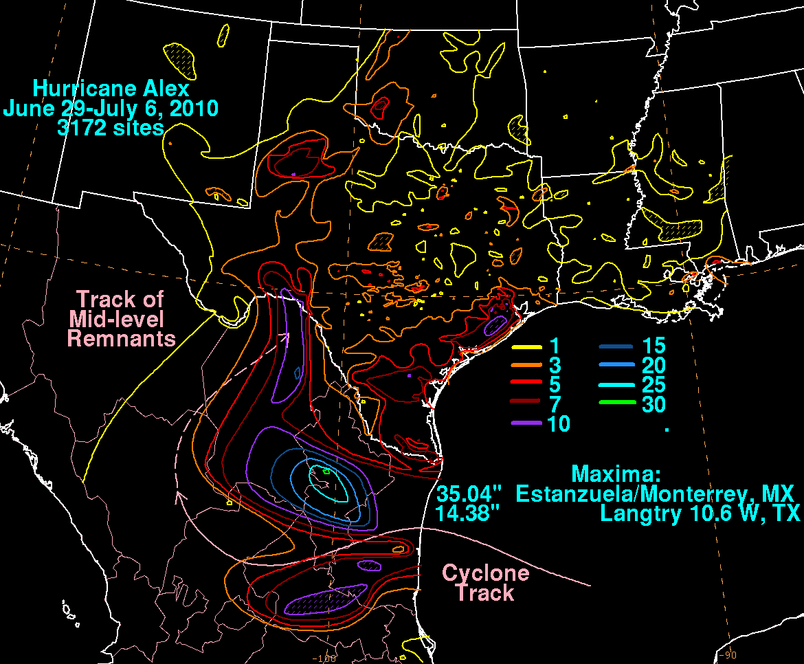
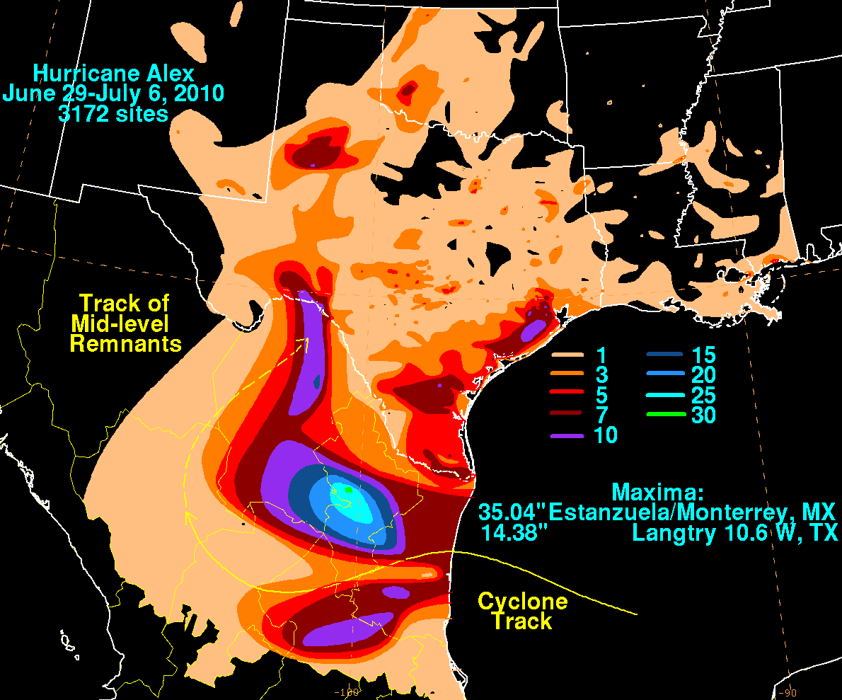
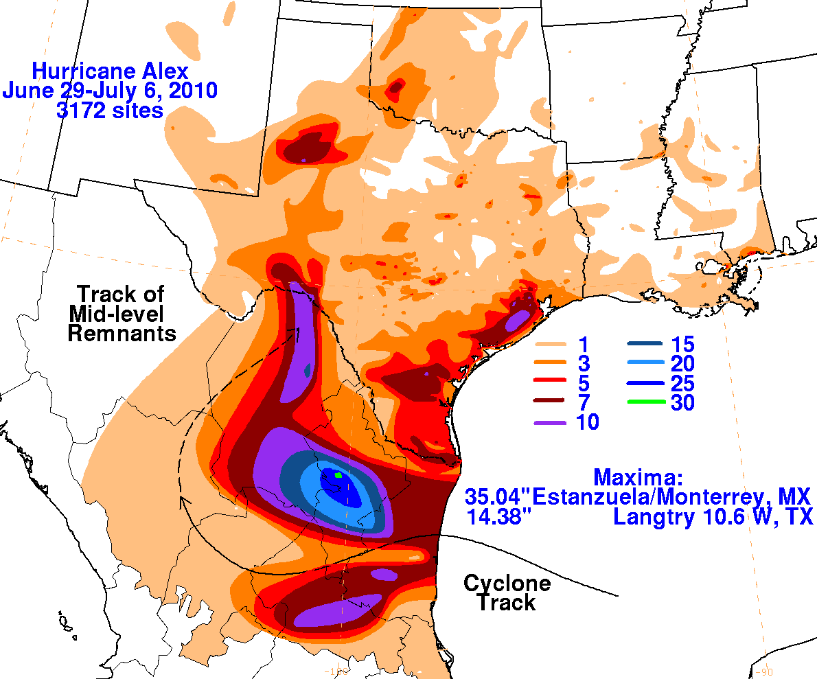
Extremely heavy rains fell mainly on the Mexican side of the Rio Grande/ Rio Bravo, particularly near Monterrey where rainfall
amounts were historic. Flooding along the Rio Grande/Rio Bravo was the worst seen since 1960. Data for the first three rainfall
graphics below was compiled from the National Weather Service River Forecast Centers, the Comision Nacional del Agua (the
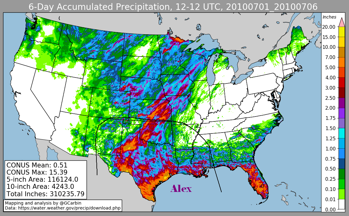
parent agency of Mexico's national weather service), and CoCoRaHS. The fourth image includes radar-derived information.
 |
 |
 |
 |