Hurricane Agatha formed south of Mexico in late May, striking west of Puerto Angel on May 30th. While Agatha weakened rapidly
thereafter on the 30th and 31st, showers and thunderstorms increased across the northwest Caribbean Sea and Yucatan Peninsula.
At that point, Agatha's mid-level center was crossing southeast Mexico and northern Guatemala. By the morning of June 1st,
a large convective burst developed on the east coast of the Yucatan Peninsula and Beliza as Agatha's mid-level center approached.
Vertical wind shear displaced convection east-northeast of its center, but the broad low moved north near the eastern coast of
the Yucatan Peninsula into the 2nd. The low continued to deepen as it edged away from Mexico, with the center getting some
definition during the night of the 2nd while winds became gale-force. The center went through a series of reformations and
quickly propagated through the southeast Gulf of Mexico. The low moved ashore southwest Florida on the morning of the 4th,
moved quickly across the Peninsula, then became well enough organized by the evening of the 4th to become a tropical storm
east of the Florida coast. It would remain tropical through the 5th while moving offshore the Carolinas before undergoing
extratropical transition and becoming a storm-force low near Bermuda on the 6th and a hurricane-force low on the 7th before
racing across the North Atlantic between Iceland and the British Isles on the 10th and 11th and dissipating west of Norway a
couple days later.
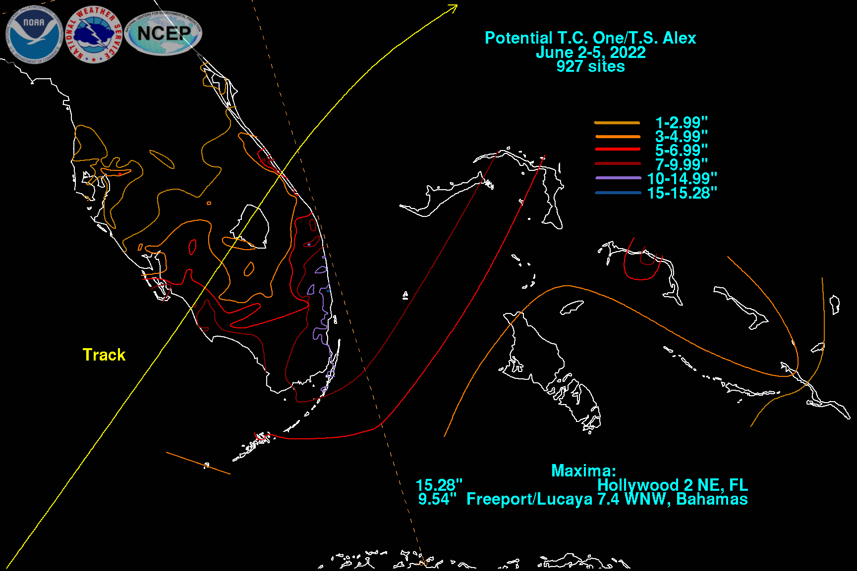
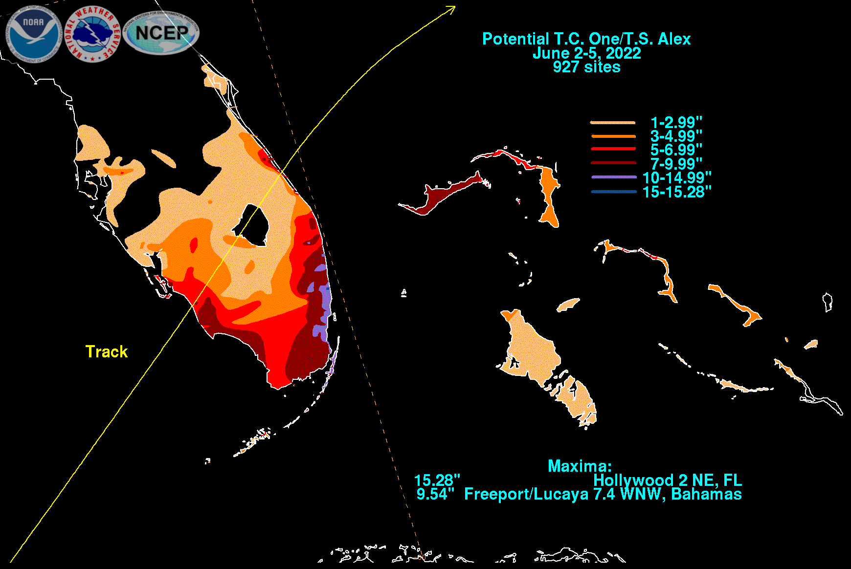
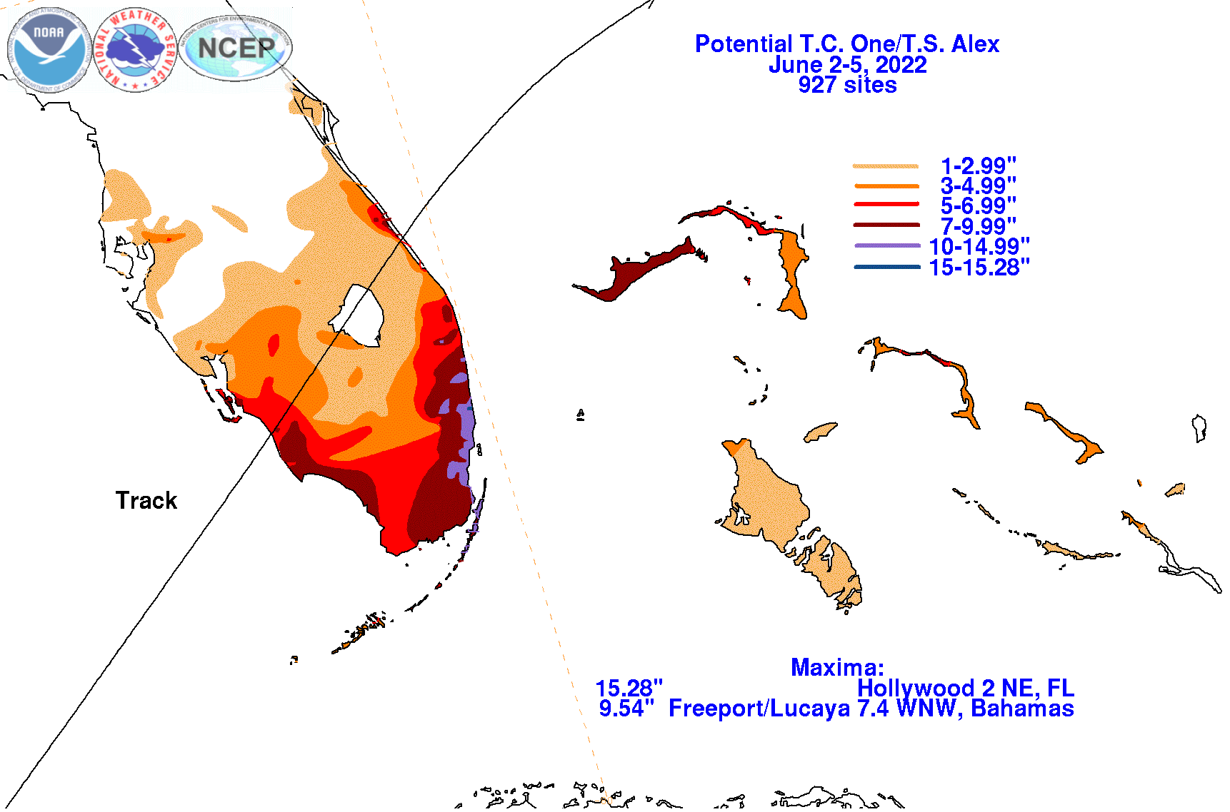
The graphics below show the storm total rainfall for Alex, which used rain gage information from South Florida Water Management
District, National Weather Service River Forecast Centers, National Weather Service Forecast Offices, and CoCoRAHS.
 |
 |
 |