An upper level low drifted northward from Panama during late
May. On the 25th, a weak warm-core surface
low developed east of Nicaragua. Moving around the upper level
low, the surface low made a counter-clockwise
loop over Central America between the 26th and 28th and weakened.
Once over the Caribbean sea, the system
strengthened as it moved northward. The tropical storm rotated
around the upper low again between the 1st and
2nd to the northwest of Cuba. On the 4th, Alice reached its peak
strength while moving through the eastern
Gulf of Mexico. Moving inland west of Panama City, Florida on the
6th, the surface low dissipated as it moved
into the Southeast, with its circulation aloft slowly drifting
northeast into Georgia into the 9th before dissipating.
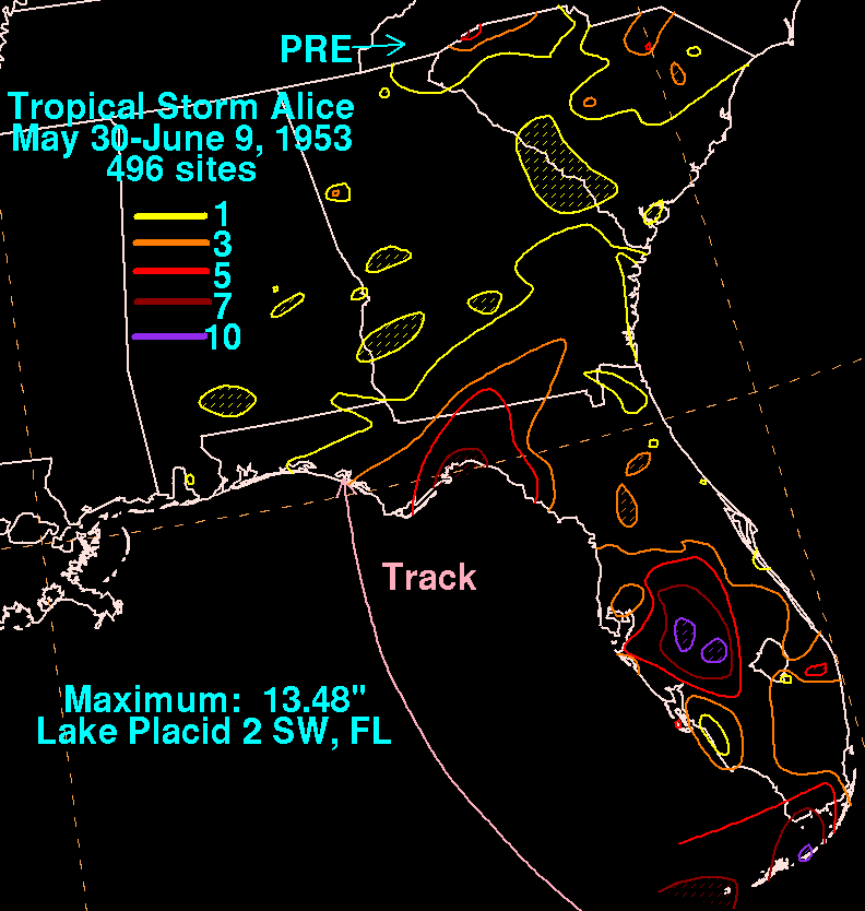
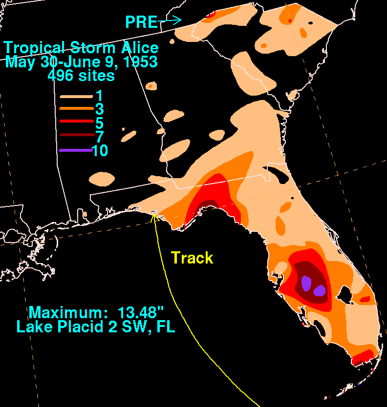
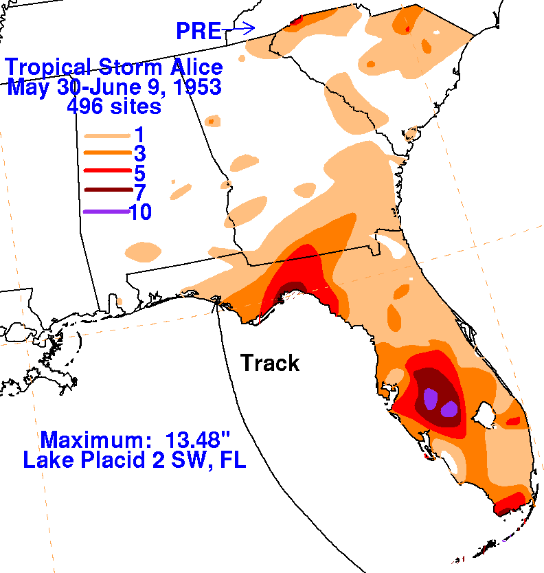
The rainfall maps below for Alice were created using rainfall data from
the National Climatic Data Center in
Asheville, North Carolina. Heavy rains fell to well northeast of
Alice along a stalled frontal boundary in the
Carolinas, and are considered a predecessor rainfall event indirectly
related to Alice's circulation.
 |
 |
 |