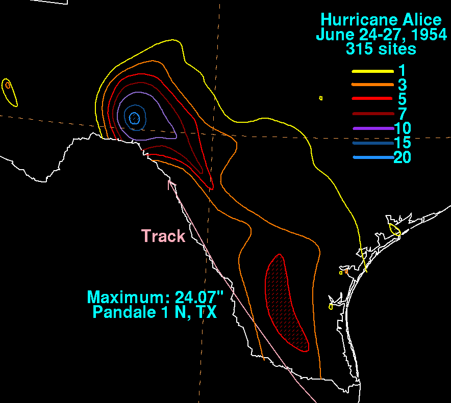
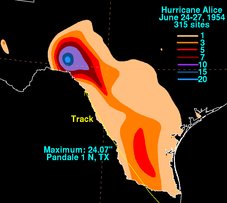
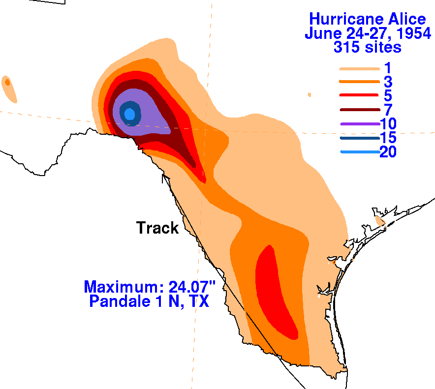
A tropical storm rapidly developed in the western Gulf of Mexico on
June 24th and strengthened into a
hurricane the following day. Moving inland into northeast Mexico,
the system crossed into Texas west
of Alice and moved north-northwest just inside the southern border
until the surface center dissipated on
the 27th. Extremely heavy rains fell near Pandale near the Pecos
river, which led to severe flooding of the
Pecos and lower Rio Grande valleys, washing away the International
bridge between the United States and
Mexico at Laredo and taking 17 lives. It was the greatest rise on
the Rio Grande since 1865. The rainfall
maps below for Hurricane Alice were created using rainfall data from
the National Climatic Data Center in
Asheville, North Carolina.
 |
 |
 |