A weak circulation was seen in the eastern Atlantic by the TIROS V
satellite on August 14th. The system moved
westward through the tropical north Atlantic without significant
development. The circulation crossed the Windward
Islands on August 20, and curved to the west-northwest through the
northern Caribbean sea. Moving across eastern
Cuba on the 26th, the system slowly developed as it crossed the Florida
Straits. The tropical depression moved along the
Gold coast of Florida before turning northeast into the subtropical
western Atlantic. Strengthening into a tropical storm,
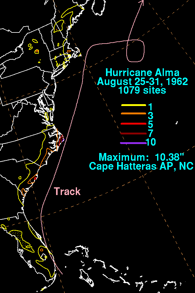
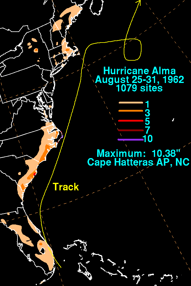
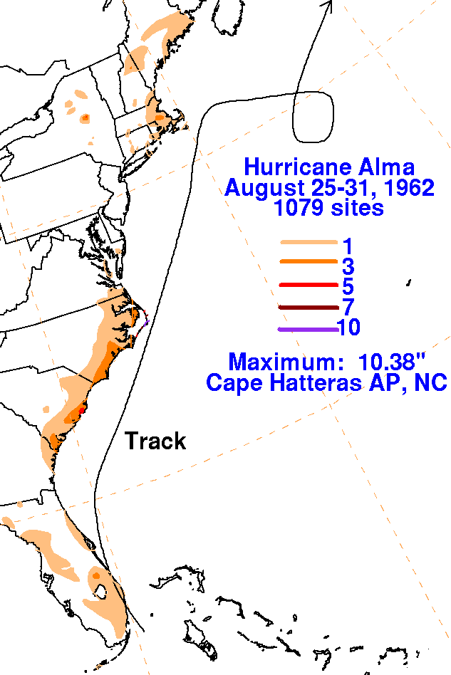
and then a hurricane, Alma moved very close to Cape Hatteras and
generally paralleled the Eastern Seaboard through the
the 29th. A blocking high to its north caused Alma to loop to the
south of Nova Scotia between the 30th and 1st. By the
2nd, Alma accelerated northeastward and evolved into an extratropical
cyclone. The graphics below
show the storm total
rainfall from Alma. Rainfall data was provided by the National
Climatic Data Center in Asheville, North
Carolina.
 |
 |
 |