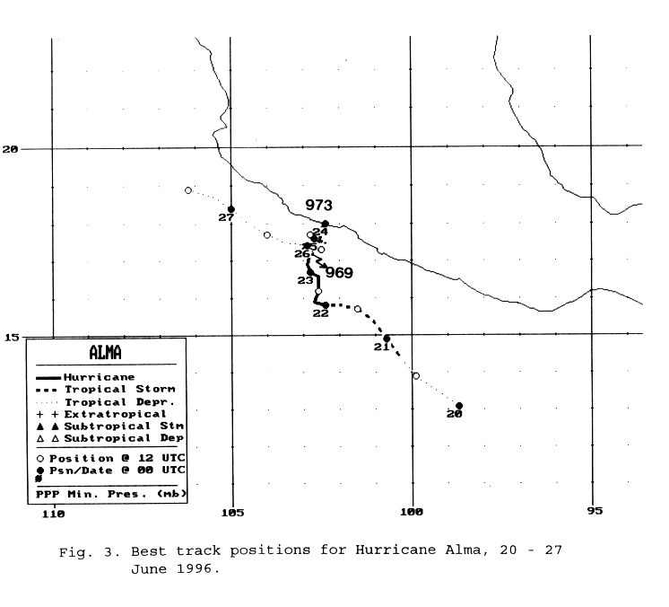
The southern extension of the tropical wave which led to the formation of Tropical Storm Arthur appears to
have moved westward and led to the formation of this system. The wave crossed into the eastern Pacific on
the 17th and 18th. Northeast winds aloft led to some initial shear which exposed the developing circulation
of the northeast side of the convection. The system became a tropical depression during the afternoon of the
19th and a tropical storm on the morning of the 20th. When the vertical wind shear finally relaxed, the cyclone
became a hurricane on the afternoon of the 21st. The system had followed a general northwest course up until
this point. The hurricane entered a weak steering environment as it neared the Mexican coast, and drifted north.
Becoming a category two hurricane, Alma made landfall near Lazaro Cardenas before drifting back out to sea.
The mountains of Mexico disrupted its circulation, and the weakened cyclone drifted west-northwest about
50 miles offshore the southwest Mexican coast before dissipating as a tropical cyclone very early on the 27th.
Below is its track, supplied by the National Hurricane Center.
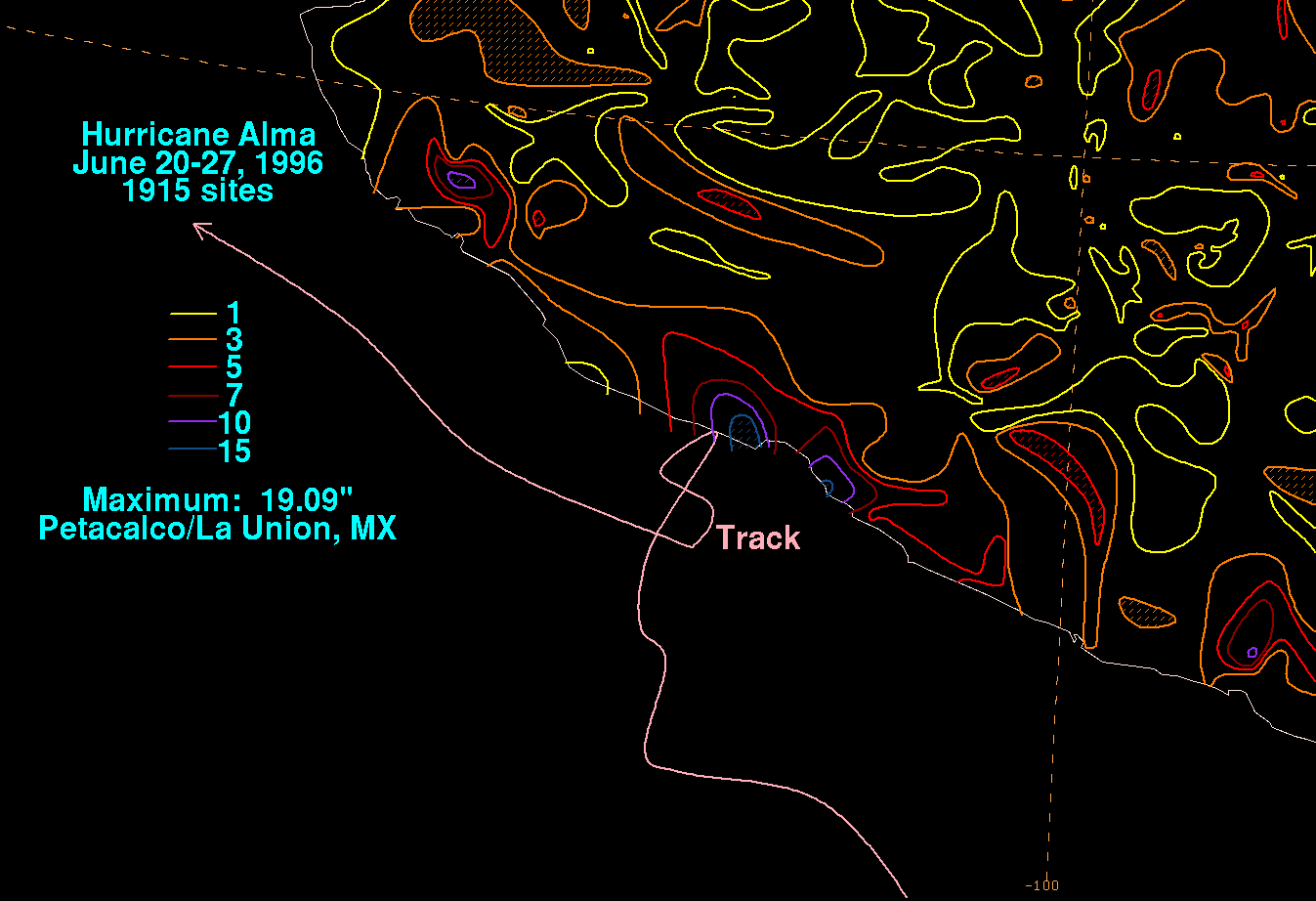
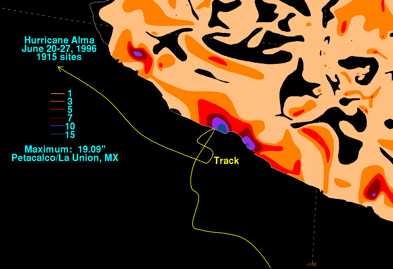
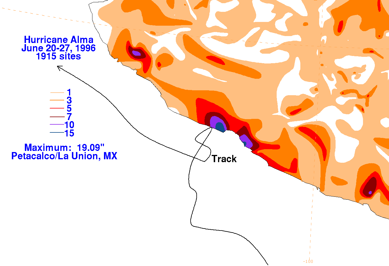
The graphics below show the storm total rainfall for Alma, which used rainfall information from the Comision
Nacional del Agua, which contains Mexico's National Weather Service. The maxima were mainly near and east
of the point of landfall.
 |
 |
 |