The remnant low of Hurricane Barbara moved in the Bay of Campeche on May 30, becoming part of a monsoon gyre.
On June 2, a surface trough from the gyre moved northward into the southern Gulf of Mexico, becoming a
separate low pressure area on June 3. Vertical wind shear led to slow development, and winds with the
system slowly increased. Once a well-defined circulation formed on the afternoon of June 5, it had become
Tropical Storm Andrea.
The cyclone moved north to northeast between the subtropical ridge and an upper level trough from the Westerlies.
Andrea moved inland near Steinhatchee late on the afternoon of June 6. The storm accelerated northeast across northern
Florida and southeast Georgia, passing back into the Atlantic near Savannah early on the morning of June 7. The cyclone
became extratropical as it merged with a frontal zone while moving into South Carolina early that afternoon. The low
moved northeast across North Carolina and eastern Virginia, went back offshore New Jersey before striking Long Island
and eastern Massachusetts by the morning of June 8. The low was absorbed by another cyclone as it moved across the
Gulf of Maine.
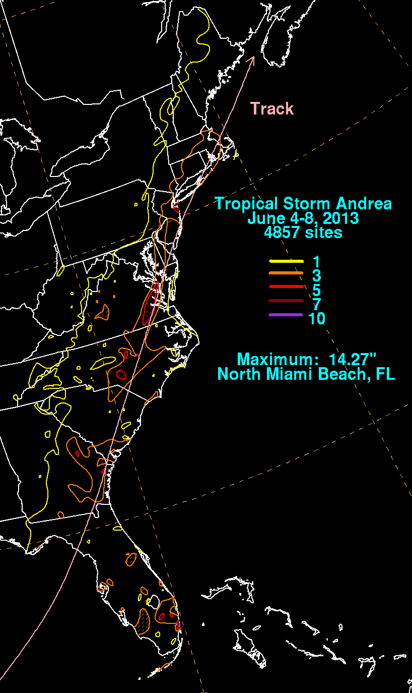
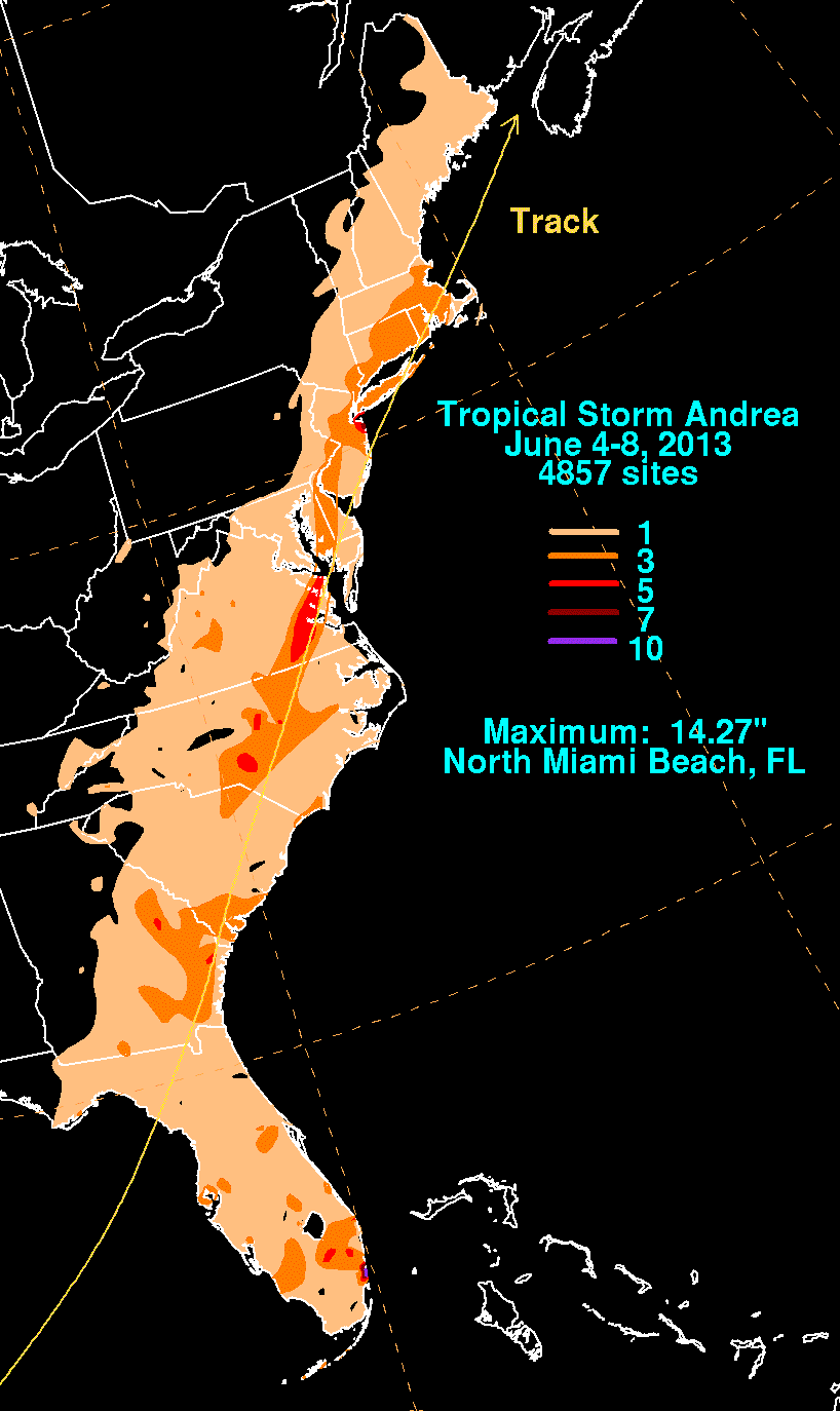
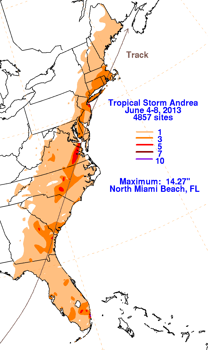
The first three graphics below show the storm total rainfall for Andrea, which used rain guage information from the National Weather
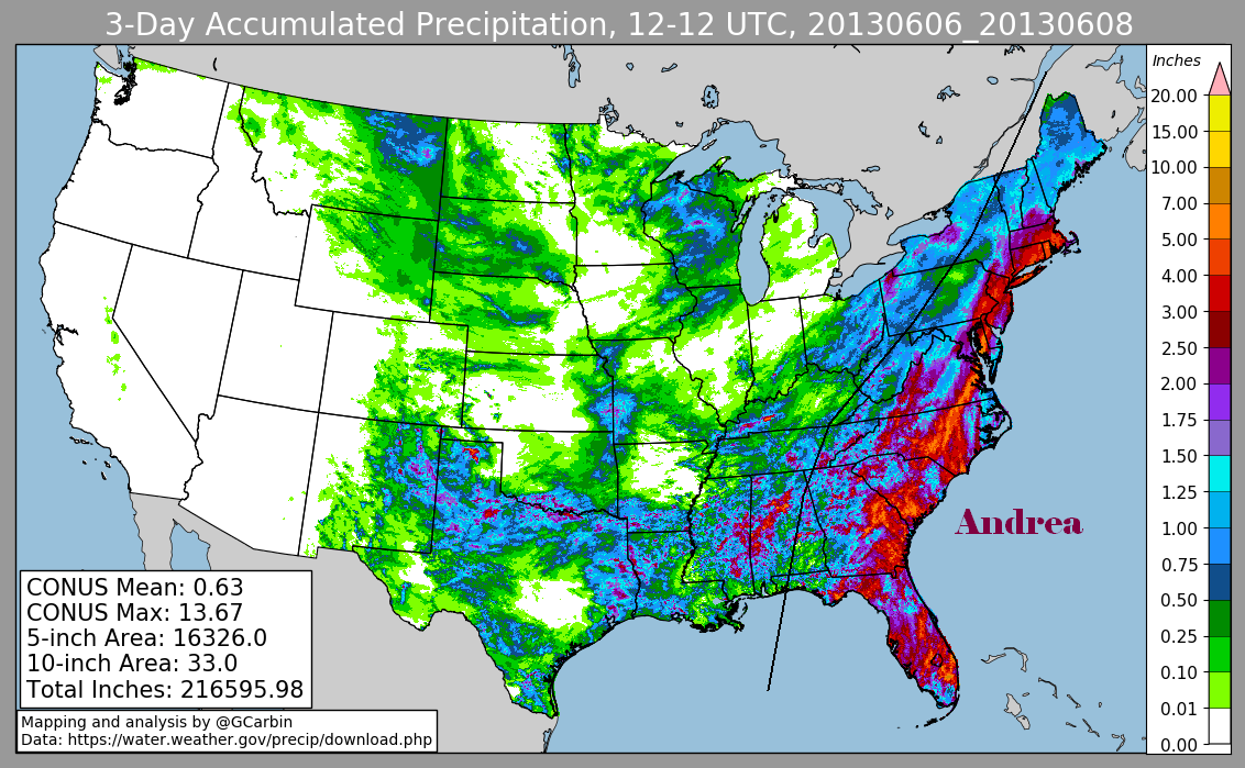
Service River Forecast Centers, Forecast Offices, and CoCoRAHS. The fourth image is a multi-sensor rainfall estimate that
includes radar-derived information.
 |
 |
 |
 |