A tropical wave brushed by the Dominican Republic on May 23rd.
The system moved westward through the
Caribbean sea, forming an area of low pressure on the 25th. On
the 27th, ship reports confirmed a closed wind
circulation with this low as it entered the Gulf of Mexico, and it
became a tropical depression. By early the 28th,
the system strengthened into a tropical storm. On the 29th,
Arlene's northwest motion became more westerly
as high pressure moved by to its north. Arlene soon became
stationary as steering around the storm weakened,
and the storm began to drift to the north as it peaked in
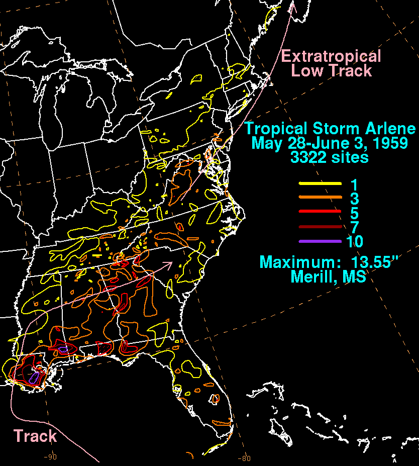
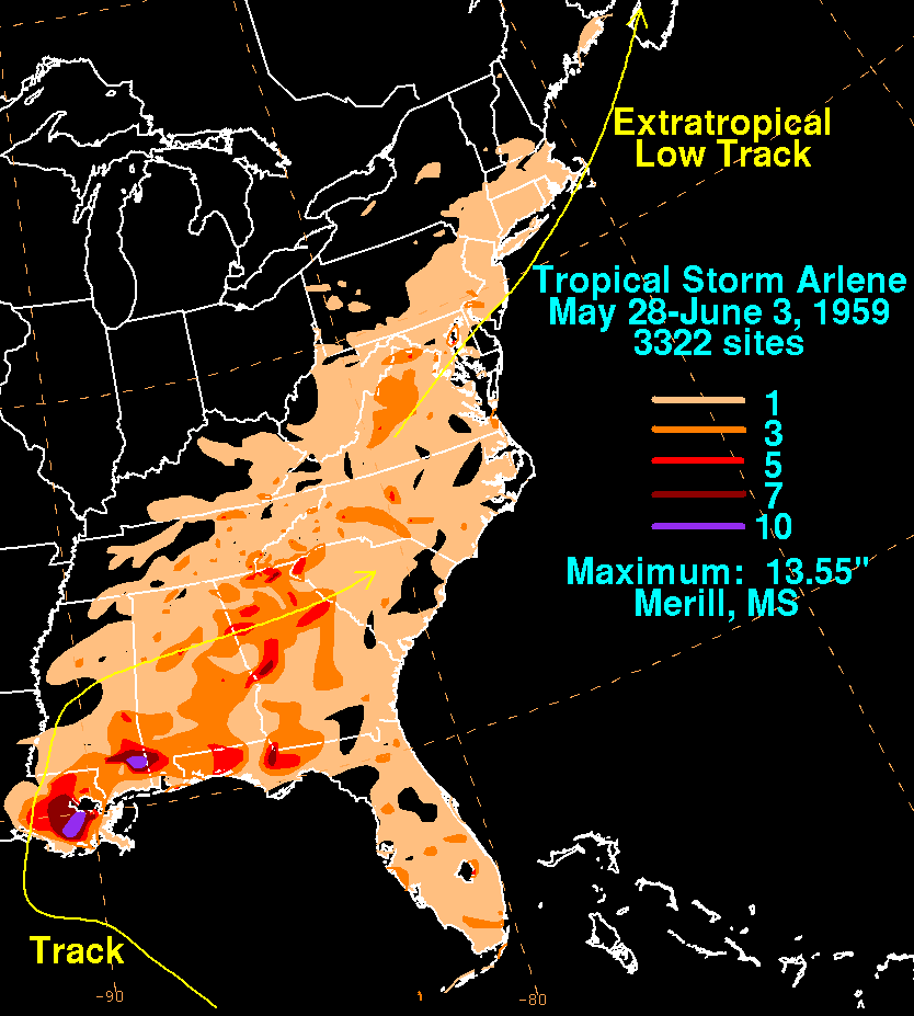
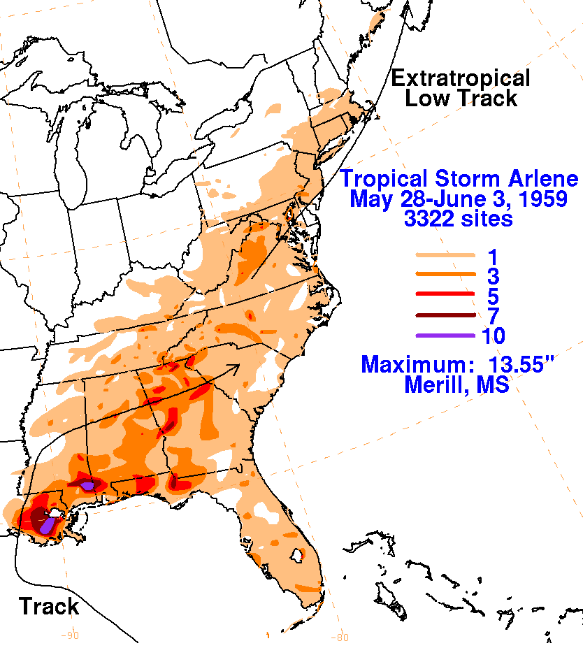
intensity. Arlene slowly recurved, striking the Louisiana
coast near Vermilion Bay at 4 pm on the 30th. The low weakened
back into a tropical depression soon afterward,
and moved eastward through the Deep South, dissipating on the 2nd as a
frontal wave developed to its north, which
spread rains through the Mid-Atlantic and New England states. The
graphics below show the storm total rainfall
from
Arlene. Rainfall data was provided by the National Climatic Data
Center in Asheville, North
Carolina.
 |
 |
 |